
Our scheduled hike for today was the Scott Paul trail. 11 of us began a counterclockwise route up the hill. We quickly split into two groups. One group that would hike around the loop and the other group that would hike slower and would either do an in and out hike or loop.
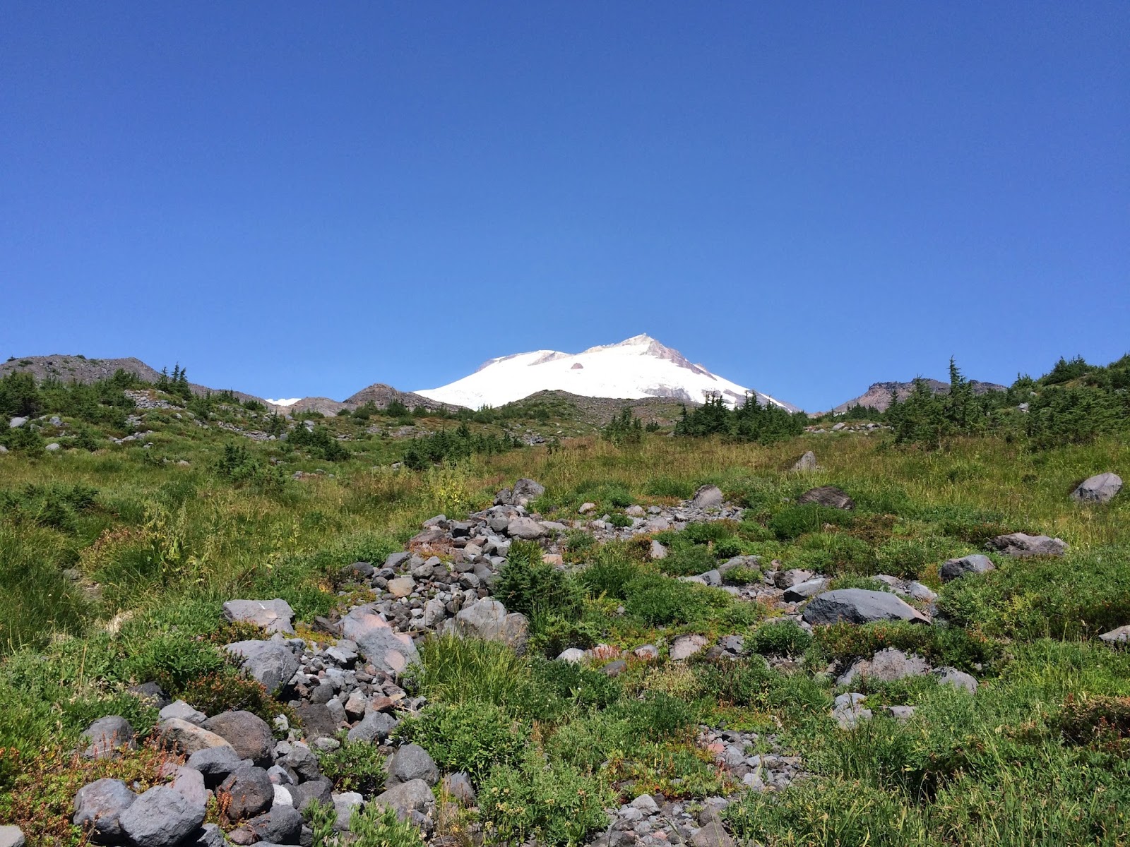
We stopped at about the 3 mile mark and enjoyed the view of Mt. Baker.

We then went on instead of eating lunch because Marjan and Frank had done this hike a few days earlier and said that the usual tricky creek crossing was much larger and swifter and hitting it later in the day would make it a lot more challenging, so off we went.
The first glimpse of the crossing.

Marjan picked a route to cross and I followed. The water was knee high in places and moving very swiftly, but thankfully the rocks were not slimey and the footing was good. The others behind us choose to not make the crossing. I didn't feel confident about crossing the creek again to join the rest. I felt that one successful crossing would be good enough for me on that creek, I didn't want to tempt fate ;-) Since the rushing water was so loud we signaled to the rest that we would continue around & meet them at the parking lot. After a short walk, Marjan and I found some shade and enjoyed our lunches together. The trail after that had some wonderful views.

We had another creek crossing but it wasn't nearly as high or fast moving, so we just walked through it.

Another crossing but this time with a swinging bridge.

One last look back to see just how bare of snow our Mt. Baker and the Black Buttes are this summer.

The shade of the forest for the hike down felt very good after being in the sun so long.
Marjan and I after we'd hiked our loop together. Note, her blue teeth. So many yummy blueberries along the trail!

We did met up with the others in our group at the parking lot. They said they had seen Pat & his group (still heading up the trail) on their return trip. The word was that they were continuing on to at least the creek.
*We did hear from Pat's group later that day, they did make it out safe and sound!
Endomondo stats:
Total miles hiked - 9.56 miles
Minimum Altitude - 3221 feet
Maximum altitude - 5186 feet
Total ascent - 2049 feet
Total descent - 1937 feet

No comments:
Post a Comment
Thank you for taking the time to read my blog, I welcome your comments.