I've been trying to sandwich some sewing time in between hiking, running and backpacking trips. Yikes! It's a wonder I've made any progress at all, but I've made 5 more birdies since my last posting. Yippee!
Today we woke early again (to beat the heat) and went to Blanchard Mtn. to hike the route we had hoped to hike on Thursday - Blanchard Mtn. trails hike. Thursday we found out about the logging operation going on during the week.
Monday through Friday the trail to the Oyster Dome and the Samish Overlook are closed and detoured through the Larry Reed trail, but on weekends the trails are opened up again.
Today we began the same way we did Thursday, but instead of going up the British Army trail we went up the Incline trail. We stopped at the Samish Overlook for a snack/rest break before heading back down the trail.
Here's the Relive video of our route, with a few view photos in the video.
We've been having some hot weather here in north Whatcom county, so my husband had a great idea. His plan was that we would set our alarm for 6 am. Get up and get an early start, but best of all hike is a nice shady forest before the temperature got too high.
He's a clever one.
We decided to start at the lower trailhead, usually we start at the upper trailhead on Blanchard mountain. It was a nice .8 mile walk through the woods after a short walk on the road.
After we got to the upper trailhead, we read the alert sign and realized we would need to change our route. They are logging a section near the trails. We had hoped to include the Oyster Dome and Samish Overlook in our hike today, but the sign stated that the particular section we wanted to do was closed on weekdays.
So we decided on a long gravel road walk and then start up the British Army trail, to the Lizard lake trail, Lily lake trail, Max's shortcut, Lily Max connector trail, Lily/Lizard trail (trail name source: Square one map) to lastly the upper trailhead parking lot and out to the lower trailhead parking lot. Whew that's a mouthful isn't it.
We walked a little over 3 miles on the road from the Upper trailhead to get to the British Army trail.
Blackberries
Thimble berries
We bypassed the Alternate Incline trail and continued on up the road.
Finally at the British Army trail.
Huckleberries
In the photos below intermixed with other photos I'm sharing the signs for when we switched to another trail.
PNT marks on the trees
Lizard lake
I found my "heart in nature" rock! ❤
Time to turn onto Max's shortcut, but first a short rest break on a bench by the trail junction.
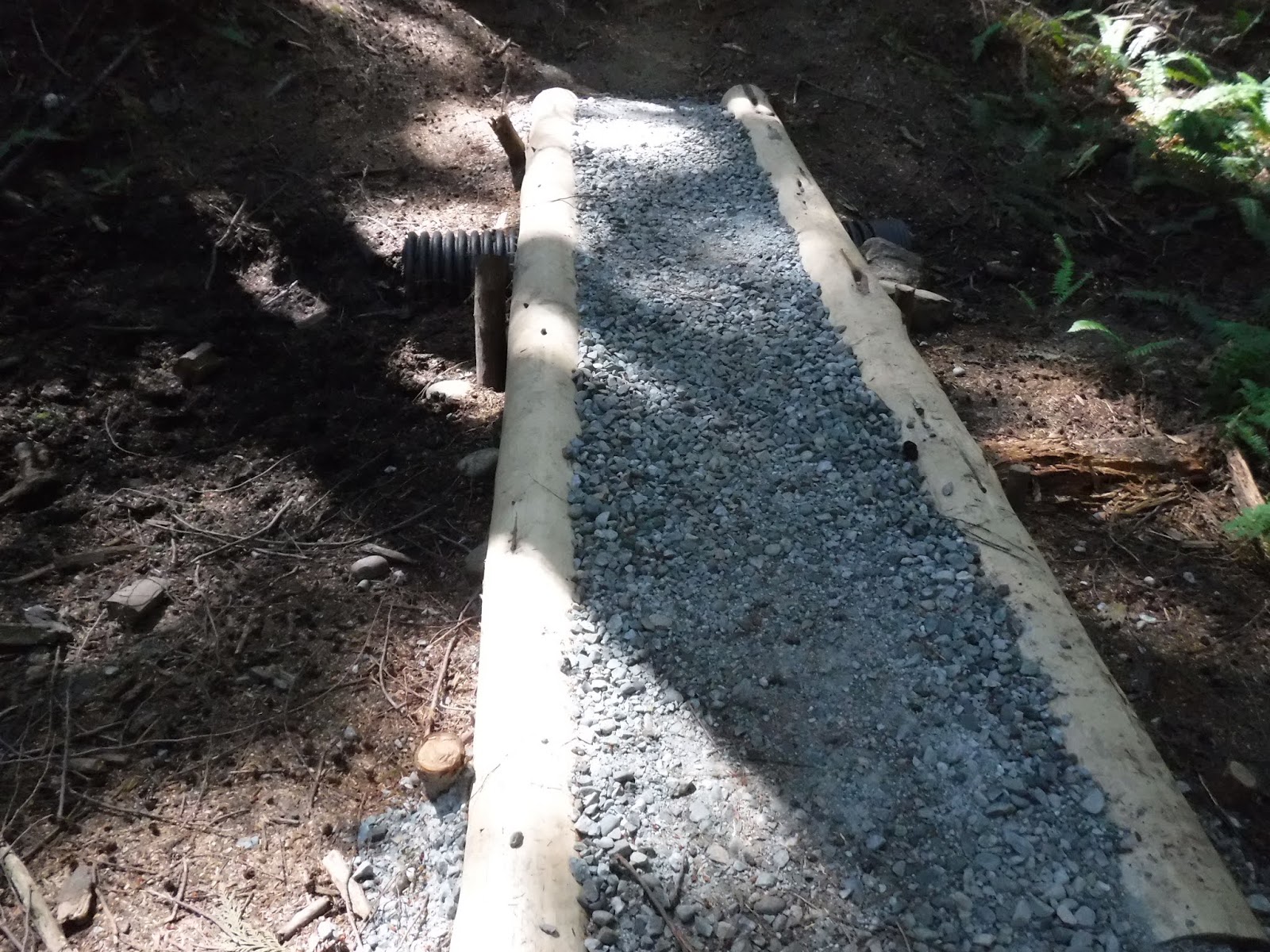
Some nice new trail work.
Ferns and Trees ❤
Monkey flowers
Lilly Max connector trail
Doesn't this photo of the bridge look almost like a black and white photo? Kind of strange.
When we crossed over the bridge, we saw
a dry creek bed below.
We exited at the trail head for the Lily/Lizard lakes trail and walked up the road to the Upper trailhead parking lot.
We joined the return .8 trail from the Upper trailhead parking lot.
Then after a short road walk to the lower trailhead parking lot we were done.
It was a great plan to get an early start AND hike in the shade. Since we finished so early we even got in a leisurely back roads drive home with some iced Lattes, a nice rare after hike treat for me since I don’t drink coffee after 3:00. Here is a picture of our weather station at our home when we returned at 3:05: 91 degrees and the high had been 92!
I took a picture of the river bed by our campsite. Lots of carnage in and around the campground.
We packed up after breakfast and began our "road" walk out.
Twin flowers along the road.
Salmon berries
Our road walk.
Thimble berries
I found my heart in nature rock ❤
We decided as we went out that we would take a side trail that we'd seen the first day.
It was an old mine trail. It would be nice if there was a sign board with information about the mine. We assumed it would be a nice wander through the forest and then we'd be on our way. We were a little surprised that after a nice level beginning we began to climb several steps, The several steps became - 209 (my husband counted them on the way out). After the hiking we'd done the last few days, my legs were feeling this steep incline.
I was glad to see the mine, I was gasping for air after our climb.