Saturday, May 28, 2011

This years Rhubarb harvest!

The first thing in our vegetable garden to be harvested this year - rhubarb!


I'm half - way done cutting and bagging it for the freezer and thought I'd have my rhubarb "pose"! I have a wonderful rhubarb jam recipe that I make throughout the year. I have a teaspoon of it nearly every morning in my steel cut oats/brown rice/quinoa/kale/raisin/flax seed and almond milk breakfast combo. I make a big batch of this every couple weeks and freeze it in individual serving containers.
Mmmmmmmmm, delicious!

Thursday, May 19, 2011

Fun in the sun (finally), Sulphide creek & Baker river hike (almost 9 miles)

 After our incredibly long wet and dark spring we finally got a wonderful sunny and warm day for our hike. We had a long carpool ride from Bellingham to Baker lake for the start of our hike.
We had planned on hiking to Noisy creek today, but there was some question about where we should go since part of the area we wanted to hike had a questionable approach. As you can see there are a couple of trees resting on the bridge cables.


We decided to go to Sulphide creek, where we had a short break. Some of us couldn't decide if it was a lunch break or a snack break. I decided to take advantage of the break and ate half of my lunch, since it was still a bit early for lunch and I would undoubtedly be hungry a little later.


Creek crossing.

Baker river


Sulphide creek and our lunch - snack break location.

After a discussion we decided to go ahead and cross the bridge and go out the trail to Noisy creek after all but to turn around at 1:30 and see how far we would get.
 The Hidden creek bridge made for a scenic area to take pictures and eat the rest of my lunch.


Saturday, May 14, 2011

Blanchard Mtn. trails

Great 11.5 mile run on Blanchard mtn. with my husband "Dick" today.
For more info. on the Blanchard mtn. trail area, go to: http://www.blanchardmountain.org/where_is_bm.html

I loved running on those trails.
We ran up to the rock outcropping above Lily lake and had lunch.
Temps. were great for running.

checking out the map to see where we want to
go next
The view from the rock outcropping
Blanchard mtn. has beautiful forest trails. The last couple miles we ran down an old logging road to the car. It's been a while since we've gone for a good distance running on the trails. Good for us!

Friday, May 13, 2011

Madrona Crest with Raptor ridge add on: 10.4 miles


The scheduled hike to Madrona Crest for Thursday (had to wait for Google to finish maintenance to post this) was given a difficulty rating of a moderate 7 mile hike. The weather co-operated this time. It was perfect hiking weather. The hike up to Madrona Crest was such a nice hike we decided to take the connector trail from lost lake trail to Raptor ridge. This presumably would add a couple more miles to our day. The connector trail is in the process of being completed, there was a lot of fresh tree cutting debris around, we got to crawl over a few downed trees and scramble around some rocks. After we got up to Raptor ridge I decided the hike had taken a turn from moderate in difficulty to moderately difficult.


At Madrona Crest conferring with Alan about if we wanted to add Raptor ridge to our hike.


View from Madrona Crest this overlooks the Stewart mtn./Olson creek area that we hiked last week.
It looks pretty cloudy, but there were some very nice sunny breaks throughout the day.


Me - on Raptor ridge, we stopped and had lunch on the outcropping. I'm glad we decided to add this section on to our hike. It was worth the effort!

Another conference on the way down, and it was decided to add a little more to our mileage and go back on a softer trail rather than the hard logging road surface. When we got back to our cars at Arroyo park we again had a conference about the distance we had hiked. Several people carry GPS units with them, and surprisingly they didn't agree on our distance. The shortest was (Al's) 9.5 and the farthest was (Fred's) 10.4, since my body told me I had hiked long and hard, I'm settling on the 10.4 miles. Another fine day with the Trailblazers. Good day and good company.


I had already taken off my gaiters, yes there was a little mud on them.
 (I didn't feel like putting them back on just for my sign off photo.)


Tuesday, May 10, 2011

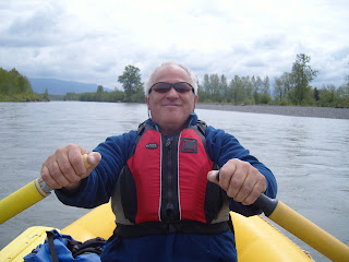
We be rafting! Everson to Hovander - the Ski to Sea canoe leg course


Loaded up and ready to go! Incredible it all fits.


Of course to start the day right,
we had to stop at our favorite coffee stand on route to our shuttle - me driving my car and my husband driving our van.
We had to take our van to Hovander for the take out. When we got there the gate to the take out area was locked, so we left our van at the boat launch about 1 mile before the Hovander ramp. So now back to home in my car to pick up the Citation loaded with the raft & our gear.

ready to launch
Everson bridge

I did take my turn rowing, but that's a story for another day.


whitewater?!?
our lunch spot
                                 
Eagle on the bank
                                                                 The bridges:
Meridian
I-5 Ferndale
Ferndale
Take out ramp

taking it all apart and loading......

such a fun day!

Thursday, May 5, 2011

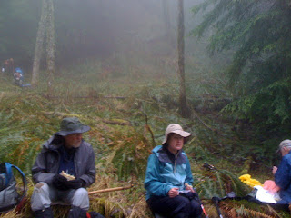
Olsen creek, 10 miles - 2500 feet elevation gain and loss


Yes, we managed to find snow again! This is the hike that was skipped twice because of weather. 10 hardy souls conquered this hard hike today. It climbed up, up and more up, with a drizzle most of the day. The weather did improve a bit, but still chilly for our lunch break.

Mike - in his usual
garb: shorts &
umbrella!
(even at today's 40 degrees)


I always manage to get mud way up
my leg above my gaiters!

finished!
another fine hike!

Monday, May 2, 2011

rafting, no - hiking, yes

We had planned on rafting down the Nooksack river today, but the weather had other plans. Yes we could have gone in the rain, but it wouldn't have been as fun. Sooooo, we decided to head to Ebey's landing on Whidbey Island. The weather was still damp, but we dressed for it and thoroughly enjoyed our day!
(remember to enlarge a picture, just click it)


I love this trail, it has beautiful views -


zig zag down
eagle in flight
and we were blessed with a window of sun,


and a rainbow on the way home!