

Sunday, September 25, 2016
Saturday, September 24, 2016
Last week, with a twist
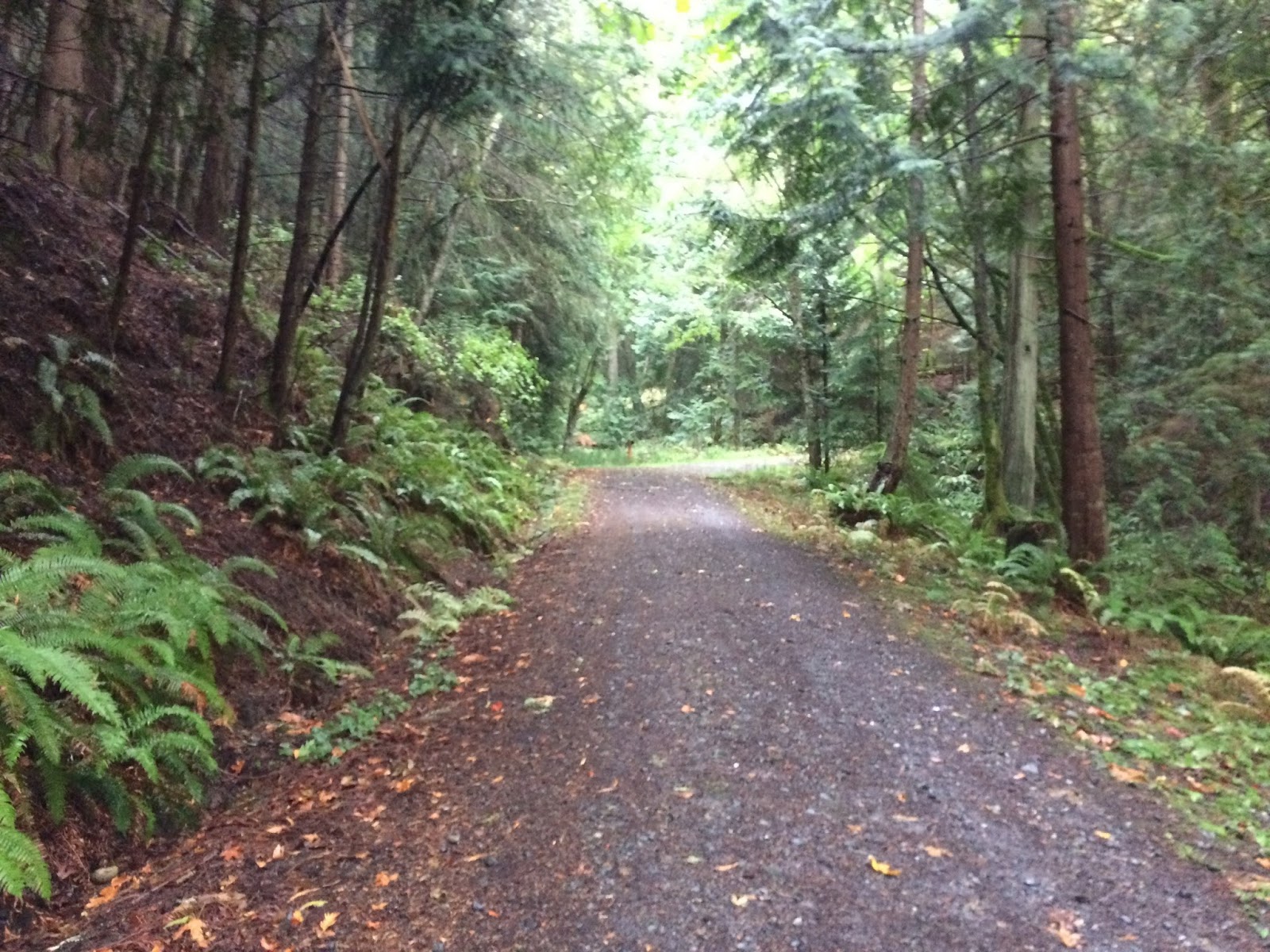
Today's trail run was pretty much a repeat of last week's run South Larrabee tour, except in reverse. We started at the Lost lake parking lot instead of the Hiline road and ran the interurban trail to Fragrance lake trail.

We then ran up the trail & once around the lake. Instead of running up the road to Gates Overlook, we ran on the Fragrance lake road to the Lost Lake trail.

Then up the Lost lake trail to Burnout point. If you look at last weeks post, you'll see that we had virtually no views. Today we had better luck.


Some of the other differences from last week's run were: we ran on to the top of the road till it dead ended. Then we ran down the long hill (road) that we ran up last week. If we saw a fun little trail off to the side we took it, hoping that our distance would match last week's.
One of our detours was this lovely old road, we ran on it until we came to a gate & keep out sign.

The photo below shows the same spot I took a picture last week, quite a bit higher clouds.

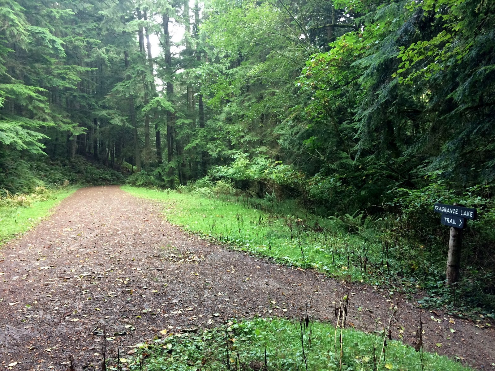
Then when we got to the fork in the road back to the Lost lake parking we took a right instead and headed up the road back to Fragrance lake. We didn't run around the lake this time, instead we ran down the trail - in and out to the overlook.
Then down to the interurban and to the Lost lake parking lot.
Fun day on the trails today, I was a wee bit tired when we finished. As usual my husband put together a great and challenging route for us to train on.
AROO!
Endomondo stats:
total miles - 14
minimum altitude - 114 feet
maximum altitude - 1810 feet
total ascent - 2825 feet
total descent - 3219 feet
*hope you didn't get too lost trying to follow my route info. ;-)
*hope you didn't get too lost trying to follow my route info. ;-)
Sunday, September 18, 2016

Saturday, September 17, 2016
South Larrabee Tour
For today's training trail run my husband had planned a last minute12 mile route. Last night he had planned a 16 mile route for us that included the Mud lake area, but we woke to rain and chose a different route. We weren't too excited about beating the brush in the rain.
This is our first rainy day run for quite awhile. I almost had forgotten how to dress for it.
We parked at the Hiline road and began our journey running south on the Interurban trail.

When we got to the Lost Lake Larrabee State Park parking lot (formerly Clayton Beach parking lot), we headed up the old logging road.

We planned on going up the Fragrance lake road to the Lost lake trail but when we got to the fork in the road we changed our plans and decided to head up to Burnout. We have hiked/ran there many times from the Lost lake trail and thought it might be fun to go from another direction. We weren't sure just how far this impromptu decision would change our miles today, but we were ready to see what the road was like.

It was a lovely old logging road that was mostly "up". I really enjoyed it!

We only saw one other runner on this road, you can just see her ahead of my husband in the fog.

I was happy to see that my pants were doing their job, wicking the moisture away from my skin. See how it lays on top of the fabric?! It's nice to have clothes like this when it rains. The old cotton sweats we used to run in years ago would get so heavy with water in the rain. Hurray for improved running clothes!

We stopped at a side opening in the road to see if there was a view at all. To my surprise there was. The cloud layer was just high enough that we could see Skagit Valley and Bellingham Bay.

It was so cloudy/foggy at Burnout that there was no view. It was raining hard and the wind had come up pretty good by the time had gotten there. No time to stand around, I was getting cold.

We then got on the trail towards the Lost lake trail.

After running a short while we connected with the Lost lake trail. In the photo below the arrow is really pointing down the trail past to the other side of the sign. We had just come from the foggy trail.

We ran down the Lost lake trail to the Rock trail junction. We ran up the Rock trail and to the Gates Overlook parking lot.

As you can see there was no view.

Then it was run on the road for awhile to connect with the Fragrance lake trail.

We ran around the lake and then headed down the Fragrance lake trail towards the viewpoint.


A little bit of a view.

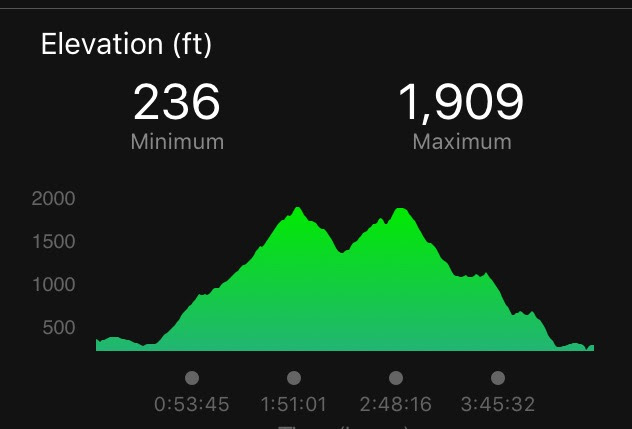
Then back down the trail to connect with the Interurban trail and head north to the Hiline road where we were parked. I was anxious to see the graph of our elevation gain from my garmin when we were done. Pretty cool, I was proud of us today.
We ended up running 2 miles farther than planned, but it was a great adventure!
Endomondo stats:
total miles - 14
minimum altitude - 236 feet
maximum altitude - 1909 feet
total ascent - 2720 feet
total descent - 2799
A great BEAST training day.
Aroo!
Thursday, September 15, 2016
Heliotrope Hogback Trailblazer hike
Our hike today was to Heliotrope ridge, our Trailblazer group hiked this last year in August. You can read about that day's hike HERE. The rangers recommended we not cross the creek to the ridge as we did on last years hike, so our 'fearless leader" Pat said that our route would be the climbers route up the Hogback. The Hogback is part of the route up Mt. Baker. I found an account of a climb up Baker from this route. You can read it HERE (Baker North Ridge in 14 hours) if you're interested.
Today 22 showed up for the hike. Wow, since it's a wilderness area we split up into a slow group and a faster group. I went with the faster group today. I haven't been up the Hogback for years, it was nice to see the views again.

I took this 360 video of the view - enjoy.
https://youtu.be/b5wioxZ8HxM
If you click & zoom in on the photo below you see our group spread out in various locations down the hill from me eating their lunches even waay down at the beginning of the hill.

Looking up the Hogback trail. Several of us continued hiking up the Hogback to the climbers camp area before turning around and heading back down the trail.

In the photo below you can see the trail going left and heading up the climbers route.

Looking back down the Hogback.

Looking towards the Coleman Glacier.

Yes! Boardwalk trails!!

A wonderful day spent in the Alpine enjoying a fantastic view of Baker.

Endomondo stats:
total miles hiked - 6.13
minimum altitude - 3636 feet
maximum altitude - 5612 feet
total ascent - 2051 feet
total descent - 2067 feet

Sunday, September 11, 2016
Blanchard mtn. trail run take two
Last week I learned a critical lesson, never get a deep tissue massage the day before a long trail running day. Last week's training run was a mental battle for me. Running with completely spent legs isn't fun. All of my massages in the future will be earlier in the week so they won't interfere with my all important weekend trail training workouts. Spartan BEAST training involves being mentally tough as well as physically tough, so all was not lost. I chose to keep running last week all of the way to the parking lot even though my body was done. "Mental" training day complete! ;-)
Today's run was what last weeks distance was supposed to be before we cut it short because of my fatigue.
You can read about our route HERE in last week post. This week was a repeat of last weeks except instead of heading down the incline trail we took a left turn up towards North Butte on Blanchard Mountain.


What a view, looking towards Bellingham Bay.

After coming down from the Butte trail we enjoyed going a short distance on the Lily lake trail and then back towards the incline trail, down it for a ways, then back to the map to see where we really wanted to go ;-)

We were correct the first time, Lily lake trail was our route.

This trail connects with the trail we started on at the beginning of day's run. This section of the trail is really people friendly, lots of benches for resting!

We passed many hikers on today's route. Samish Overlook and the Oyster Dome trails are always heavily travelled areas now. When we were about 2 miles from the parking lot several riders on horseback met us on the trail. We learned on a previous encounter with horses on trails that it's not only good to step out of their way but to speak to them as they pass so they don't get spooked when what they thought was a tree, starts to move. I guess it's unnerving to horses. So now we say "hi horse, we're people not trees!" The riders are always appreciative that we know how to respond to their horses on the trail.
It was a good run, so much better than last week. Fresh legs are good legs and the distance covered was better too!

Endomondo stats:
total miles - 10.72
minimum altitude - 938 feet
maximum altitude - 2302 feet
total ascent - 2241 feet
total descent - 2252 feet
Saturday, September 10, 2016
Picture of the week ~ Early 16 celebration!
My granddaughter invited me to go to Carrie Underwood's "The Storyteller tour" at the Key Arena with her, her family and a friend from school.
It was her first concert & Carrie Underwood was the only singer she's ever wanted to see.
I was glad I got to see how over the top excited she was.
What a great "early" gift from her parents!

Tuesday, September 6, 2016
Ebey's Landing & Pratt loop
Monday being Labor day and a day off for my husband, we chose to go walk the Ebey landing trail. We parked at the trailhead parking lot by the cemetery in Coupeville, and noticed 2 things that were new to us. There was a sign posted showing "Pratt loop". An addition to the existing Ebey Landing trail & we noticed a sign stating that the Ebey house and the blockhouse were open for viewing. As many times as we'd been hiking there, I never knew that these buildings were open in the summer. We also learned from the National Park docent that the historical buildings are part of the NATIONAL PARK's system. I knew that Ebey Prairie was a National historic reserve, but I guess I just didn't register the info. about the houses and the National parks. The National park is in charge of the restoration of historic buildings and these buildings are in their care.
We enjoyed going through them and listening to the knowledgeable docent.


They had signboards set up with information about the history of the Ebey family and the Landing inside the house.


We weren't allowed to go up the stairs of the blockhouse to the second floor, but the main floor door was open for us to peek inside.


We then walked from the houses to connect with the trail heading towards the Ebey's Landing trail.


We've hiked the Ebey Landing trail many times. Here's a photo collage taken on a much sunnier day, while hiking with the SENIOR TRAILBLAZERS in February of this year.


On our way back through the upper Prairie ridge trail we decided to take the new Pratt loop trail.

I'm glad we did, it follows the field for a ways and then the trail tucks into the forest.
We sat on this bench for awhile

to enjoy this view.

We then followed the trail into the forest and towards other historic buildings that are in the process of being restored by the National Park's.

We also saw that another trail sign notes that this trail connects with the Kettle trails. Click on this LINK to see a map of the Kettle trails. Wow, this opens up a plethora of connected hiking trail opportunities!
As you can see, they did a great job of posting directional signs.


We really enjoyed our day of historical sightseeing and walking with the bonus "Pratt loop" thrown in to make it just right!

Endomondo stats -
Total miles walked - 5.75
total ascent - 456 feet
total descent - 531 feet
Subscribe to:
Posts (Atom)