Monday, January 29, 2018

Mon Oeuvre ~ On Ringo Lake Mystery Quilt progress 10 (Flimsy complete)

This last week, I took a picture of the almost finished flimsy (quilt top) on our bed, I wanted to see how big it was getting to be. It won't be staying with us, but I was happy to see how big it was.

Here's the finished top! 
It was kind of hard to get it all in the picture.

Now I get to make my quilt sandwich!
The next things on my "to do" list are to put the backing fabric together, attach it and the top to the batting with spray adhesive. Then it will be time to quilt it all together, and finish it off with the binding.
This quilt is going to my daughter. When I saw the colors of this years mystery quilt, I knew it had to be hers. This is the inspiration photo I  used, she's standing on a beach in Hawaii at sunset.


Thursday, January 25, 2018

Kukutali Preserve, Sharpe park hikes

Two hikes today!
We decided we didn't need to hike "up" today since it was snowing low in our local hills, so we drove to our usual winter "oasis" location for our hikes - the Fidalgo/Whidbey Island area.
First we set out to explore a new to us area, the "Kukutali Preserve, located on Swinomish tribal lands. You can read about this wonderful place in THIS article published by AdventuresNW magazine.
The weather was wet and windy & cold while we were there.


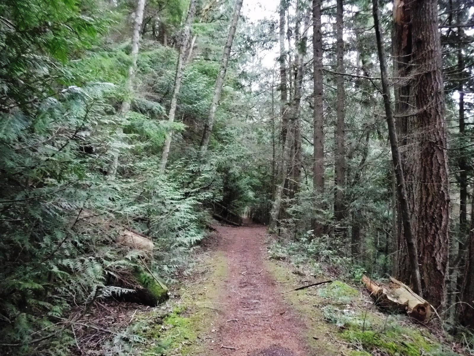
We walked down the road from the parking lot towards Kiket Island and first explored the south trail.

The gravel road goes through the center of the area, between the south and the north trails.

Hiking along the south trail through salal, ferns and a few Madrona trees. Then we hiked down the north trail.

The photo below shows some one's handy work on a rock along the north trail. It's made up of small sticks and tree needles.


It's hard to see through the clouds, but from this view point we could see the Deception Pass bridge.

The road and trails come down to a large opening where there is a bathroom and a picnic shelter.

It was so windy and rainy when we were there for lunch that we sat in the bathroom alcove, on the cement to give us some shelter. We bring foam pads to sit on when we hike so that helped our comfort level a bit. We also sat against our packs for a back rest and it was pretty comfy.
Our lunch view.

After lunch we went down the short trail to the beach. The tide was up, so we couldn't explore there.


We then walked the short beach trail towards Flagstaff Island.

Flagstaff Island, is a wildlife sanctuary and it's closed to the public.

The wind and rain were bitter cold against our faces as we walked back along the beach trail. It was nice to get into the forest and be sheltered from the weather.

There are several information signs on the preserve. I particularly like this one. If you enlarge it you'll see that it has the original native names listed with our present day names.

We hiked the north trail again on our way back I really enjoyed exploring there and would like to go back when we could feel the sun on our faces. It would be a nice place to hang out at if the weather was better. We had planned on hiking Sharp park perimeter trail after being at Kukutali, but I wasn't sure I wanted to if the weather stayed like this. We decided we would drive to the trail head and see if the weather was any better before we bailed on the hike. The weather did get better. We headed down the trail with no rain or wind.

We hiked the trail clockwise this time, the other 3 times we hiked here we've always hike counterclockwise. When we got up to the highest view area it was still dry and a little dark.

I was so glad we stayed with our plans to do our second hike because by the time we got to the lower view area the sky had begun to clear and the sun came out.


A large Madrona with blue sky behind it.

We stopped at Porpoise point for a break and a snack. We were just talking about how we had seen Porpoise there the last time we were there, and wondered if they are always in the area. Sure enough there they were swimming by. We also saw a Harbor seal. He poked his head way out of the water and looked around. The photo below shows a large kelp bed that the Porpoise and seal swam by.

As we were walking away on the trail, I looked back and saw our lovely green patch on the rocks where we had just been. What a beautiful area.

Two hikes in one day that seemed so different, just because of the weather.

Kukutali preserve Garmin stats:
total miles hiked- 3.3 miles
total ascent - 502 feet

Sharpe park Garmin stats:
total miles hiked - 3.35 miles
total ascent - 961 feet

Combined stats:
6.65 miles hiked
1463 total ascent

Wind, rain and sun, made for a day of fun!

Monday, January 22, 2018

Mon Oeuvre ~ On Ringo Lake Mystery Quilt progress 9

HALFWAY!
 I figured out a way that works for me to be a little more efficient. I stack all of the blocks in the order that they will be sewn in the row: left (top of the pile) to right (bottom of the pile) into a pile. Then I sew each layer's pieces of the pile together for that block. As I complete each block (with it's sashing), I sew it onto the previously sewn block. When that entire row is sewn together, I then sew that "long" row to the previously completed section of the quilt. This works for me as it helps me keep all of the points and pieces facing the correct way, and I don't have to do any sorting as I sit at my sewing machine. The bonus in this is that I am ripping far less "mistaken direction" seams apart and having to resew them. 
Below is the photo of all of the blocks (11 counting the setting triangle and the corner piece) for the 6th row, it will be a mirror of the 5th row as it will add the lower left corner to the quilt., from there the rows will get shorter and shorter. Hurray!!

On Ringo Lake Mystery Quilt

Saturday, January 20, 2018

Picture of the week - Skinny man, Dreamer

Every great dream begins with a dreamer. Always remember, you have within you the strength, the patience, and the passion to reach for the stars to change the world." Harriet Tubman

Friday, January 19, 2018

Chuckanut Ridge/Fragrance Lake loop hike

Our "up" hike for the week started at the North Chuckanut trail head parking lot today. I'm glad this sign was there, so we wouldn't be lost before we started.

We hiked through Arroyo park, 

and then "up" the North Lost Lake trail to the Chuckanut Ridge junction.

It was clear enough to get a view of Bellingham from the ridge trail.

As we hiked up the ridge the wind picked up.
You can watch the wind blowing through the trees and get a view of the trail on this video.
https://youtu.be/L3yuYES8v30

We continued on up the ridge until we got to the junction that led to Cleator rd.

A nice view of Bellingham Bay as we hiked down to the road.

Such a nice trail corridor.

Finally down to Cleator road,

which we walked up till we got to the Fragrance lake trail sign, where we joined the Fragrance lake trail.

Fragrance Lake


We walked on around the lake and sat down under some trees for lunch.
It was chilly enough that I wore my fleece gloves and buff on my head and neck while we hiked. I was glad I had a thermos of hot cocoa in my pack.
During lunch we talked about whether we would go back by the Two dollar trail that turned off right by the lake or continue all the way around the lake and hike up over the hill and join the Two dollar trail from there. It was decided we would go over the hill. We had hiked to Fragrance lake via the hill trail once before, you can read about that hike HERE. Today we hiked that trail going the opposite direction. I was interested to see which direction I enjoyed more. I decided I didn't have a favorite, I like hiking it both ways. 
We joined the hill trail at the Fragrance lake trail sign. The trail is behind the sign and around the ferns.

The photo below show the trail, it goes up a short hill to the ridge above the lake.

A view of Fragrance Lake from the hill/ridge trail.

We hiked down the Two dollar trail and then walked down the Cleator road to the Interurban trail.


The last stretch of today's hike was along the Interurban trail.

We walked along this trail to the North Chuckanut trail head parking lot.

Garmin stats:
total miles - 12.7 miles
total ascent - 2303 feet

Relive video of our route.

*a side note. I noticed a news story today that made me very happy. "The iconic trails, forests and habitat around Oyster Dome, Lilly Lake and Samish Overlook will now be preserved for future generations!...The state passed a Capital Budget in January 2018 that includes full funding to preserve the Blanchard core as a new conservation area! ". The Blanchard hill area will be protected from the proposed logging. You can read about it HERE. Happy trail to you!

Monday, January 15, 2018

Mon Oeuvre ~ On Ringo Lake Mystery Quilt progress 8

This week has been all about assembling.
I started on the top left corner and am working diagonally, since the blocks are on point. The row on the lower left isn't sewn on yet. My system is to sew each block individually, I then sew the sashing onto it. All of those sewn blocks will be sewn together to make that row. Then comes the tedious part for me, pinning and sewing that row to the upper section.
I need to really concentrate to get all of the sashing points going the correct direction, and to make sure I don't sew over the points in the seam. It's been a bit intense, but I'm slowly making progress.


We have an official graphic for "On Ringo Lake" mystery quilt now.
http://quiltville.com
On Ringo Lake Mystery Quilt