

Friday, March 27, 2020
Thursday, March 26, 2020
Clearcut view hike
Today our hike started at Samish Lake. I checked the Whatcom County parks website before we left to find out if they are still allowing parking and hiking on their trailheads and trails. I was happy to see that as of a notice dated March 24th they are allowing us to use their areas. The Washington State parks closed access March 25th after our Governor gave his mandate on Monday March 23rd. I was glad he said that going outdoors was an "essential" activity. As long as we keep our 6 foot distancing we may go for walks, bike rides etc. (we edited his mandate to be more specific: "with people we live with only"). In order to keep as safe as possible in this current state of our new normal, we have decided that our hikes will be on logging roads where we will have more than the 6 foot space allowed. These also have typically less people walking on them. We decided that single track hiking isn't for us as sometimes a trail doesn't allow for being able to step aside as far as is needed.
When we arrived at the Samish Park parking lot we discovered the bathrooms were locked, so we drove to the Squires Lake trailhead parking lot. There is a port-a-potty available there. Back we drove to Samish Park to begin our hike. It was raining while we did our back and forth driving, but it stopped by the time we got our things together and set off.
Lake Samish

I named this hike the "Clearcut view hike" because we would be walking by old logging areas, known as "Clearcuts".
Logging road walking


We took a side road off of our intended route for a break to eat a bit & found a nice spot to sit.

Some pretty sightings at our lunch spot.
A nice fern garden nestled in an old mossy log.

A baby Fir tree.

The new growth of a Foxglove emerging for another years’ season.

Currant or Salmon berry bush in bloom, I’m always confused as to which is which.

Views from our lunch stop.


As we made our way back to our intended route, we passed some Pussy Willows near an old gravel quarry.
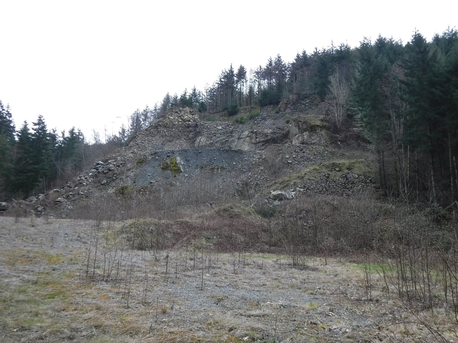


It started softly raining shortly after we passed the gravel quarry, so we put on our rain ponchos and kept them on for the rest of the hike.
Back on our original logging road route we had some nice views past the clear cuts.

We could see Bellingham Bay far in the distance.

On our last section of the hike we got to enjoy a nice splash of Spring color,

a peek at a small pond

and the ever green moss alongside the road💚

Seeing all of the new growth along the road today reminded me that we too can have "new growth" and a time to begin again.❤
I hope you are staying well in this strange time our world is going through and that you can have some time to venture out and be thankful for this beautiful earth that we are fortunate to be living on.
*We saw "ZERO" people on our route today, so we followed the physical distancing mandate pretty well.
Relive video of our route:
Relive video stats:
total miles hiked - 8.4 miles
total ascent - 885 feet
Saturday, March 21, 2020

Thursday, March 19, 2020
Mon Oeuvre - Frolic Mystery Quilt progress 16
My last post showed that I had completed the inner border.

This week I worked on the two rows of the outer border and the pinwheel corners.
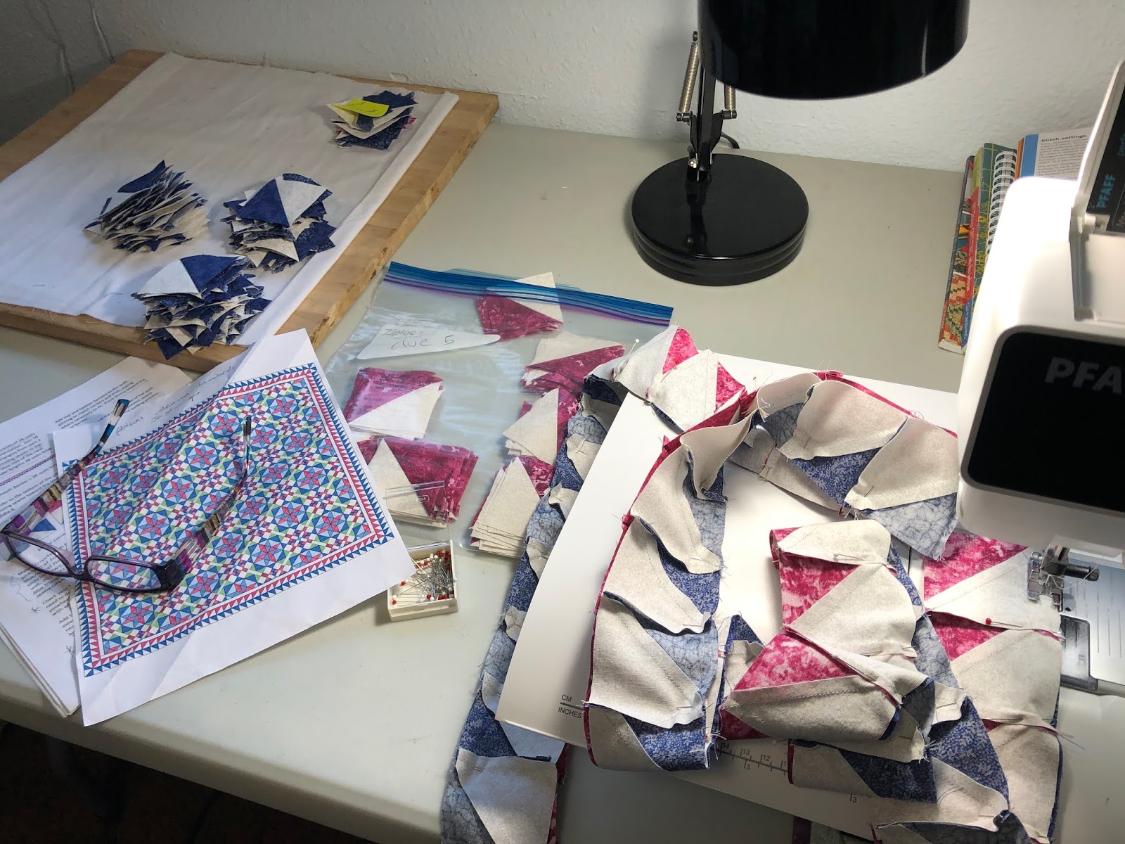
Sewing the outer borders to the inner border. Pins were very much my friends on this last bit of outer sewing.

After I pinned and sewed the side borders on, it was time to pin the top and bottom rows of the border to the quilt.

Outside photos of the completed "Flimsy" (completed top of the quilt)


Now to think about the back. Hmmm, what to do.
Monday, March 16, 2020
Mon Oeuvre - Frolic Mystery Quilt progress 15
Time to trim the edges from the "Frolic" Mystery Quilt. Pardon me while I vent for a bit. I've never done a quilt where I had to trim off parts of blocks on the edges before, I'm not sure how I feel about it. It seems a waste to me. Some of my "unhappy" thoughts as I am nearing completion of this quilt: Too many units were made as per her instructions and are left over now. Spare pieces that have already been cut & sewn together, I don't want to have the joy of figuring out what to do with all of the left over units as she said to do in the last clue. Lengths of fabric that didn't need to be bought have been cut and sewn and can't be used as uncut fabric. Stress during some of the released clues wondering if I had enough fabric to complete the quilt, could have been eliminated by only cutting what was actually needed. Yes, I sound like a broken record. Now on the flipside, I am thankful that the Mystery Quilts are provided to us for free and I understand that we are her Guinea Pigs in formalizing a pattern. So in the long run I will still say Thank you to Bonnie Hunter, but I'll add a hmmmm..... this year.
Anyway, this week I trimmed the excess off.

Stay stitched around the edges.

Trimmed center of the quilt.

Sewing on the "inner" border.

"Inner" border.

This has been a challenging quilt from the start for me. I struggled with deciphering the instructions on several of the clues, but it's coming together and I love it!
Saturday, March 14, 2020

Friday, March 13, 2020
Mon Oeuvre - Frolic Mystery Quilt progress 14
After much wrangling to sew the last corner section onto the rest of the quilt,

The center is done!

Now let's see, what's left to do?
Trim and baste the edge
Cut the first "inner" border fabric out, sew it together and attach it to the quilt
Put together the final outer border pieces and attach them to the quilt
Stay stitch the outer border to the quilt
Put the back together
Making the quilt sandwich
Quilt the sandwich
Bind the finished quilt
Have I forgotten anything??
Whew!
Thursday, March 12, 2020
Blanchard Mtn. Loop hike
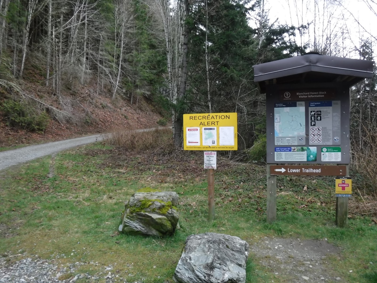
Today's hike was a loop of Blanchard Mtn. We began at the Upper trailhead parking lot and checked out the logging info. sign, we then walked up the logging road for about 3 miles to the British Army trailhead.

The PNT (Pacific Northwest Trail) follows the British Army trail so there were the usual emblems and Blazes painted on the trees.


I love the ones that are painted low on the tree, I spend a lot of my time looking down so it was nice to see that they double marked them. It would be a shame to miss a turn because you didn't see a Blaze on a tree.

For some reason the trail sign is a ways up the trail, but it's there.

Making our way to Lizard lake.

Beautiful forest trail.

The trail comes to the northern end of Lizard lake. The photo below is looking to the south end of Lizard lake. There was a lot of sign of Beaver activity.


A Beaver house in the distance.

A closer look.

We walked along side the lake, part of it still had a bit of ice on it.

More Beaver activity.

A view of Lizard lake looking back to the northern end. We had just finished walking the length of the lake. It was pretty chilly at the lake so I put on my gloves and hat.

Now it was time to hike up to North Butte for a late lunch.

Instead of climbing up the rocks and sitting on the top for our lunch we walked around the rocky top and looked at the view from the more spacious rock "shelf" area.

The breeze was a bit chilly at the larger rock shelf area so my husband wandered around until he found a perfect little moss covered rock area for us to eat our lunch. It was great because the breeze rarely came our direction and we actually felt the sun's warmth on us off and on. We hadn't started our hike until nearly 11, and now it was 2:00. Needless to say I was ready for lunch!
The view was wonderful.
*that bump to the left is Oyster Dome

After lunch we made our way down to Lily lake.

We walked past the campsites as we walked along the lake. Lily lake also had some ice on its surface. I was really cold by the time we got to the end of the lake. So on with the hat, gloves and now my fleece buff to cover my face from the cold.

At the trail junction directing us to the Samish Overlook, I saw that this poor tree had been upended.

The "fancy" bridge. Always a conversation starter for us.

As we made our way down the trail, we were being treated to the sun's warmth. All of my "extra" cold weather clothing came off, as I enjoyed "this" side of the mountain.

The Samish Overlook view. We stopped here for a break and a snack. We only had about a 3 mile mostly downhill hike to the parking lot after this.

To the Larry Reed section of the trail.

I love this photo of my husband hiking in front of me with the sun shining low through the forest. I took this photo at 5:50. So nice to be hiking later and it's still light.

One mile to go marker.

I really enjoyed our "loop" hike of Blanchard mountain. The only area that we really saw any other hikers was the upper Oyster Dome trail section before we turned off to the Samish Overlook. It was nice to start and finish alone in the quiet of the forest, just the two of us.
Garmin stats:
total miles hiked - 12.14
total ascent - 2251
Subscribe to:
Posts (Atom)