Thursday, March 31, 2016

Rock trail, Burnout Point, Lost lake & Chinscraper!

My husband took off some days from work for his birthday. 
64! He's old ;-)
We decided to head up the Hiline road to the Cyrus Gates Overlook parking lot and begin our day of wandering by going down the Rock Trail. You can read about the Rock trail and see more photos of the area HERE
It was a beautiful blue sky day for our hike. 
Here's today's view of the bay from the Overlook parking lot.

When we got to the trail junction with the Lost lake trail, we took a right and headed to Burnout point.


There are no signs telling you that Burnout point is to the right, but now you know an insider tip. 
We hiked to Burnout point (2 years ago) on my 60th birthday, you can read about that epic day in "my" life HERE. On that particular hike we did a point to point hike from Larrabee Park's, Fragrance lake trail and ended at North Chuckanut trailhead.

On this hike today I'm 62 and still savoring everyday.

The views from Burnout point, starting at the south and working my way to the north.


We continued walking up the road till it dead ended. From this point we could see Lost lake (where we were headed). If you click to enlarge the photo below you will see the lake easier.

Samish lake,

and Mt. Baker.

After we ate lunch we headed down the trail towards Lost lake. If you look closely you can just see my husbands head above a tree.

Just one of the "5" Trillium's we saw today.

I found this fella hanging around in a tree down by Lost lake.

The photo below was taken with me standing in front of this massive root ball to show it's size in comparison to me.

When we got back to the Rock trail/Lost lake trail sign junction we continued on straight and repeated our way towards Burnout point, but this time we took a right at the junction near Burnout point. We were still on the Lost lake trail but headed towards the Chinscraper trail junction that would lead us back up to the Cyrus Gates Overlook parking lot. 
The area is popular with the mountain bikers, and at this trail junction they have labeled the trail for bikers to the left and hikers to the right.

The chinscraper section is about 1 mile in length and pretty much "up". 
I really enjoyed it.

It was nice to be out hiking with my husband on his birthday week, we had such a good time together.

I checked to see what the high temp for the day was and saw this - wow!

Here's a video collage of our day.

Endomondo stats:
total miles hiked - 8.25
minimum altitude - 1097 feet
maximum altitude - 1860 feet
total ascent - 1833 feet
total descent - 1779 feet
Thursday, March 24, 2016

Cub/Smith creek Trailblazer hike 2016

What a fun bunch we are. Raring to go on a dark, wet day. 
Our group of 12 donned our rain gear and headed up the trail behind Marjan.

She was filling in for our "Fearless leader" - Pat, who was at home dealing with a head cold. We had hiked this trail in January of 2015. If you want to see what the area looks like on a beautiful blue sky day with wonderful views you can read that post HERE.
As we began our upward trek it stopped drizzling and we were getting a bit warm, so when we got to a section where the trail crosses a logging road we stopped to change out of our rain jackets.

We came to a downed tree and had to scramble over it. When Joe and Ed came to it they whipped out their handy hand saws and cleaned up the branches. When we returned after lunch we had just a couple of nice logs to step over. Their work was greatly appreciated.

There was a nice low fog/mist hanging in the trees.


We had just enough of a clearing in the clouds to make out Lake Whatcom below.

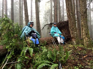
Our group broke up into 3 groups. One group (of 3) stopped just before the trail really got steep to eat lunch. They made sure they had some car keys with them, so they could get out of the weather if they returned before the rest of us. The second group (of 4) stopped about a 1/2 mile from the first group for their lunch. Marjan and the rest of us pressed on hoping to get to our usual lunch spot. The weather was deteriorating. We agreed that since the wind was picking up and it was raining that it probably wouldn't be a great idea to go on and eat our lunch in the open area we usually eat at. So we found a nice sheltered area and stopped for lunch. Bill took this picture of Marjan and I just settling down to eat.

It was a quick lunch for our group, it was chilly and our hands got very cold. We packed up and made our way back, hoping to connect with our other hikers. As we left our spot I took this picture of our misty forest.

We hiked out quickly and were happy to find all of our group at the parking lot. As it turned out they had just gotten there themselves.
Proud of us. 
Hardy folk were hiking today.

 Endomondo stats:
total miles - 4.7 
minimum altitude - 352 feet
maximum altitude - 1938 feet
total ascent - 1586 feet
total descent - 1523 feet

As I'm in training for several events in the next few months I decided to "Spartan up" (push myself further) and hit the trail again after I got dropped off at the Bellingham Senior center. I really wanted to get some more distance in for the day.

Endomondo stats:
total miles 5.3
minimum altitude - 429 feet
maximum altitude - 539 feet
total ascent - 163 feet
total descent - 140 feet

My totals for the day:
total miles 10
total ascent - 1749 feet
total descent - 1663


Choose to live

Super proud of the honesty & love of this woman, she loved her sister & put the truth in her sisters obituary. 
Depression is real.
Do something about it now.
Read the article: Aletha Meyer Pinnow

Thursday, March 17, 2016

Bowman Bay/Pass Lake Trailblazer hike 2016

This morning as we met at the Senior Center, our "fearless leader" Pat laid out a map to show us his proposed route for the day.

Our route marked out in green.

15 of us began our hike today from the Bowman Bay parking lot after a long carpool from Bellingham.
There was a chill in the air even though the skies were blue, with a promise of warmth later in the day. It didn't take long for us to warm up once we got to Pass lake and began our upward trek.

Joe, from our group has been itching to use his new hand saw on some trail work. He finally got a chance. Our "crew", helping him get the job done.


We made our way up the Ginnett trail for lunch up on the foundation of an old house site.

The sun's warmth was wonderful while we sat and ate our lunches, I sat on a bank a little below this concrete foundation.

My lunch resting spot 
(photo credit Joe Hashmall)

The view of Pass lake in the distance.

Daffodils about to open.

Vinca in bloom.

Then it was on to the new section of the trail. Pat and Ed in our group work on trails throughout the year, and this was one they had helped with. We walked by an old log cabin where the roof had long since fallen in. Ed and Karen posed for me in the cabin.

Farther along we came to an old mine. It didn't go back very far, I went in and with the light from my cell phone was able to see the back wall.


In the photo below I'm looking back towards the opening from about half way back in the mine.

Walking back through the Jurassic Park-ish ferns.


When we got to the trail junction, Pat decided we would go straight back to Pass lake and walk the Bowman Bay road to our cars. He was done for the day. I enjoyed this hike, as Pat is a wealth of information about the area and the trails we hike on. We had hiked this before in April of 2015. That time we did the full route, you can look at the pictures and read about that day's hike HERE.

After we got back to Bellingham, I decided to go for a quick walk around Lake Padden since our hike today was cut short.
The perfect way to end the day.

Endomondo stats:
Total miles hiked - 6.45 miles
minimum altitude - 4 feet
maximum altitude - 402 feet
total ascent - 647 feet
total descent - 739 feet

My "Spartan up" extra training miles walked after the hike - 2.55 miles
minimum altitude - 416 feet
maximum altitude - 538 feet
total ascent - 104 feet
total descent - 141 feet

My totals for the day:
total miles hiked/walked - 9 miles
total ascent - 751 feet
total descent - 880 feet