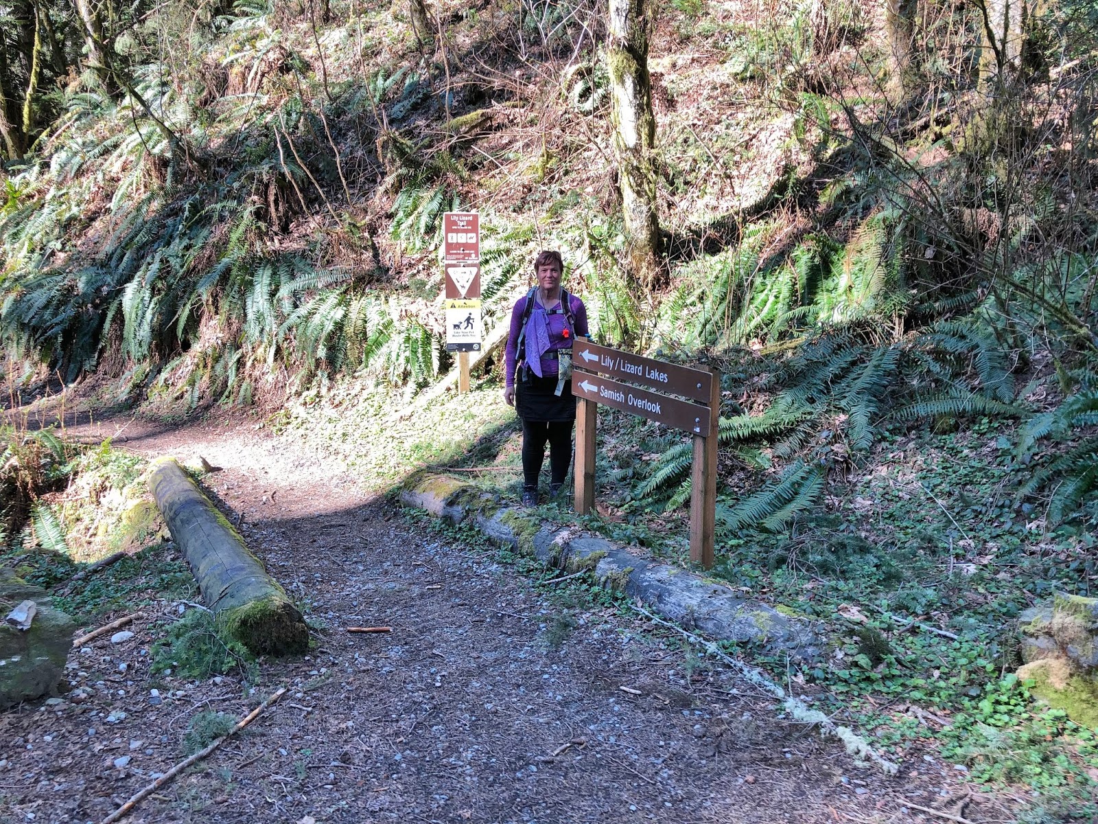
Today we toured Blanchard mountain. It was a beautiful day with just the slightest chilly breeze in the open areas. We began at the Blanchard mountain parking lot and headed down the road towards the Lily Lizard trail.
I was ready for today's adventure, my Shingles episode is nearly over. Whew, still needing soft clothes around the sensitive areas though. I came down with Shingles sometime around the end of February& early March. I said in last week's POST and I'll repeat it here again, there's only one type of Shingles a person wants to have and that's the roof variety. Such an ordeal. I'm so thankful that I'm able to get out and enjoy this glorious world of ours.
There was a nice little stream flowing under the bridge near the beginning of the trail.
A large heart rock on the trail❤
We headed towards the Samish Overlook and the Larry Reed trail.
Another heart rock on the trail today❤, framed in the silhouette of ferns.
As we neared the Larry Reed trail and the clear-cuts we could hear a chorus of spring frogs.
You'll have to turn your volume all the way up to hear them in the video.
The view was spectacular at the Samish Overlook today, we enjoyed it while we ate half of our lunch.
There were also several hang-gliders & para-gliders preparing to take off.
I really enjoyed watching one of them in particular soar above us.
After lunch we took the Chuckanut trail to get us to our destination of North Butte. As we entered the Chuckanut trail from Samish Overlook I took this photo of the PNT trail marker.
The single white "blaze" markings and other signs for this trail are found on many of the trails in our area and on the Skagit county trails that we hike on. This last Saturday we attended the Bellingham Ruck, held at the Deming Logging show grounds. The attendees each received free Hydro Flask cups commemorating the 10 year anniversary of the PNT trail.
The Ruck was a gathering to learn about Long Distance hiking. We were particularly interested in attending the Ruck not because we have plans to do something epic, but to learn about how to lighten the load in our backpacks and hopefully hear some food and nutrition tips for while out on multi-day backpacking trips. The hikes showcased at this Ruck were the: CDT - Continental Divide trail, PCT - Pacific Crest trail, PNT - Pacific Northwest trail, ODT - Oregon Desert trail and the Wonderland trail. It was a great day and we learned alot.
My husband has been reading these books about the PCT and I'm next in line to read them. The "Long Trails" book by Liz Thomas is a great resource book.We heard Heather Anderson talk about her book "Thirst" at the author talk at Village books recently. We met the author of "Tamed" (Ann O'Regan) while we were on the Wonderland trail last summer. We met her on August 26th "Day 6" of our journey. You can read about that day's hike and see where we met her HERE.
Anyway back to today's hike. We hiked up the trail that leads to the Oyster Dome via Samish Overlook, but we didn't go to the Oyster Dome instead we headed towards Lily lake.
I was surprised to see that the snow was still along the trail.
I love this little corridor that leads to Lily lake, the snow patch was beside us all the way to the lake.
Still frozen Lily lake
We hiked past the newly upgraded lakeside camp sites. It looks much lighter and less muddy than in the past.
Then on to North Butte.
Our destination!
It was so sunny and warm on top of the Butte as we ate the rest of our lunch, I wanted to stay there all day.
A wonderful view of Bellingham bay and the San Juan Islands.
My husband taking one last look before joining me on the trail below.
Time to head down the mossy trail towards Lizard lake.
Another frozen lake view, this time Lizard lake.
We stopped and checked out the campground before we left. A couple was setting up their tent for a nights stay at the lake as we left.
There was sign of several busy Beavers.
To end our hike we headed down the Alternate Incline trail and the road back to the parking lot.
Hopefully this precariously perched tree won't find a head to fall on. Yikes!
Where to go when the weather is beautiful, preferably a place with views. We did just that today on our Fragrance Lake loop hike.
We had planned on heading up to Burnout point from the Lost Lake trail head parking lot by Larrabee State park, but they are doing a logging in that area. We read the signs and saw that an active logging will be in the area for awhile with trucks going up and down the Fragrance lake road so we changed plans. We drove to Hiline road parked at the Fragrance lake trail head to begin a loop with Burnout point for lunch. We first walked up the road to the Cyrus Gates Overlook.
Such wonderful views!
Looking out over Bellingham bay.
Then down the Rock trail with it's many steps.
Past the wonderful Chuckanut Sandstone cliffs.
First Skunk Cabbage sighting this spring!
Finally to Burnout point,
and it's wonderful views for our lunch stop. We could hear the logging operation going on, but we couldn't see it. Lots of chain saw noise and the occasional tree falling other than that a warm and pleasant place to take a break.
My happy place❤
Today I was thankful for REI dividends. I got my new hiking dress there, I liked it because it makes me feel like I'm in my Brownies/Girl Scout uniform I wore as a young girl. I'm also thankful for day packs that ride high on the hips and no hiking pants with tight waist bands. After a break it's nice to be on the trails again. Just a note of information there's only one kind of shingles that a person wants and it's the roof variety, and yes I had my vaccination😥
Back towards Fragrance lake. The sign below shows where we hiked from to get to Fragrance lake.
Not quite still enough waters for a great reflection but beautiful anyway.