 |
| Sighted near Elbow Lake |

Saturday, February 28, 2015
Thursday, February 26, 2015
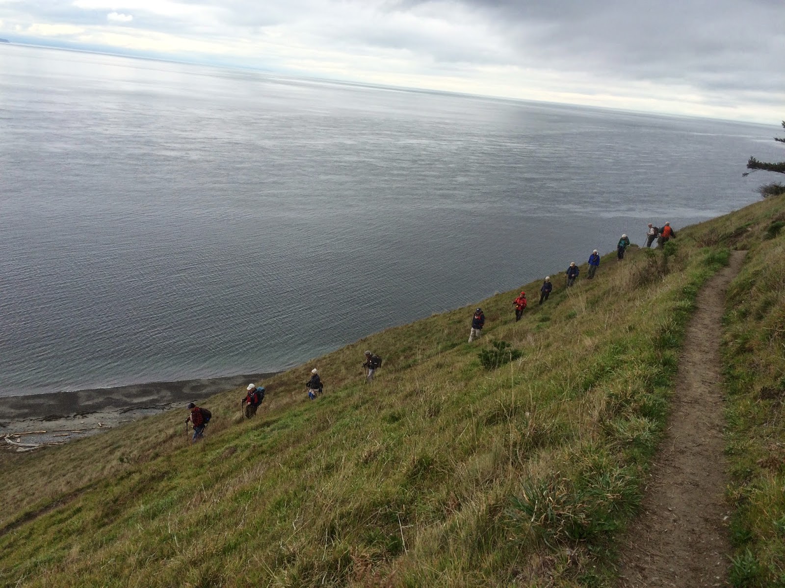
Ebey's landing Trailblazer hike
The Senior Trailblazers were scheduled to hike at Ebey's Landing today.
I was happy to be back with the group as I'd missed last weeks hike. I was busy playing on an Oregon beach for my 61st birthday. In the photo below I'm standing on the beach in Lincoln City, Oregon.

I was happy that this weeks hike would be on a beach as well. Our group of 13 were raring to go after our 1 hour drive from Bellingham.
We began at the beach parking area.

We then went up the stairs to get to the top of the bluff.

Once we were at the top we paused to enjoy the green fields of
Ebey's Landing. Ebey's Landing is a National Historic Reserve.
 |
| Several of us stopped to take pictures of the fields |
We then walked towards Sunnyside cemetery for a quick out and back to give us a bit more mileage. I particularly enjoyed this area because of the historic signs and buildings along the way.


 |
| Our fearless leader "Pat" |
We then headed back towards the bluff to continue our loop hike.


We found a nice view place for lunch.

The bluff trail continued on for a little longer -
 |
| The bluff trail winds down to a spot just at the end of the Lagoon, just visible in the distance. |
We then began the nice, long switch backs down to the beach -


The rest of our hike was along the shore.
Since the beach was still in my mind this was the perfect way "for me" to end today's hike!

Endomondo stats:
Total miles hiked - 6.8
Minimum altitude - minus 55 feet?
Maximum altitude - 252 feet
Total ascent - 322 feet
Total descent - 323

Saturday, February 21, 2015

Thursday, February 19, 2015
Savoring "60"
Today is the last day I will be sixty, tomorrow I turn 61. My husband & I are celebrating my birthday week on the Oregon coast. He asked me where I wanted to go for my birthday.
I said to the Ocean, so here we are.
I said to the Ocean, so here we are.
I thought about what I wanted to do on the last day of my 60th year. I decided to run 6.0 miles, I thought that would be nice. I started at the Otter creek overlook & then veered off of hwy 101 to the Otter Crest drive. It runs parallel & below the hwy.


Some of the views along the way -


I finished right at the Beverly Beach turn off.

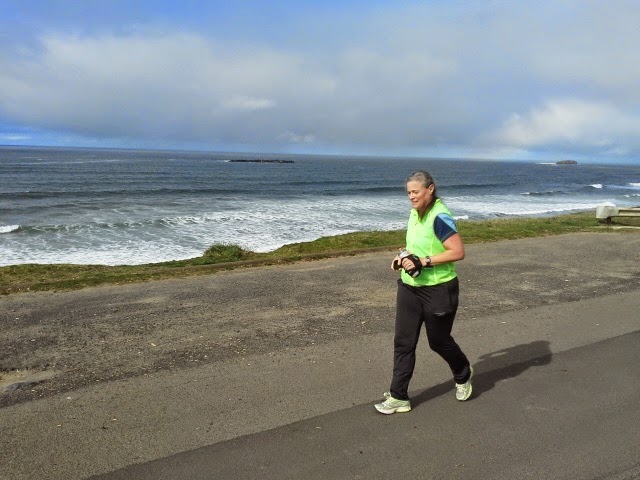
It was the perfect way to close out my "60th year.
I wonder what "61" has in store for me?!


Sunday, February 15, 2015
Ten mile run
What wonderful February weather we've been having. The weather forecast for today showed sun and mid 50's for the temp's, so I was very happy. I usually try to do a long run on Sundays. Today I had decided it would be 10 miles. I haven't ran that far for awhile, so I thought I'd give my endurance a test. I'm hoping to get some longer distances in throughout the summer, so this is just the beginning.
Back in October I did a post inviting my readers to come along on an 8 mile run with me.
You can read it here. I thought I'd do the same thing today since it was so beautiful.
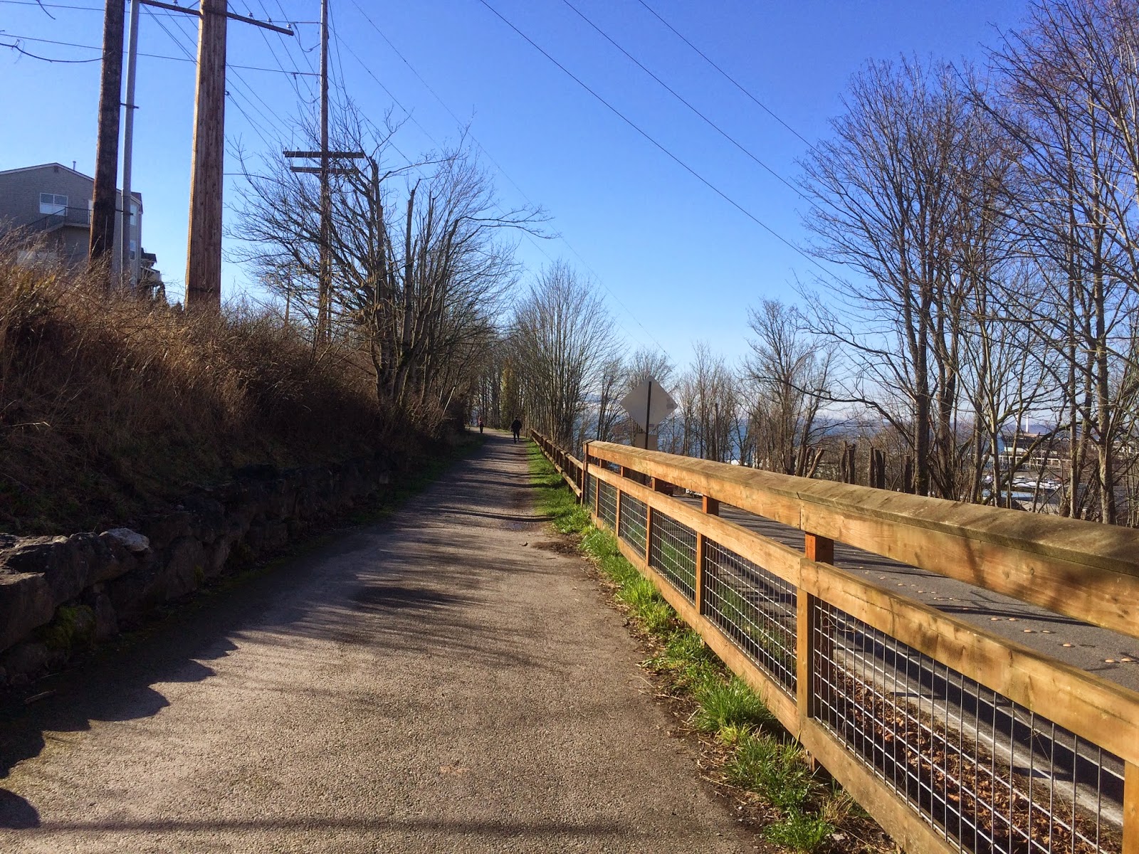
I did an out and back course starting in Cornwall Park.
Here are my views as I ran -
 |
| Squalicum Harbor |
 |
| Looking towards Zuanich park |
 |
| South Bay trail |
5 mile turn around point, time to head back. If you click on the photo below to enlarge it you can see some of the Sail boats in the bay.

Heading back through town -


and happily back along the water again.
 |
| Bellingham Shipyards |
Passing Hotel Bellwether

Squalicum way - almost done,
and past one of Bellingham's newest city parks Squalicum Creek park.

 |
| Cornwall park |
Done!
Now, wasn't that a beautiful 10 mile run?
Saturday, February 14, 2015

Friday, February 13, 2015
Campbell Valley Regional Park Trailblazer hike
We are indeed international hikers.
Every once in awhile we go across the border into British Columbia, Canada to hike. Thursday we went to Campbell Valley Regional Park. We went there before in November of 2013. You can read about that very cold hike here.
This week's hike was much warmer (mid 50's) and just a slight sprinkle off and on.
11 of us carpooled for our journey into another country for our hike.
11 of us carpooled for our journey into another country for our hike.
 |
| New "early" leaf growth |

 |
| A very high bridge railing |

 |
| Packs at rest, for our lunch break |
 |
| An unusual tree |


Our great hiking day ended with an exclamation point!
We were asked at the Border crossing coming back in to the United States:
"What were we doing in Canada?"
Pat (our fearless) leader replied, "We were hiking".
The customs agent said, "Aren't there any trails in the U.S. that you could have hiked on?"
Pat then replied, "We occasionally enjoy coming to Canada to hike"
The agent then replied, "Why aren't your clothes wet?"
*note - it was raining quite hard at the time we were at the border crossing.
To which Pat replied, "It hadn't been raining enough for us to get wet."
The agent then asked us what were we bringing back in to the United States, a fellow hiker in the back seat replied, "oh only a little mud".
The agent quickly said, "turn off your car and unlock the trunk."
He then proceeded to go through our packs that were stowed there. Finding nothing of interest, he gave us our identification information and let us go. Whew....
Upon arriving back at the Senior Center in Bellingham, we asked the other drivers of the cars in our caravan how their crossing went. They all replied that they were asked "if they had been hiking why weren't there clothes wet. They however weren't searched.
Lesson learned by our quippy back seat hiker, don't try to be funny.
Border crossing agents don't have a sense of humor.
I trusted Pat for our distance. We hiked about 5 1/2 miles mostly flat, with about 164 feet of elevation gain.
I use my iPhone & the endomondo app to track my activities. Since we were in Canada and I didn't want to pay for *roaming data fees, I turned on "airplane mode".
*note, I'm adding this because I had an aha moment.
I'm such a silly, I had a lightbulb moment & realized why I can't get my GPS to work when I try in Canada. On my iPhone I've been turning on Airplane mode instead of turning off data. Oops, apparently I didn't understand the difference. Hurray for me though, I'm happy to discover my brain still works.

Saturday, February 7, 2015

Subscribe to:
Posts (Atom)