Friday, July 31, 2020

PCT Section i Day two, White pass to Snoqualmie pass

After leaving Sheep lake we climbed to Sourdough gap, as we climbed we saw Mount Adams and Mount Saint Helens.
Mount Adams
Mount Adams zoomed in

Still climbing.

Through the haze was Mount Saint Helens

Mount Saint Helens zoomed in.

Looking at the trail we would traverse.


Looking back at where we'd come from, the Sourdough gap trail on the distant ridge.

Heart rock❤ on the trail!


We stopped at this survey marker, noting the elevation of 5,882 feet.

Yes, I'm tickled to be hiking on the PCT!

A good place for lunch.

The wildflowers were abundant.

Looking towards the burned area of the Norris creek fire of 2017. We had been hiking the Northern loop on Mount Rainier when this fire was raging. On the last day of our trip a ranger from Sunrise met us and escorted us off of the trail. You can read about that trip HERE.

Mount Rainier above the Crystal mountain ski area.

Crystal mountain.

I love these Pasque?  flowers, we didn't see many on this trip though.

I love walking on spine trails.

Walking through some of the old burn.

Looking down at Basin lake.

I tried to get a photo of some Mountain Goats along the trail, but they were moving and the photo is rather a blur. If you zoom in on the photo you might be able to see them between the trees.

A meadow we walked through as we were nearing our water stop and our camp.

Home at last!

We stayed at camp 4 for the night.

This was our campsite view.

Relive video of our route:

Garmin stats:
miles hiked - 8.42
total ascent - 1562 feet
total descent - 1168 feet

to be continued.....
PCT Section i Day one, White pass to Snoqualmie pass

This trip was all about learning to be comfortable with the uncomfortable, both emotionally and physically. The camp sites aren't reserved like we've been used to on the Wonderland trail, sometimes there just isn't a camp site when you want one and you have to make the best of it, or there isn't water for a long stretch and you have to carry it for miles. Such is the PCT.
We've been reading a few books on the PCT and you know what happens when you read things, your mind keeps abit of it inside and just won't let it go. That's what happened to us. We both had read these books:

My husband had read Cheryl Strayed's book "Wild", I chose not to read that one. Anyway...we made a plan to do some sections of the PCT this summer. We didn't know if the current issue with the Covid virus would keep us from going or not, but when they opened the areas back up to hiking we made our plans.
We brought pages torn from this guide book so we wouldn't have to carry the whole book. We bought two books: one to read and one to tear up section by section for our hikes.

The photo below show our map and map sections that we brought with us plus a screenshot of our route from the Guthook app on my phone. The app was very helpful when we needed to know if a side trail was our route or just an animal trail. It also was extremely helpful for letting us know where the water was and how many miles away complete with photos. Very helpful.

The Guthook screenshot of our first route going northbound from Chinook as you can see it shows where the camps and water are as well as other essential info. Each icon if tapped on opens to more detailed info. as well as comments by others and usually a photo. The app works on airplane mode so not a huge battery drain.

Our night time reading aloud time in the tent consisted of reading the next days trail description and reading from the Patrick McManus book "The deer on a bicycle".

We drove two cars to the passes as we'd be doing our own shuttle. The first drop off was Snoqualmie pass on an off and on rainy morning. This trip was a two part trip. The first started at Chinook and ended at Snoqualmie pass, the second trip had another car shuttle and hike start from White pass finishing at Chinook pass. Both trips combined would give us a distance of aprox. 100 miles. This way we'd get all of section I of the PCT done, all hiking was northbound. We parked our car at the PCT northbound lot, then drove to Chinook pass to begin our journey.

It would be nine days and aprox. 69 miles hiked until we saw this lot again.

The weather had greatly improved by the time we had driven to Chinook pass. The forecast was for sunny and warm days while we would be hiking. The photo below shows a look back at the lot as we made our way up the trail. The restroom was closed because of the virus and there were no permit tags or signs at the start of our hike. Our first day's hike would be a short one to Sheep lake. The general Covid trail protocol worked out pretty well. Most people put on masks and stepped aside. If they didn't have a mask they turned away from us. We put our buffs up whenever we saw anyone on the trail. We generally only saw the most people near the roads and tourist areas other than that it was nice and quiet on the trail.
We began hiking just before 3 pm.

Avalanche lilies

First day photos of us on the trail.


Heart rock❤ on the PCT

Sheep lake

After we set up our camp we took an evening stroll to enjoy the wildflowers and the view of the lake.


That night the wind came up and it was very cold, but the stars Oh my goodness: spectacular!!

Relive video of our route:

Garmin stats:
miles hiked - 2.14
total ascent - 538 feet
total descent - 98 feet

to be continued.....


Saturday, July 11, 2020

Picture of the week ~ Wildflowers


Burnout Point/Lost Lake loop hike

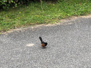
We set our alarm this morning so we could get an early start for our hike. We drove to the Lost Lake parking lot off of Chuckanut drive. It was overcast but a comfortable temperature for hiking. As we were walking through the parking lot we spied this Towhee.

We headed up the Fragrance lake road until it forked with the Burn out road.

Our view at the first view spot.

My husband walking up the road in the clear cut area.

Foxgloves galore.

Of course we had to stop and enjoy eating the ripe wild Blackberries along the road.

Me - enjoying the view.

Huckleberries

Salmon berries

More views and flowers❤


Did I say the flowers were spectacular❤❤

Red Elderberry. We saw several Cedar Waxwing eating off of these bushes that were all along this section of the road.

As we made our way up to the high point of the logging road we saw a bunny enjoying a snack. it didn't seem to mind that we were there at all.


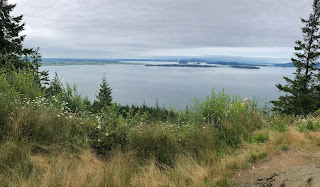
No views of Mt. Baker today, but we could see Lake Samish.

The trail down the hill side to Lost Lake had grown in considerably since the last time we'd gone down it. It appears as if it is a Mtn. bike trail now. Sometimes it was so thick I couldn't see the trail or my husband in front of me.


We had a log over the trail at one point. I tried to figure out the best approach to get past it: under or over? We chose over. Here's a look at it "after" we'd conquered it.

We saw "many" slugs along our journey today and a couple of open robin eggs.

Trillium gone to seed

After we'd gone about a mile through the "jungle" we found the forest floor we were used to, we walked along the lake for awhile and then stopped at the large rock at the lake for lunch.


As we made our way around the lake I spied this small fungus with water drops all over it, I found it interesting so I took a close up of it.

After turning to go along the other side of the lake, we passed the Rock trail junction and continued on to the South Lost lake trail.

We went through a stinging nettle jungle. Wow, they were tall and reaching out for us. Yikes!

After turning onto the Fragrance lake road that would take us to the parking lot we saw these Ghost pipe plants just erupting from the earth.


One last stop as we made our way down the road - the waterfall!

Total miles hiked - 10.6 miles
total ascent - 2395 feet

It started to drizzle just as we were nearing the parking lot and by the time we got home it was raining, so we timed it perfectly😉