

Friday, February 26, 2016
Thursday, February 25, 2016
Oyster Dome Trailblazer hike
18 of us Senior Trailblazers started at the Samish Overlook and headed towards Oyster Dome.


I was excited to see the new trail work to bypass the rooted uphill experience of the old trail.
 |
| old trail |
 |
| new trail |
When we got to the top, the view was fantastic. On a sunny day the rock on the top is really a nice place to laze around and enjoy the day.

As we headed down we followed Max's short cut and then on to Larry Reed's trail.

 |
| macro mushroom |


Endomondo stats:
*I had my doubts about the accuracy of today's stats
total miles hiked - 8.25
minimum altitude - 111 feet
maximum altitude - 2096 feet
total ascent - 2566 feet
total descent - 1396 feet
In November I used a picture of Marjan, one of our hikers for the picture of the week. She was building a kayak from a kit. Yesterday I was happy to watch her put her kayak in the lake and paddle it's maiden voyage.
Here are some pictures of the day -

Karen brought Sparkling cider, we toasted and Marjan poured a bit on the bow to christen it!


It turned out beautifully and I was happy that I got to share her joy!
Friday, February 19, 2016

Thursday, February 18, 2016
Ebey's landing Trailblazer hike
As I laid my head on my pillow last night and listened to the pounding rain on the roof, I wondered what kind of weather we would have for our hike to Whidbey Island. I always pack for whatever kind of weather we may have, just so I won't get caught without and end up freezing or soaked to the skin ;-). Whidbey Island is usually kind to us and we can have a lower chance of rain there than here in Bellingham where we begin our long carpool ride.
13 of us met at the Senior Center, I checked my blog postings and saw that last year on February 26, 2015 we also had 13. You can read about that day's hike HERE. In that post I put in photos of the historical buildings in the area, and since I'd already written about that, I skipped it in today's post.
The skies did lighten up and the day looked to be grand, but when we got out of the cars we realized that there was a brisk wind blowing and it was chilly. Since I pack everything including the kitchen sink. I quickly put on my Buff headband, windbreaker and gloves. In the photo below you can see the large tree and it's top is not standing straight up, but curled over in the wind.

As I stated previously there are historic buildings on the site, this is the sign leading to them.

We walked from the cemetery near Coupeville towards the bluff, where we would join the loop trail.
I had the photo below taken of me to show how windy it is, my pant leg has ballooned out from a gust.
I also had this photo taken, since this is the last hike I will take as a 61 year old with the Trailblazers. On our next hike I will be Social Security/Lifetime National park pass eligible - YAY!!

We hiked along the bluff and then down to the beach.

There is a fresh water lagoon just before the beach. On a calm day the lagoon is a nice place for birding. We did see one lone Heron, a few Sandpipers and some Eagles playing in the wind currents.

We stopped when we got to the beach for lunch. The photo below is a panorama of the view looking from the south to the north. Click on the picture to enlarge it.

After lunch we headed down the beach. The tide was up a bit, so we walked close to the driftwood and watched for the odd high wave that wanted to take a stab at getting our boots wet. If you enlarge the photo below, you will see some of our group just a ways back in the distance.
I tried to spy an agate as we walked along, but no luck.

A little creek seems to flow right into the restroom/picnic area.

After quick trips to the restroom, we headed back up to the bluff to make our way to the cars.
The wind was still blowing terrifically.
I loved it.
Looking north towards the bluff trail.

Looking south from where we had come.

As we were nearing the cemetery I spied these violets in bloom.

What a wonderful clear, sparkly day we had on Ebey's landing.
Always one of my favorite hikes.
I went back and looked at the days wind observations for Coupeville for while we were hiking, the wind gust speeds were 30 to 37 mph, and sustained in the 20's.
Good thing it was 50 degrees and dry.
Fun!!
Endomondo stats:
total miles hiked - 5.35 miles
minimum altitude - minus 25 feet?
Maximum altitude - 252 feet
total ascent - 325 feet
total descent - 399 feet

Friday, February 12, 2016

Thursday, February 11, 2016
Raptor ridge Trailblazer hike
Today's Trailblazer hike was to Raptor Ridge, the first time I'd hiked this with the trailblazers was with Group 1, in May 2011. You can read about that day's hike HERE.
20 of us "group 2" hikers set out from north Chuckanut trail head on a trail surrounded by a sea of large ferns.

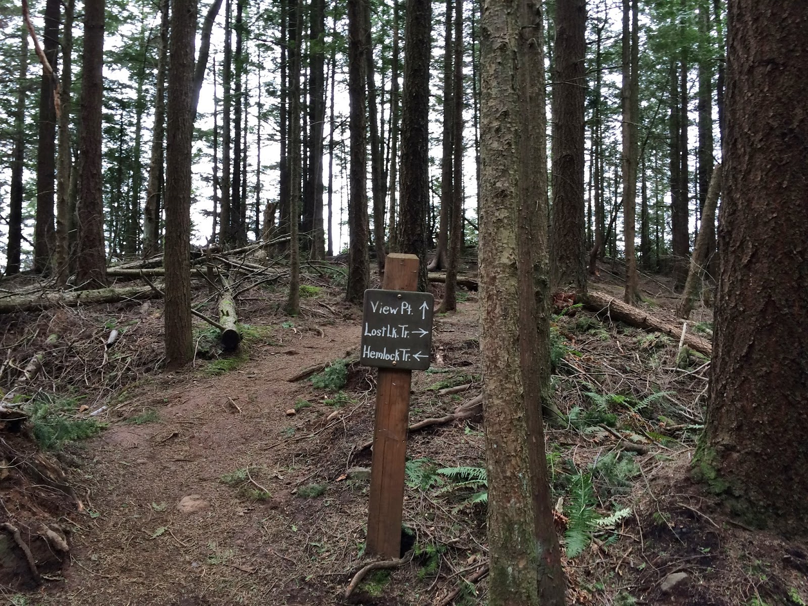
After we'd hike just over a mile we came to a junction with a signpost. We would be hiking on the Hemlock trail up to Raptor ridge. The next section of trail is a pretty good incline as you'll see in my endomondo stats at the end of this post.

Another signpost letting us know that we were .4 miles away from Raptor ridge.

While we were waiting for everyone to get to the fork in the trail, a few brave souls agreed to be photographed on the bridge for me. From the left: Joe, Con, Cindy and Frank. It was good to have Con with us, he joins us every once in a blue moon.

Joe and Ed decided they would do some trail work today. In the above photo you can see a small tree down near the left side of the bridge, it was blocking the trail abit. It was easy enough to step over, but they brought out 2 hand saws and had it cut and moved in a short period of time.


Then on to my favorite section of the trail. The trail meanders through a series of large rocks. I found a website that describes a geology hike of the area, you can read that info. HERE.


Finally the Raptor ridge view point sign.
This was the view we enjoyed from the narrow rock top, while we ate our lunch.

Then it was off to hike again following the Hemlock trail.

Here are a few pictures of some things I enjoyed as we hiked along today. I believe these are called "Turkey tail".


I learned that this is called "rag bag".

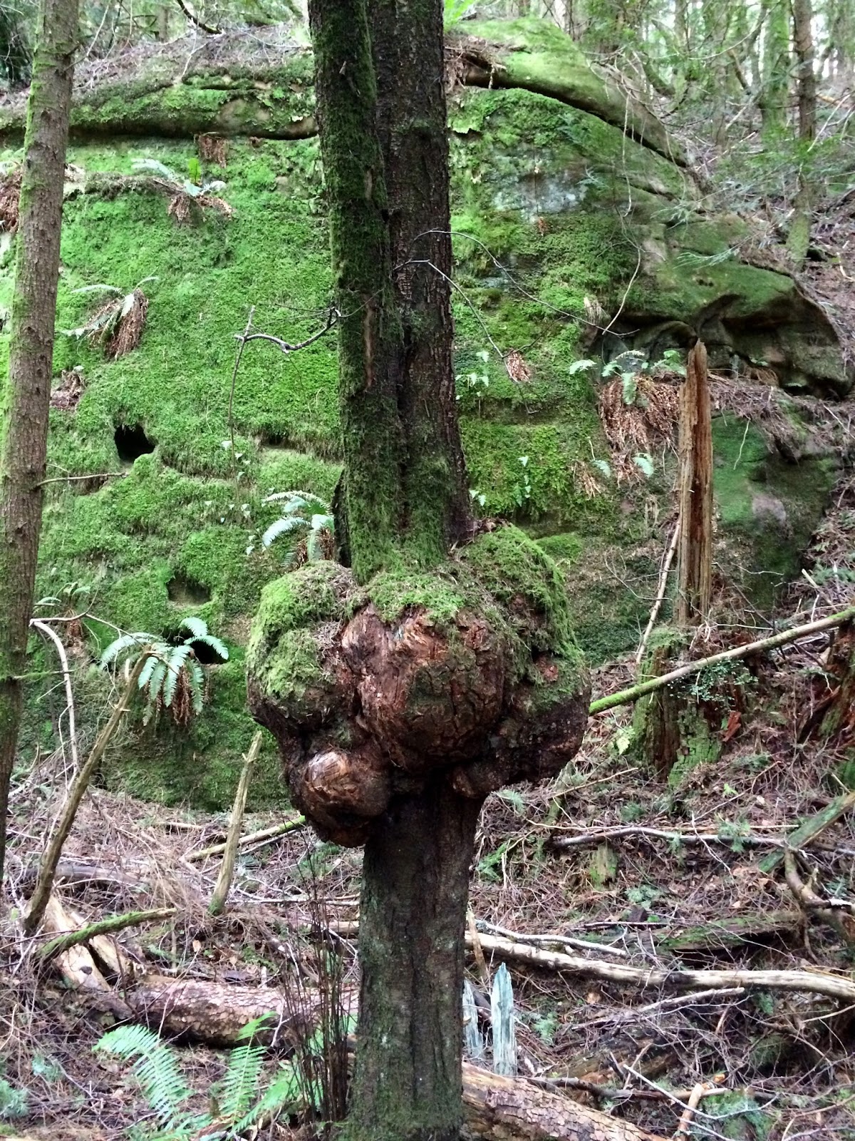
We found a few curiosities in the forest.


We never really had an all out rain on our hike today, but if you look at the surface of the pond in the photo below you can see some raindrops were falling.

20 began the hike and 20 finished, I call that a good day for us Senior Trailblazers!
Endomondo stats:
total miles hiked - 7.7 miles
minimum altitude - 88 feet
maximum altitude - 1651 feet
total ascent - 1698 feet
total descent - 1669 feet

Subscribe to:
Posts (Atom)