

Saturday, February 29, 2020
Thursday, February 27, 2020
Tursi trail loop hike
We thought about hiking to Mud lake from Samish lake today, but it was raining when we got up and it was cloudy still by the time we drove through Bellingham so we went with plan B: hike the Tursi Trail. You can read about John Tursi and find out about some of the points of interest on the trail on this Pdf brochure HERE. The trailhead parking area is just off the Campbell lake road. It's a small parking lot that is a short road walk from the actual trailhead. This trail is also part of the Pacific Northwest trail, we saw the emblems on several sign posts throughout our hike today.

After walking the short uphill, we came across the mine cave and the old cabin remains. We both posed for our "proof we were on the hike" photos.


Nearing the top of the Tursi trail is a view of the great rock face of Rodger Bluff across the valley.

Just before the old house site was a sign post for the Pacific Northwest trail.

As you can see in this close up photo, there is also a directional arrow on the post.

The view of Pass lake from the old house site.

As we made our way down the hill we got to walk in a creek that was making its way down the trail.

At the trail junction we chose to go in the direction of the Big Cedar tree.

The "Big Cedar" tree.

After hiking up the Big Cedar tree we turned right and hiked along the West Pass lake loop trail.

Instead of continuing on the lake loop trail we walked out to Rosario road, where we turned right and walked along the shoulder to the Rosario Beach picnic area.


Spring color on this bush at the beach parking lot.

Yes! Real spring blossoms!

We walked up to the Rosaria Head trail and found an "out of the breeze" place to eat our lunch. The photo below was our lunch view.

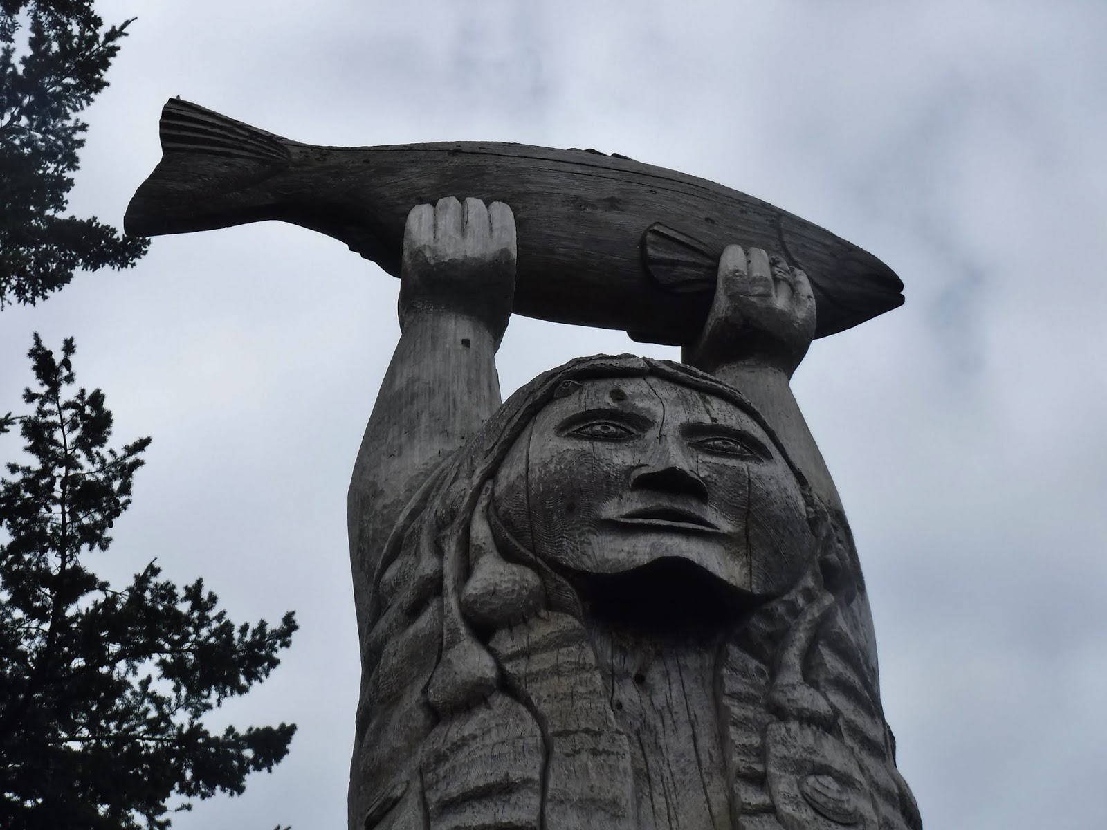
After lunch we walked the rest of the way around the Head trail and past the Maiden of Deception Pass. You can read about her by clicking on the links in this Anacortes Museum & Maritime Heritage center info. page.
We hiked on the trail towards Bowman bay and found more Spring color!

I really enjoyed walking down this fern lined section of the trail.

A trail bridge and a Madrona tree.

Instead of keeping to the trail, we walked the beach until the parking area.

We then headed towards the Lighthouse point trail, but at the trail sign junction we turned left and headed towards hwy 20.

We then made our way on the trail that goes parallel along the hwy to Pass lake.

Pass lake info.

Pass lake.

We then joined the trail that hugs the lake until the trail junction. There were several stumps along the way with the old "springboard" notches in them from the early logging days of the area.

Right turn at the Ginnett sign.

This section goes through some boggy lowland scenery. In a short time the Skunk Cabbage buds that I saw in the distance will be open and sharing their lovely perfume with anyone lucky enough to be hiking there at that time😉
I was lucky enough to see a heart rock and a heart shaped by a tree root as we made our way along this section, that I'll call the "Everglades".


Tursi trail straight ahead. Note the sign post with it's PNT emblem on it.

We spent some time doing our volunteer trail crew work, diverting the creek from the trail as we hiked back up towards the old house site. We then stopped and enjoyed the view at the top before heading back down the Tursi trail.

Looking back at Pass lake, where we'd just been hiking along.

Just before hiking down the last section of the Tursi trail there is a peek a boo view of Lake Campbell.

Garmin stats:
total miles hiked - 9.2
total ascent - 1955 feet

Plan “B” turned out to be just right❤️
Sunday, February 23, 2020
Mon Oeuvre - Frolic Mystery Quilt progress 12
Many blocks and sashings went into this fourth row.


I'm now halfway!!!

I'm slowly falling in love with this quilt and it's bright happy colors. As I sew it's colors are looking very "Eastery" to me. Hmm...can I finish it by Easter??
Time will tell.
I saw these pictures on-line and thought they were great: A view into a quilters brain.


Friday, February 21, 2020

Thursday, February 20, 2020
Ebey Landing hike February 20, 2020
Today was so spectacular I don't have words.
So scroll through to see how beautiful our corner of the Pacific Northwest looks on a blue sky February day❤.
We started at the upper Pratt loop parking area and then we hiked the Bluff trail where we had lunch. We then hiked down to the beach to our finish.

Mount Baker

Looking towards Granite Peak.


The Olympic mountain range

Prickly Pear cactus


Lunch view

Happy 66 to me.


What a birthday!
Garmin stats:
total miles hiked - 6.5
total ascent - 541 feet
Maps of our miles and with a satellite view.

Subscribe to:
Posts (Atom)