

Saturday, May 28, 2016
Thursday, May 26, 2016
British Army trail shuttle Trailblazer hike
"Point to point"
This is a different approach for our hiking group, we usually start and finish at the same parking lot. Today Pat our "fearless leader" decided to branch out and planned a shuttle trip for us. After waiting at the Blanchard mtn. parking lot for the shuttle drivers to arrive, 19 of us began our hike. If you'd like to know why a section of the trail we hiked on today is called the British Army trail please read this ARTICLE.

After hiking a short ways on the road, we joined the trail. At the trailhead signboard map, Pat is showing some of our group his proposed route for the day.

Columbine along the trail <3

The trail views heading towards Lizard lake.


Lizard lake

It stayed overcast for the hike and we got a bit chilled during our lunch, but we had a good time chatting with each other & enjoying the lake view before heading back onto the trail.
Our group settled in here and there for lunch.

Bunchberries

After lunch we connected with the British Army trail, it's a wonderful area to hike in. If you click on the photo below you will see our group way below snaking through the trees.

Part of today's hike was on trails and part was on old logging roads.

We followed the "blaze" and signs of the PNT (Pacific Northwest Trail) for most of our hike today.

The trail was in rough shape towards the end of our hike due to the damage from mountain bikers and water erosion. A few in our group tried to see how strong their ankles were and just how soft the earth felt on their behinds. No injuries, thank goodness.

We ended our hike at the Summerland road gate and waited for about 30 minutes for the shuttle cars to return.

I found an interesting hike on the internet while I was researching this area. I found a hike called the "Blanchard Mountain Traverse". This is a 10 mile hike that starts at the Summerland road gate and ends on Chuckanut drive by the Oyster Bar restaurant. Hmmm, I might have to try that one. Anyway the hike description from the start to Lizard Lake follows the last half of today's hike. If you're interested in checking it out, here's the link: http://www.switmo.org/hikes/blanchard/blanchard.pdf.
Endomondo stats:
total miles hiked - 8.2
minimum altitude - 551 feet
maximum altitude - 2039 feet
total ascent - 1483 feet
total descent - 1798 feet

Friday, May 20, 2016

Thursday, May 19, 2016
Park day: Fairhaven, Boulevard, Padden Trailblazer hike
Today was my first hike back since the first week of April, wow has it really been that long since I've hiked with this group? Our group hiked from Fairhaven Park to Boulevard Park via the Interurban & South Bay trails. We had a small group of 8 today, I'm guessing because it was a bit damp outside. We were promised by "Joe" that the weather would get better and better as the day went on. He'd checked the radar and weather report before leaving home. I hate to say it but he was right. The drizzle slowed and we actually had a nice weather day for hiking.
Before we left the Senior Center, Pat our "fearless leader" showed us the trails we would take for today's hike.

The Rhododendron were beautiful at Fairhaven park for our start.

Our trail view before we headed on to the South Bay trail.

Taylor street docks

Bellingham bay


We stopped at the Woods coffee shop in Boulevard park for some coffee and treats, bonus!
As we walked to the end of Boulevard park, someone noticed an Osprey on a piling. Sorry for the picture quality, but I take all of my photos with my cell phone.

The flowers along the trail were spectacular, here's just a few of my favorites ~
The California poppies were too cold to open for us, they'd shut their faces tight.

A volunteer Sweet Pea in the Lavender

A Fairhaven street side bouquet

Thanks to Pam for noticing the Iris in the photo below. Quite a different variety than what I'm familiar with. *Added note: it may be a "tradescantia (spiderwort)".

We had a short hike today because our annual Trailblazer (group 1 and group 2 combined) picnic was scheduled today as well. We jumped in our cars and headed over to Lake Padden for a great time together, eating potluck and sharing great memories with each other.
The sunny side of the shelter was definitely warmer!

Endomondo stats:
total miles hiked - 3.93
minimum altitude -73 feet
maximum altitude - 173 feet
total ascent - 171 feet
total descent - 164 feet
Sunday, May 15, 2016
Mud Lake meander
Today's trail run with my husband was going to be 10 miles with a view of Mud lake. We didn't turn on the correct road junction and ended up going a tad farther. We didn't mind, it was nice to have the forest and the time together. We wondered around for abit till we got back on the correct route, and got our view of the lake.


Endomondo stats -
Total miles - 13.23
minimum altitude - 265 feet
maximum altitude - 1255 feet
total ascent - 1936 feet
total descent - 1978 feet
Friday, May 13, 2016
Montana Spartan Sprint 2016 results
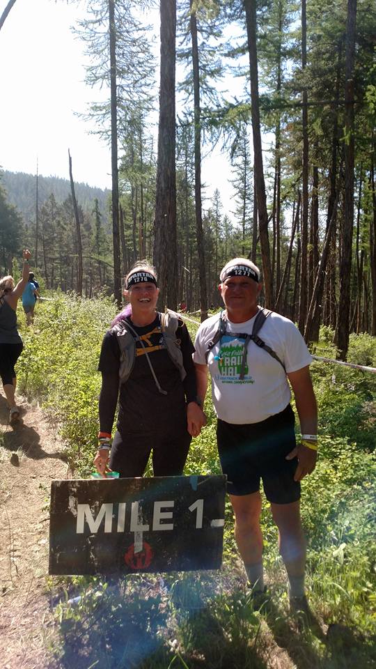
This year's Montana Sprint race was filled with emotion for me, it was the anniversary of my first Spartan race (you can read about that day's race HERE) and it would be my husbands first Spartan race. He decided that this year he would accompany me on my Spartan races and give me support and encouragement as we're going along. It was so nice to have him along. I think I was a little tired from the recent Seattle Super. It seemed I needed help on most everything. I always complete the hercules hoist, altas carry, sandbag carry, barbwire crawl, chain log carry. The ones I struggle with are the tall walls, rope climbing, monkey bars, tyrolean traverse, Z wall and rig. So for those obstacles it's always the 30 penalty burpees for me. We went with a team so were able to split up our burpees as we went through the course, that really helped. *The courses are always farther than the map board says btw.

The Montana course is always hilly and they really took advantage of that, taking us up and down many times. The sandbag carry was the longest and steepest one I've ever done. I was disappointed that the slip wall wasn't there this year as I'd hoped to conquer it, since NBC likes to show my struggle face at the top of it. The photo below is from last year and has been used in their NBC coverage.

Some photos of the day:

Trying to look tough -


Trying to make a tough face -


So nice to finish together!

After glow - We are Spartans!


Endomondo stats:
total miles - 7
minimum altitude - 3165 feet
maximum altitude - 3713 feet
total ascent - 1824 feet
total descent - 1759 feet

Sprint and Super complete, just a Beast in October and I'll have my Trifecta!
AROO
Subscribe to:
Posts (Atom)