Friday, June 28, 2013

North Butte - Blanchard Mountain

I had originally planned to start hiking with the Senior Trailblazers yesterday but my husband had the day off, so we decided to hike to the North Butte viewpoint on Blanchard Mountain instead. We started on the Alternate Incline trail, heading towards Lizard lake went all the way to the viewpoint on the top then came back down by Lily lake and returned by way of Max's shortcut.


Lizard Lake
Beaver activity
View from the top
Lily Lake
Very industrious Beaver activity

Columbine
It was a really nice hike, after doing Oyster Dome last week 
I didn't know if my legs would do it but it was great fun.

Endomondo stats:
7.76 total miles hiked

I've been hiking alot to get into shape to hike with the Trailblazers again. Here's the post I wrote that has a summary of the hikes I did to prepare for joining them again - https://hearsdifferentdrummer.blogspot.com/2013/06/our-resident-frog.html 

Wednesday, June 26, 2013

Our resident Frog

This week we were sad to find our resident frog dead in one of our ponds, he had a puncture wound. We think either a crow or Blue Heron might have taken a stab at him. Here's my post about how I finally got a picture of him sitting on our duck decoy - http://hearsdifferentdrummer.blogspot.com/2012/09/our-frog.html

Not long ago I got a picture of him sunning himself in our Irish Moss. 


I will miss him. I had started a habit of eating my meals outside by our pond on sunny days and watching him. I greatly enjoyed watching him: floating in the pond with just his eyes visible, sunning himself on the pond ledge & in the Irish Moss. We decided to give him a proper burial since he brought such joy to our days. RIP Frog.

What I've been doing lately -
I've been hiking again, trying to get myself fit enough for the trails. 
Running & biking are NOT the same as hiking. Whew, my legs have been talking to me.
I've hiked -
May 27th Stimpson Nature Reserve
Endomondo stats:
4.44 total miles hiked
Min. altitude 455
Max altitude 937
Total ascent 3520
Total descent 3549

June 5th Fragrance Lake
Endomondo stats:
5.27 total miles hiked
127 Min. altitude
1269 Max. altitude
5518 Total ascent
6017 Total descent

June 12th Pine and Cedar Lakes
Endomondo stats:
5.13 total miles hiked
252 Min. altitude
1740 Max. altitude
5881 Total ascent
6001 Total descent

June 19th Oyster Dome
Endomondo stats:
7.01 total miles hiked
74 Min. altitude
2247 Max. altitude
8224 Total ascent
8357 Total descent

I survived so am hopeful to join the Senior Trailblazers again soon. Here's a post of my first hike with them - http://hearsdifferentdrummer.blogspot.com/2011/04/my-day-with-senior-trailblazers.html

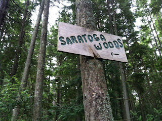
Over the weekend we drove down to get on the Mukilteo/Clinton ferry to Whidbey Island. Driving the back roads through Whidbey Island we found the most wonderful network of trails. Since we had our dog with us we only went for a short hike (she's getting older and can't go as far anymore). We found a trailhead at the Saratoga woods parking area.


We thoroughly enjoyed our hike through the forest, later as we were driving we came across a larger parking lot with a more official looking trail entry area. There was an info. board with this map on it, as you can see the trail system is extensive.


here's a link to more info.- http://www.putneywoods.org/about.html

Friday, June 21, 2013

March 2013 vacation complete

16 days, 4,196 miles - what a great vacation. Here are all the links together for your armchair viewing!
Enjoy -

Post 1  http://hearsdifferentdrummer.blogspot.com/2013/04/yakima-canyon-run.html

Post 2   http://hearsdifferentdrummer.blogspot.com/2013/04/march-2013-vacation-part-2-wa-ore-ca.html

Post 3   http://hearsdifferentdrummer.blogspot.com/2013/04/kingsbury-grade-to-lake-tahoe.html

Post 4   http://hearsdifferentdrummer.blogspot.com/2013/05/bridgeport-and-bishop.html

Post 5   http://hearsdifferentdrummer.blogspot.com/2013/05/big-pine-area.html

Post 6   http://hearsdifferentdrummer.blogspot.com/2013/06/desert-in-bloom.html

Post 7   http://hearsdifferentdrummer.blogspot.com/2013/06/in-flagstaff.html

Post 8    http://hearsdifferentdrummer.blogspot.com/2013/06/hwy-261-utahs-thrilling-drive.html

Post 9    http://hearsdifferentdrummer.blogspot.com/2013/06/utahs-high-country-and-moose-sighting.html

Post 10   http://hearsdifferentdrummer.blogspot.com/2013/06/heading-home.html

Thanks for taking the time to go on our travels with us, hope you enjoyed it as much as me!

Heading home

March 2013 vacation: part 10 - from hwy 89 we took hwy 30 west at Soda Springs Idaho and headed towards Pocatello on  I-15. At I-15 we jumped onto I-86/84 which took us to Boise (whew lots of road #'s huh! - you never know you might want to retrace our route). Just outside of Boise is hwy 55 & The Payette Scenic Byway, one of our favorite roads in Utah..


Many more frozen lakes were on this stretch of the road as well. We also saw Sandhill cranes by the frozen lake between Cascade and Donnelly. One of the largest frozen lakes on hwy 55 was at McCall. 
The Payette Lake.


The road down hill from McCall to Meadows is quick, steep, & windy. Whew!
We enjoyed watching kayakers having fun on the Little Salmon river from Meadows to Riggins on hwy 95.
We stayed on hwy 95 all the way to Moscow, Idaho, then headed to Washington on hwy 8/270/26 to Othello. Got in to Othello very late at night, ready for bed. We continued our back roads route, from hwy 26 we got onto hwy 17 to Ephrata, hwy 28 to Quincy and then meandered down the Palisades road near Wenatchee.

side trip fun near the Palisades road
Then on to hwy 2 to Leavenworth.

in Leavenworth
Needless to say our dog Lexis who was vacationing at the kennel -


was super glad to see us, we just had to take her on a much deserved welcome home walk -


Total days gone 16, total miles driven 4,196.

Thursday, June 20, 2013

Utah's high country and a Moose sighting

March 2013 vacation: part 9 - we are still taking a more scenic route to home. After leaving Hanksville, Utah we took hwy 24 to connect with I-70. We then went north on Hwy 6/191. Just north of Price, Utah we took hwy 191 north. The pass toward Duchesne is awesome, very steep up and very steep down - beautiful area! We then headed west on hwy 40. In the Duchesne area there were many oil pumps as well as lots of dead Mule deer all along the road, and a hwy truck was stacking them on a flatbed. Bizarre! There were no "Caution deer crossing" signs posted. We joked that maybe the Duchesne auto repair stores didn't want any signs posted. Just west of Duchesne was a wonderful rest area. The Pinion Ridge rest area has a nice paved walking path around it with picnic/BBQ sites along it.


We really enjoyed Utah's high country. 
We were surprised to see Strawberry lake completely frozen over since it was so large.
A good time to get out and stretch our legs and snap a few pictures.


click on the panorama to enlarge it
Just after going over Daniels summit on a hill side we spotted a Moose. 

click to enlarge
Just north of Park City, Utah we connected with Hwy 189/I-80 and decided to just pop in and out of Wyoming just for fun. As we were passing the entering Wyoming sign I noted that we hadn't seen any Antelope on this vacation at all, no sooner had the words come out of my lips my husband said look up, and there was a large herd of them. Too funny!
On to hwy 89 north and back into Utah! We decided to take hwy 16 and connect with Bear lake on hwy 30. This is a huge lake that is in both Utah and Idaho.

next post heading north via hwy 89 into Idaho....

Friday, June 14, 2013

Hwy 261 Utah's thrilling drive!

March 2013 vacation: part 8 - We left Flagstaff in the afternoon of Apr. 3, we chose to drive through Sunset Crater National Monument and then towards Monument Valley. We got there as the sun was beginning to set so I was glad we could get some drive by pics.


We were driving on Hwy 163 and drove by Mexican Hat. 
This is the Location that we put in our rafts for our San Juan river rafting trip in 2007.


We then proceeded to take the turn towards Hwy 261, we had been on this stretch of road when it was daylight only once. It was on our return shuttle from the end of the San Juan rafting trip. Well...it was awesome. It was gravel and very steep and curvy for about 3 miles at a 10% grade. I found a blog with pics and descriptions of the road and you can read it HERE if you'd like. 
I also found a couple YouTube videos. Part one shows the road really well, part two shows more of the scenery and may make you a bit motion sick. 


this time we unfortunately did it in the dark and going uphill. No lights but our own headlights. Luckily we didn't meet any cars. I was SO glad when we arrived at the top. 
We drove what seemed like forever in an endless night and finally found the town of Hanksville for a much needed nights sleep.

next post Utah & beyond....

Wednesday, June 12, 2013

In Flagstaff

March 2013 vacation: part 7 

We celebrated my husbands birthday at the Grand Canyon -


I loved this wall decoration at the local laundromat!


of course Sedona!
We walked around another one of my favorite areas near Flagstaff "Kendrick Park"


Our time there is always too short.

Friday, June 7, 2013

Desert in Bloom

March 2013 vacation: part 6 - Joshua Trees, Yucca, Wildflowers you name it. Everything in the desert was in bloom in the Lake Mead City/Grand Canyon Sky-Walk area. After driving the new bypass of Hoover Dam on hwy 93 we took the Pierce Ferry road. My husband wanted to revisit the South Cove launch. This is where he and a group of his friends pulled out their rafts after a 21 day rafting trip on the Colorado river through the Grand Canyon in 2008.

Couldn't resist a memory pic for him. This picture is from their trip going through Lava rapid.

South Cove launch
We then went on a photo taking spree! 


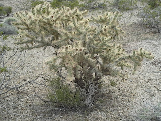
Here are just a few of the desert flowers/plants we found -


We stopped at the Lake Mead city overlook -


I took a panorama of the view -
Click to enlarge
We then stopped to enjoy the many Joshua Trees that were in bloom -


We decided not to go to the Grand Canyon Sky-Walk as it is about 20 miles of unpaved road to get there, not what we wanted to do that day - maybe another trip.
On towards Kingman, Arizona.

next post, our destination "Flagstaff, Arizona"