Yesterday we hiked to Lindeman Lake with our son, his fiancée and her daughters. They had a photo shoot planned and we got to tag along and watch the fun.

I looked up at the sky before we began hiking and loved the blue sky and the mostly Pine trees rising to the sky.

The trail was not only rocky itself, but it had some wonderful rocks to view as we made our way up.

The rocky trail

Crossing Post creek

I liked that the trail had markers on the trees to keep you on the route. Also near the top there were ropes along the way blocking off the side areas from foot traffic.

We walked by a large rock. I always wonder how these rocks get to where they are.

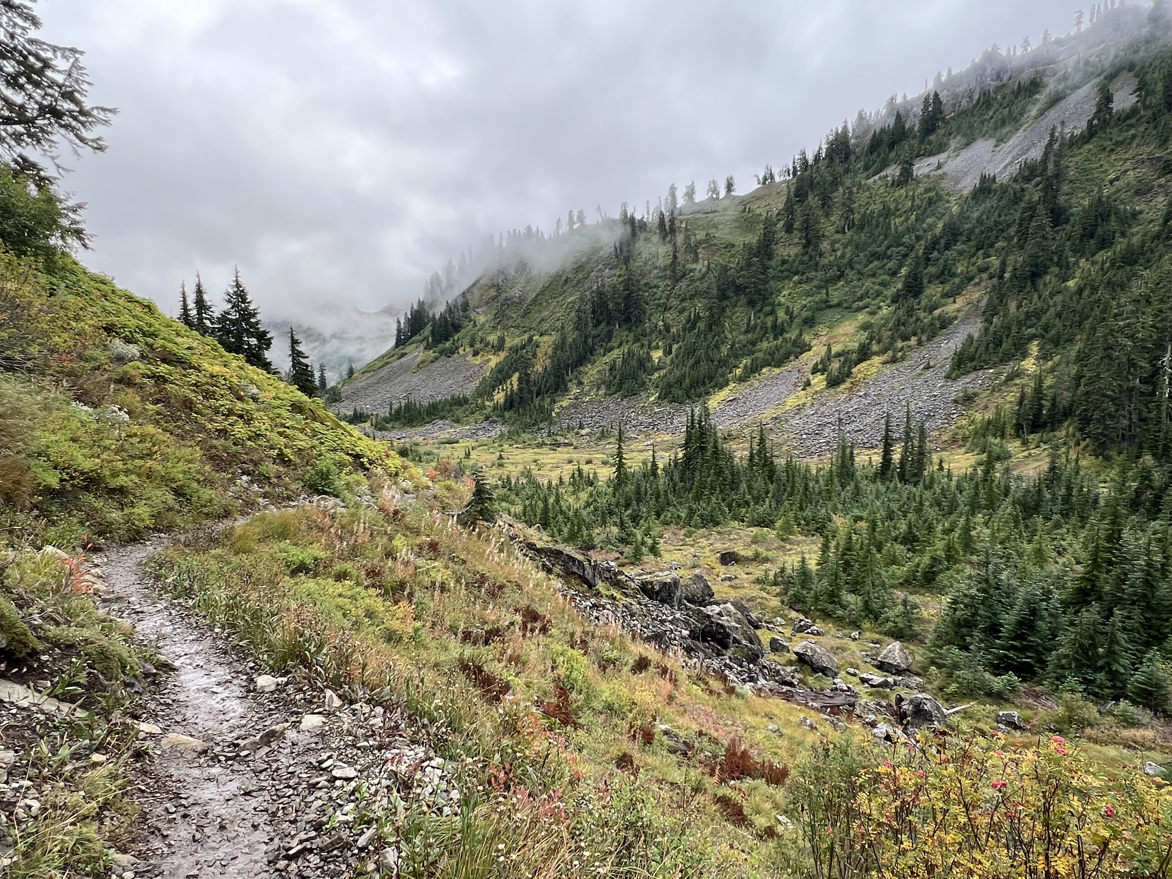
Making our way up the hill.

A nice set of stairs and a smoother surface as we neared the lake.

The south end of the lake had a lot of windblown trees piled at it.


The lake was very scenic. There was a cool breeze blowing most of the time while we were there. Some other groups actually jumped in the lake, but they didn't stay in long.

There was a composting toilet at the lake, some campsites, a helicopter landing pad and cables stretched out between the trees to tie and to raise packs or food bags out of the way of hungry bears.

We had a chipmunk and steller jays stay near to us as we sat, I think they're used to being fed by people.

Some pinnacles in view from the lake.

We did have some breaks in the breeze that smoothed out the lake for some nice reflections. We saw some small fish jump here and there.

After the photo shoot we all headed down through the rocks and forest below.

I enjoyed seeing some fall colored leaves here and there on the ground.


Some heart rocks found on the trail.

The trail parallels Post creek. I took a short video of it as we neared the parking lot.
A nice mountain view in the distance from the parking lot.

my trip totals were:
total miles: 3
total ascent: 1148 feet
our sons track was:
total miles:2.78
total ascent: 716 feet
alltrails info. says:
total miles: 2.11
total ascent: 715 feet
I used my Apple Watch for this hike. I usually hike with my Garmin watch & I try to provide links to places we hike so if you click on those hopefully you'll get some useful & factual info. there if you think mine are suspect.
A nice tagalong hike in Canada🍁