Thursday, March 5, 2015

Whatcom Falls Trailblazer hike

When I saw what the hike for today was, I wasn't too thrilled about it. 
It was to be a hike? walk from the Bellingham Senior Center to Whatcom Falls park, 6 - 7 miles easy. I went determined to enjoy the day with the others in our hiking group.
It was great to be on this Urban hike?walk with the 13 (lucky?) ones of us who went today. 
Bellingham has an extensive trail system. We are truly lucky to live in such an area.
We really only hiked in neighborhoods for short periods of time, the rest of the time was spent on trails.


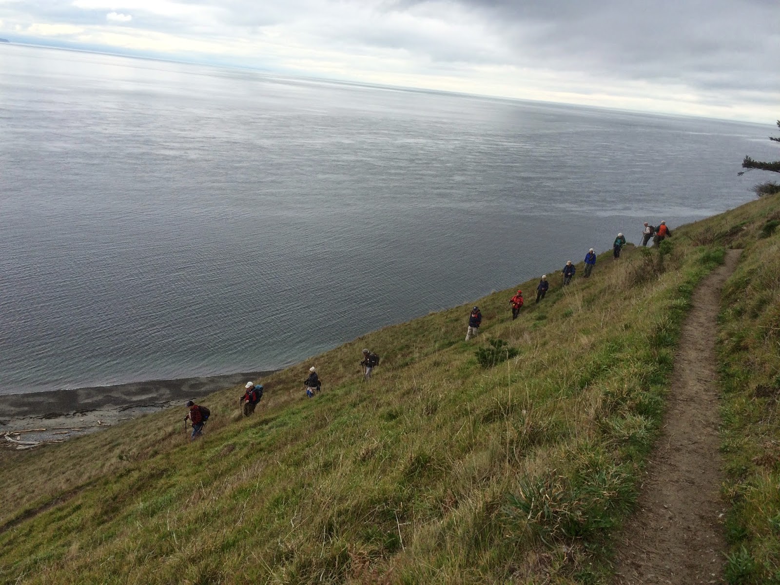
We even got in some uphill ;-)


We then enjoyed walking in Whatcom Falls park,


and the trail towards Scudder's Pond


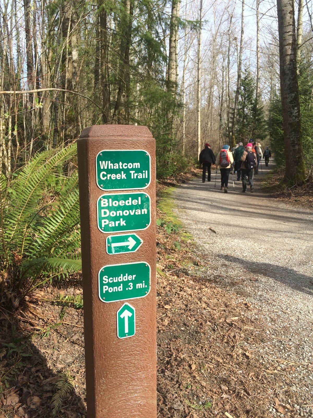
We didn't go all of the way to the pond, we instead took a right turn on the trail to head back to Whatcom Falls park for lunch,


It was a little cold & dark in the shelter for lunch, but our view. Oh how glorious!


After lunch on to the trails.....


We walked through the cemetary and more "spring".


We walked past Bellingham's famous "Angel".
I found this site with some beautiful photos of her.


Time to head back onto the trail once again.


Just when I thought that this had been a fine hike, 
I was given another gift of spring!


Thank you Mother Nature, just what my heart, soul & mostly my attitude needed.

Endomondo stats:
Total miles hiked - 8.65
Maximum altitude - 378 feet
Minimum altitude - 49 feet
Total ascent - 388 feet
Total descent - 378 feet


Monday, March 2, 2015

Raptor Ridge

We wanted to go on a long hike on Sunday, so my husband got out his trusty "Happy Trails" map & figured out a route that would be just a little over 12 miles - we hoped.


We started at the North Chuckanut trail head and walked the trail through Arroyo park to Old Samish hwy.


We then walked on Old Samish hwy for a little over a mile to the Pine and Cedar lakes Trail head. 


Along the way there were quite a few sticks with Hair ice on them.
It was 29 degrees when we started, so it was a wee bit chilly.


We then began the just over 1 mile UP of start to the Pine and Cedar lakes trail.


The photo below shows me during the UP.


We then hiked to Pine lake for lunch.


After lunch we hiked to Cedar lake and around it.


We then hiked the Pine and Cedar lakes viewpoint trail. We saw Mt. Baker in the distance when we got to the top of the ridge.


Then it was on to Raptor Ridge,


and finally Raptor Ridge viewpoint!


The photo below shows my husband inspecting the map at the base of the Hemlock trail, it was fun to see where we had been.


On to the North Chuckanut trail head to our car. A most excellent day with my best friend.


Endomondo stats:
Total miles hiked - 13.25
Minimum altitude - 87 feet
Maximum altitude - 1865 feet
Total ascent - 2359 feet
Total descent - 2392

Thursday, February 26, 2015

Ebey's landing Trailblazer hike

The Senior Trailblazers were scheduled to hike at Ebey's Landing today. 
I was happy to be back with the group as I'd missed last weeks hike. I was busy playing on an Oregon beach for my 61st birthday. In the photo below I'm standing on the beach in Lincoln City, Oregon. 


I was happy that this weeks hike would be on a beach as well. Our group of 13 were raring to go after our 1 hour drive from Bellingham.
We began at the beach parking area.


We then went up the stairs to get to the top of the bluff.


Once we were at the top we paused to enjoy the green fields of  
Ebey's Landing. Ebey's Landing is a National Historic Reserve.

Several of us stopped to take pictures of the fields
We then walked towards Sunnyside cemetery for a quick out and back to give us a bit more mileage. I particularly enjoyed this area because of the historic signs and buildings along the way.


Our fearless leader "Pat"
 We then headed back towards the bluff to continue our loop hike.


We found a nice view place for lunch.


The bluff trail continued on for a little longer - 

The bluff trail winds down to a spot just at the end of the Lagoon, just visible in the distance.
We then began the nice, long switch backs down to the beach - 


The rest of our hike was along the shore. 
Since the beach was still in my mind this was the perfect way "for me" to end today's hike!


Endomondo stats:
Total miles hiked - 6.8
Minimum altitude - minus 55 feet?
Maximum altitude - 252 feet
Total ascent - 322 feet
Total descent - 323