Our "up" hike for the week started at the North Chuckanut trail head parking lot today. I'm glad this sign was there, so we wouldn't be lost before we started.
We hiked through Arroyo park,
and then "up" the North Lost Lake trail to the Chuckanut Ridge junction.
It was clear enough to get a view of Bellingham from the ridge trail.
As we hiked up the ridge the wind picked up.
You can watch the wind blowing through the trees and get a view of the trail on this video.
https://youtu.be/L3yuYES8v30
We continued on up the ridge until we got to the junction that led to Cleator rd.
A nice view of Bellingham Bay as we hiked down to the road.
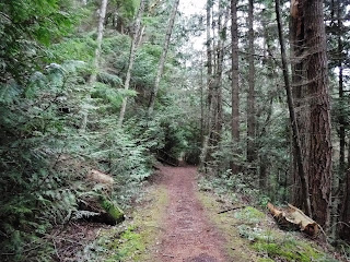
Such a nice trail corridor.
Finally down to Cleator road,
which we walked up till we got to the Fragrance lake trail sign, where we joined the Fragrance lake trail.
Fragrance Lake
We walked on around the lake and sat down under some trees for lunch.
It was chilly enough that I wore my fleece gloves and buff on my head and neck while we hiked. I was glad I had a thermos of hot cocoa in my pack.
During lunch we talked about whether we would go back by the Two dollar trail that turned off right by the lake or continue all the way around the lake and hike up over the hill and join the Two dollar trail from there. It was decided we would go over the hill. We had hiked to Fragrance lake via the hill trail once before, you can read about that hike HERE. Today we hiked that trail going the opposite direction. I was interested to see which direction I enjoyed more. I decided I didn't have a favorite, I like hiking it both ways.
We joined the hill trail at the Fragrance lake trail sign. The trail is behind the sign and around the ferns.
The photo below show the trail, it goes up a short hill to the ridge above the lake.
A view of Fragrance Lake from the hill/ridge trail.
We hiked down the Two dollar trail and then walked down the Cleator road to the Interurban trail.
The last stretch of today's hike was along the Interurban trail.
We walked along this trail to the North Chuckanut trail head parking lot.
Garmin stats:
total miles - 12.7 miles
total ascent - 2303 feet
Relive video of our route.
*a side note. I noticed a news story today that made me very happy. "The iconic trails, forests and habitat around Oyster Dome, Lilly Lake and Samish Overlook will now be preserved for future generations!...The state passed a Capital Budget in January 2018 that includes full funding to preserve the Blanchard core as a new conservation area! ". The Blanchard hill area will be protected from the proposed logging. You can read about it HERE. Happy trail to you!


