Tuesday's hike took us over Seattle and Spray parks, one of my favorite sections in the Mount Rainier trail system. We got to see some wildflowers as we made our way through Seattle park.
There are a few streams and small falls along the way.
I'm usually a big fan of what I call "bog board" trails, but I got a real education on this one. I took this photo looking back at where I had fallen. I must have stepped a wee bit to the left of center and the board flip up. I must have put my weight on my trekking poles because one of them bent pretty good. My husband was able to straighten it without it breaking, which was a relief to me since I really use my poles for: ups, downs and water crossing. Boy did it hurt when I got launched, my right leg took most of the impact and I'm guessing a nail scraped it also. I wear compression socks when I do activities and I think that they protected my wound from being any worse than it was. I was concerned that I'd broken something it hurt that bad, but after my husband helped me to stand back on the trail I discovered that my leg worked just fine. We put some bandages on my leg and marched on ahead. I decided that when we took our next rest break around snow I would put some on it to help keep the swelling down. Before we left the area my husband lifted all of the loose boards off of the bridge and laid them beside the trail so no one else would get upended. He discovered quite a few that were no longer attached. I got quite the reminder: stay to the center always!!!!
A small waterfall along our very green trail.
Once we came to the opening we got some of our first views and snow! I put in several photos of our trek up so you could see just how spectacular this trail is.
Our first peek at Mount Rainier,
We had several snow fields to cross, but the snow was soft and just needed a kick step for a good foot placement. Most of the snowfields were on an incline, so I was thankful for a soft surface. There weren't any icy sections at all. We packed our Yaktrax just in case, but we never needed them. My husband took this series of photos of me coming up one of the longer snow fields.
I was glad I got this photo of my husband, because you can see that he's kicking in his steps.
In the photo below you can see way down to where we began this upward climb.
A painted rock to mark the trail.
Finally a chance to put some snow on my leg, it had been throbbing and had swollen a bit. So I was ready for a break.
Lunchtime!
Another snow field and then nearly to Spray park.
We took a left instead of a right at the top of the snow field and took a side trip higher up. The clouds were starting to move in, so the effect was interesting as we made our way up the trail.
I love the high up "artic tundra" look to the environment at these higher elevations.
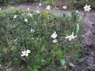
Some Alpine color along the trail.
Just a peek at Rainier through the clouds.
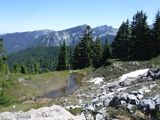
There is a small lake nestled near the snow. Can you see it?
The clouds cleared for another peek at the mountain. We joined the trail that headed towards Spray park and saw a rock with paint on it so we knew we were headed the right direction,
Heading down Spray park.
There is a Marmot on the rock in the center of this photo, can you see it?
See if the photo below helps you to spot it. You made need to click on the photo to enlarge it.
The clouds stayed high enough that we could still see some views.
There were only a few snow fields in Spray park.
Another view of Rainier, I just was so happy to see it and the wildflowers. It really made my day. Sometimes I get over taken with emotion when I'm enjoying something. I cried alot in this section, just because I was so happy. Does that make sense to you?
So many Avalanche lilies along this section. ❤
Heather, Bistort and Indian Paintbrush were here and there as well.
We saw several Beargrass in bloom as we neared Eagles Roost.
We passed this creek just before the campground, it is the drinking water source for the campers. We purify everything we drink with a SteriPen and then boiling it for our meals.
Finally Eagle's Roost campground.
Two nights we stayed in camps numbered "6". It must be our lucky number. They were both great sites. Several campsites were closed at Eagle's Roost because of hazardous trees. So at a campground that was supposed to have 7 sites, only 3 are now available.
This site had two levels. one was a great kitchen space. It's always nice to have a place to put our stove and also logs to sit on.
The other level was where we put our tent.
Perfect!
When we got to camp I took off my bandages to see how my leg was doing. Not too bad, the ice did it's job for the swelling and my compression socks had kept my delicate baby soft leg skin 😉 from being more damaged than it could have been when I fell.
Here's the Relive video of the day's route:
Garmin stats:
Miles hiked - 7.1 miles
Ascent - 2329 feet
Descent - 2287 feet
Highest altitude - 6673 feet
Next post Part 4: Eagle's Roost to Ipsut Creek campground.


