When I opened the tent door I was happy to see a little brightness in the sky. Hopefully we would have views as we made our way up to Panhandle gap, the highest point on the Wonderland trail.
The aftermath photo,
we came out pretty well considering how much it had rained that night. You can see the trenches he dug out. They did their job! We stayed absolutely dry inside our tent.
As I was looking around at our camp that morning, I noticed these gouges in this tree. Hmm, from bear?
Trying to dry out our boots before we put them on, they got pretty wet during yesterday's hike.
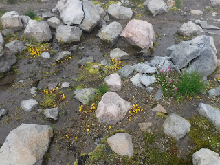
Flowers near our campsite.
A little brighter view of the shelter today even though the fog was still low.
Making our way through the Ohanapecosh cirque river valley.
Wildflowers along the trail for today's climb.
A look at where we'd come from with a view of the shelter in the valley below.
The trail kept going up so we took a nice rest break and watched the clouds move in and out briefly giving us views of a half dozen Elk in the distance below. I was pleased that I felt much better on this section of the trail this year.
The Elk were in the tree area below, we watched them for awhile with our binoculars.
One last look at Ohanapecosh before we turned to begin our trek towards Panhandle gap.
We were hiking in the fog again.
It was so nice to see the blue sky peeking in and out of the fog.
Flowers and a Marmot
Finally some views!
Very little snow to cross today.
If you enlarge the photo below you'll see goats on the hillside. Easily seen with our binoculars.
Panhandle gap.
Just like that we made the turn and were heading down to Summerland camp, after picking our way through the rocky trail.
Another small snow crossing.
A nice view of Mount Rainier and the turquoise colored lake below.
In the distance a creek crossing and the Summerland shelter.
The log crossing
A view up the creek
The view as I crossed
Almost to camp!
A view of Rainier as we make our way to Summerland.
Sun means drying out time on the trail, we were lucky enough to get the same camp we did last year. It's great for spreading our gear out! Everything was dry by the time we put it away.
We walked out to the trail junction to take an evening photo of the mountain. Our last night on the trail, so many feelings and emotions.
Relive video of our route:
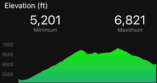
Garmin stats:
5.09 miles
2001 feet ascent
1562 feet descent
Elevation profile:
Trip summary:
97.28 - miles
25,647 feet - ascent
24,581 feet - descent
Elevation profile:


