Daylight is returning!
Friday, March 6, 2020
Thursday, March 5, 2020
Mud Lake hike reversed
Today we chose Mud lake as our hiking destination. We usually hike it in a counterclockwise direction, but today my husband thought it would be nice to do it in a clockwise direction. The weather forecast was for rain later in the day and some breezes off and on. I was hoping we'd finish before the rain.
We parked at Samish park. Samish Park is located at Lake Samish.
This sign tucked into a rocky section of a planter has info. about where the parks plants were from. It states they were from the "86 Expo Landscaping Plants and Materials donated by Washington state and U.S. Pavilion". I was excited to read this as we had attended the Expo 86 in Vancouver, B.C. many times. Our family really enjoyed it. A fun bit of trivia right here in our neck of the woods.
Fitting that we should step through mud as we began our journey to Mud lake. We hiked from the parking lot straight up the road in the distance.
We then joined a gated logging road and began our trek off from the paved road.
There was a breeze and it kept enough of a chill in the air that we kept our fleece jackets on all day. Just when we would think we could take them off after hiking uphill and warming up, we'd feel the breeze and decide to keep them on.
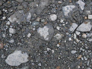
A heart rock in the gravel road.
A heart rock in the gravel road.
Making our way up the first section of the road.
Lookout mountain in the distance.
Another nice heart shaped rock.
This muddy road was where we began our clockwise section of the hike, usually we would be coming down this road. When we came down we walked by this junction again.
A beaver pond along the road.
Just at about 5 miles into our hike we got to Mud lake. It was breezy enough that we were a bit chilly as we sat to eat our lunch so besides our jackets we put on our Buff's (hats), I even put on gloves while we sat and ate.
The spectacular view of Mud lake. It's hard to get a very large photo of the lake as there are trees all the way around it.
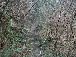
After lunch we headed up the trail. This was the only section we hiked today that had a hiking trail the rest was logging road walking. The way up the trail was a bit spooky. The wind was blowing the Alder trees around and as they banged together it sounded like bones rattling together. Creepy. I couldn't wait to get out of that area with the wind blowing as it was. I didn't want a wayward branch to land on my head.
Finally out of the deciduous forest and back into the evergreens. The wind gusts felt and sounded higher and farther away in this protected area.
Back out into the open of the old logging. In the distance I could see the fields of Skagit county, although they don't show up well in this photo. We would follow our road down the hill and in and out of old logging area.
Another beaver pond down below us. The wind was getting pretty strong again as we walked along in this section.
As I made my way down the road I spied this fine fellow perched amongst the green moss❤
A true sign of spring - Skunk Cabbage in bloom!
At about 3:00 it started sprinkling and by 3:30 we both had our rain ponchos on. We were only about a mile away from the car so we very nearly beat the rain.
Relive video of our route:
https://youtu.be/fPeb92Gb4yA
Garmin stats:
total miles hiked - 11
total ascent - 1243 feet
Map of our route, the loop section is the part we went clockwise:
*some of the ascent stats on my Garmin have been suspect lately, so I went with the Relive video results for this hike as they seems more accurate.
Hopefully I'll get my Garmin sorted out.
Subscribe to:
Comments (Atom)


