Saturday, August 15, 2020
Wednesday, August 12, 2020
Chuckanut mtn. 4 lakes loop hike
Today we would be hiking on our home stomping grounds again. We chose a lollipop route with a very short stick for our route from the North Chuckanut trail head.
After a short stretch on a trail we began our uphill journey on an old road.
It's not yet fall, but these Maple leaves looked like they are getting the fall bug.
When we came to this sign near Lost lake showing where we'd come from, we continued straight on the trail. If we'd turned right it would have led us to the Rock trail.
It wasn't long until we got to Lost lake
Lake #1 Lost lake
Salal bush with berries
Oregon grape bush with berries
We came to a junction in the trail, if we turned right it would take us to Burnout point.
We turned left towards Mud lake.
Foxgloves still in bloom
Our trail came out to another old road. We turned right at the small green patch.
Heart rock❤
Daisy
Heart rock❤
A fairly long road walk brought us to Mud lake
Lake #2 Mud lake
Lunch at Mud lake
Then it was time to head up the trail to another old road that would take us to Pine lake.
Heart rock❤
We walked up a VERY steep old road to get to the trail that would take us to Pine lake. Whew!
The trail as it turned off the road.
Finally at the Pine lake trail sign post
Pine lake water trail.
Huckleberries!
Lake #3 Pine lake
The sign post for Cedar lake
Lake #4 Cedar lake
Happy to see the sign for the Hemlock trail, 4 miles to go!
This has got to be the largest Trillium plant I've ever seen.
Heart rock❤
Closer ever closer to the North Chuckanut trailhead.
A very large heart rock❤
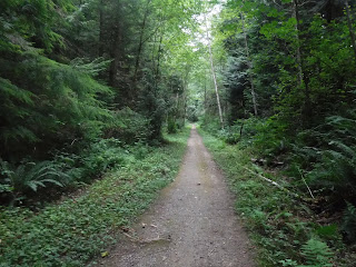
What a serene corridor to walk along as we finished our "4 lakes" hike on Chuckanut mtn.
I saw so many heart rocks today, it was as if Chuckanut Mtn. was welcoming us back❤
Garmin stats:
total miles - 14.5
total ascent - 2864 feet
total descent - 2969 feet
Relive video of our route:
Subscribe to:
Posts (Atom)


