After looking at the weather forecast for the week we decided Monday (yesterday) would be our clearest weather view day for a hike to Watson lakes. Since we'd be heading south of our area we took a chance to invite our daughter to hike along with us. Our selected meeting place would be about the same driving time for each of us, so a perfect rendezvous hike. It was quite cloudy when we met up and we debated changing our hike destination, but the forecast showed that it should clear a bit through the day so we chose to trust the forecast and set off together in our truck. We saw a herd of Elk as we made our way to the Baker lake road.
After crossing the Dam we began our off pavement drive to the trailhead. We drove about 10 miles up. The road seemed to be in pretty good shape at the start with the normal potholes we have on these high use trailhead roads, but it deteriorated quite a bit as we neared the top. As the grade increased so did the ruts.
I've hiked this trail 2 other times: once with the Trailblazers, you can read about that 2015 hike HERE.
A photo from that day's hike

the second time here was on a backpacking trip, you can read about that 2016 trip HERE.
Apparently my Spartan training never ended in those days. The photo below shows me getting in my 100 pushups at camp.

Anyway back to today's journey.
Trailhead and trail sign-in photos.


After going up for a bit we came to our first bridge crossing.

Our first signs that the season is changing.

There was plenty of water along the trail for Scoutina. There were a few very low water crossings before the lakes.


Our first views of Watson Lakes.

The shore of the first Watson lake.

A small brown frog spied by my husband.

Heart rock on the trail

We stopped at this campsite for our lunch.

Scoutina found just the perfect stick to chew on.

Our lunch view of the second Watson lake.
Do you see the face in the rock across the lake? I spotted this when we were on our backpacking trip. I tried to find it in person yesterday but couldn't find it. Then as I was going through the photos of the day this morning I noticed it! Don't know why I couldn't find it yesterday. In case you don't see it I put and arrow pointing to it in the second lake photo below.


There were many blueberries ripe on the bushes around the lake. The plants were just beginning to show their fall colors.

I spent some time wandering around during our lunch break just enjoying the area once again.


We packed up our packs and began our journey out. One last view of the lake as we made our way up the hill.

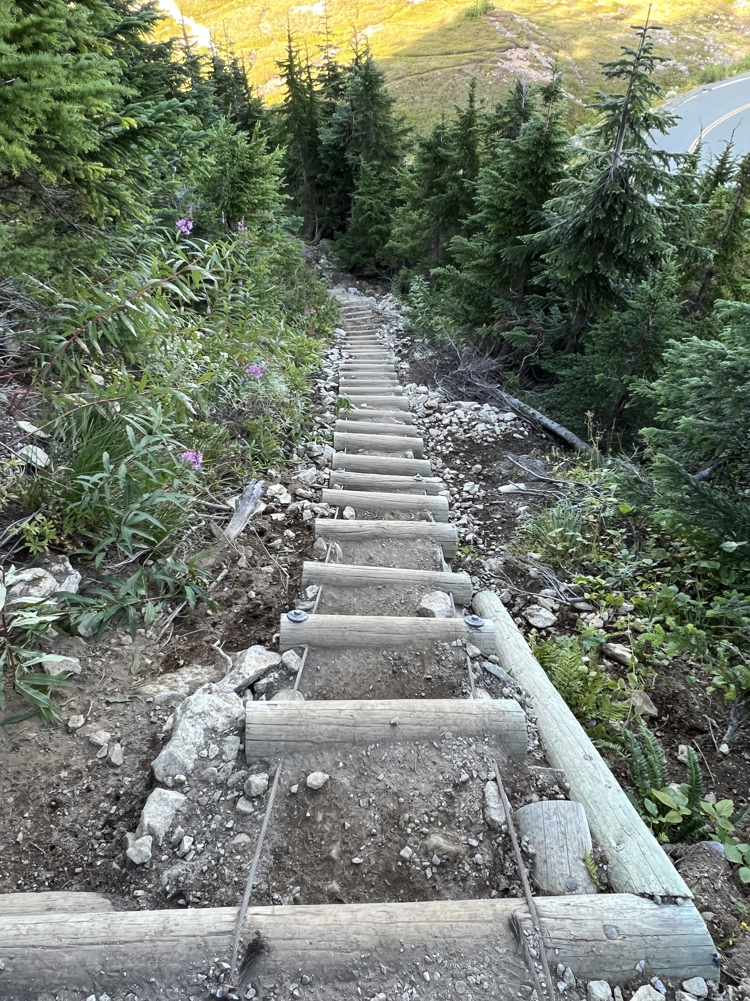
We could see the boardwalk trail down below us.

Some of the steps in the boardwalk trail.

My daughter and I were laughing at this spot, because I had told her when I invited her that this was a fairly flat hike. She said that it was because you only remember the boardwalk sections. I guess she's right, I do have an overly nostalgic memory about my favorite parts of trails. In the photo below she was also trying to show me how her Android phone will take a countdown photo just by using a palm gesture. When she raises her hand to a certain location behind her for a selfie a countdown shows on her phone, giving her enough time to lower her hand before the shutter clicks. My iphone doesn't do this. Yes I'm jealous.

I was happy that the anticipated view of Mt. Baker was there on our return.

As we drove down the road my husband stopped at one of the corners for us to enjoy another view of Mt. Baker.

As we were heading towards Sedro Woolley I spied a Sundog in the sky. So many colors in a cloud, like a rainbow but without the bow.
We didn't start hiking until about 12:30, but I think that was good because it gave the clouds a chance to clear more for our views. Glad we checked to see if our daughter could join us. It was a good time together. Oops sorry about the elevation gain on our promised "fairly flat' hike.
Trail rating: Moderate
Total miles: 5.6
Total ascent: 1561 feet