Thursday, September 12, 2013

Chain lakes Trailblazer hike

The magic number is "12".
The wilderness regulations state that the maximum hiking group shall be 12, exactly the number in our group today!
We began our Chain lakes hike today at the Artist point parking lot.
(Reminder - click on the pictures to view them larger)


A beautiful if not a little warm (mid 80's) day of hiking.
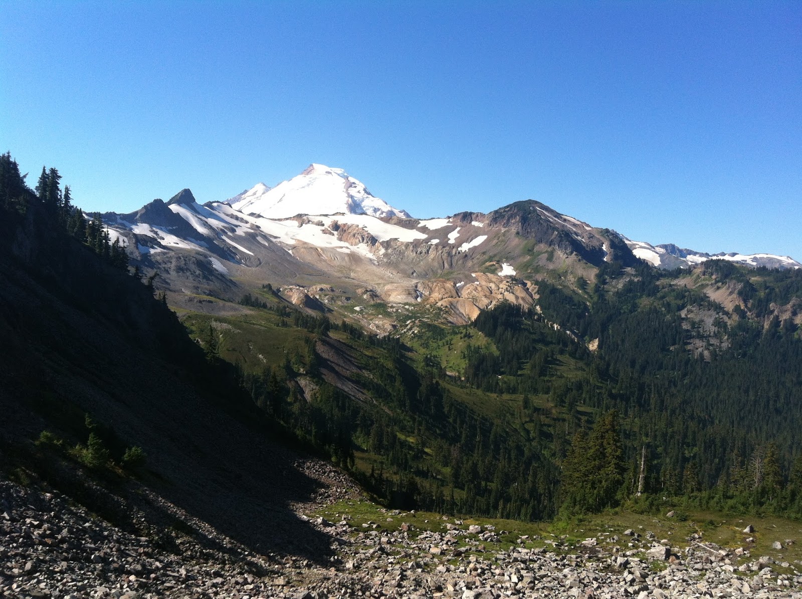
Every direction I looked was breathtaking, I obviously could have taken way more pictures.


We stopped for lunch at Iceberg lake.


my husband couldn't resist a cooling dip!


after lunch we walked a little further enjoying the many blueberries along the trail. 
Jean put hers in a container for her pancakes tomorrow morning!


We saw lots of different mushrooms along the trail. Here's my favorites - by favorites I mean to look at, I have no idea if they are edible or if they should be eaten.


As I said earlier it was a warm hike, whenever we found shade we stopped to cool down a bit.


I saw these bees and a butterfly in the flowers beside the trail.


In a word, the day was "Glorious"

Endomondo stats:
5.48 total miles hiked
4643 Min. altitude
5266 Max. altitude
3943 Total ascent
3800 Total descent


Thursday, September 5, 2013

Mt. Erie Trailblazer hike

Only 7 of us decided to show up and see where the weather would take us. We were scheduled to go and hike Yellow Aster Butte, but the forecast was for an increasing chance of rain, thunder and lightening later in the day. We headed towards Anacortes instead! The Anacortes area is usually a dryer option when it's rainy here in Bellingham. Fragrance lake and Mt. Erie were mentioned as possible alternatives and since it was Fred's last hike with us this season, we agreed with his choice of Mt. Erie.  Sorry the picture is a little blurry, but I wanted to show this one with Fred in it helping Carol with her rain gear.


We chose wisely there really wasn't too much rain to suffer through!
The sun filtered softly through the trees off and on during our forest walk.


We went on alot of different trail numbers: 302, 305, 21....etc., till I was very confused. I really didn't think I could retrace our route if it were left up to me. So thankful that Pat knows his way around so many trail systems as well as he does.


Owen's remark to the following sight - "He's really out on a limb"!


A welcome sign -


When ate lunch at the top, not much of a view.


but by the time we left....


ahhhhhhhhhh 
Pat showing us just how extensive the trail system is.


A wonderful alternative hike, and we didn't see any sign of the trail bullies.


Endomondo stats:
6.67 total miles hike
281 Min. altitude
1328 Max. altitude
6638 Total ascent
6759 Total descent