

Friday, November 15, 2019
Thursday, November 14, 2019
Chanterelle trail hike
Today we would explore the new upper section of the Chanterelle trail. In the past we would walk on a different trail and then road walk after the Chanterelle viewpoint, but today we were excited to see where the new trail would end.


Turkey tails and a Slug were our first views on the trail up to the viewpoint.


Madronas❤

New signs had been attached to the trail sign post.

The Chanterelle viewpoint is a short walk to our right....

but before our rest break we needed to visit another resting place😉

Doesn't it look lonely down there all by itself😥?

We then took a rest break at the view area.

We recently purchased a new camera with a zoom, I've been frustrated at my cell phone and small camera's inability to get a good zoom for animal photos etc. I don't know how to do most of the settings yet, so today was mostly point and shoot on "auto" and play with the zoom day. The hill in the distance is Lookout mtn.

I practiced with the zoom and was able to capture the antenna's at the top, something none of my other camera's would have done. So I was happy with that.

Another chance to practice the zoom was at the end of Lake Whatcom. The Bp/Cherry Point refineries are visible at the end of the lake just by a faint smoke going up if you enlarge the photo.

The photo below is my zoom of the area. The refinery smoke area is more visible. Interesting to think that the photo below was taken from the same vantage point as the above photo.

Then it was time to head into new territory, the upper Chanterelle trail.

A heart on the tree.

The new trail goes through a lovely forest, where we would have been road walking to get to our destination in the past.


To put it mildly I was dissapointed that the terminus of the new trail ended at the road with a couple of log boards arranged as benches, with no view whatsoever. We'd walked this road before so we knew that up the road a ways we could get some views while we ate our lunch, so we turned right and walked on the road until we came to a gate.


The above photo shows the gate we came around. After the gate we turned left and made our way up to the power lines in the distance.

Our lunch spot!

A few more opportunities to play with the zoom on the camera.
The photo below is looking west towards the Olympic mountain range, which is barely visible in the regular photo,

The Olympics with a zoom.

We had some great views to enjoy while we ate our lunch, I'm so glad we didn't just turn around at the terminus of the new trail.

Beautiful, power lines and all.

A slight breeze was blowing and I had sat long enough to feel chilled, so we packed up and made our way down to the trail.
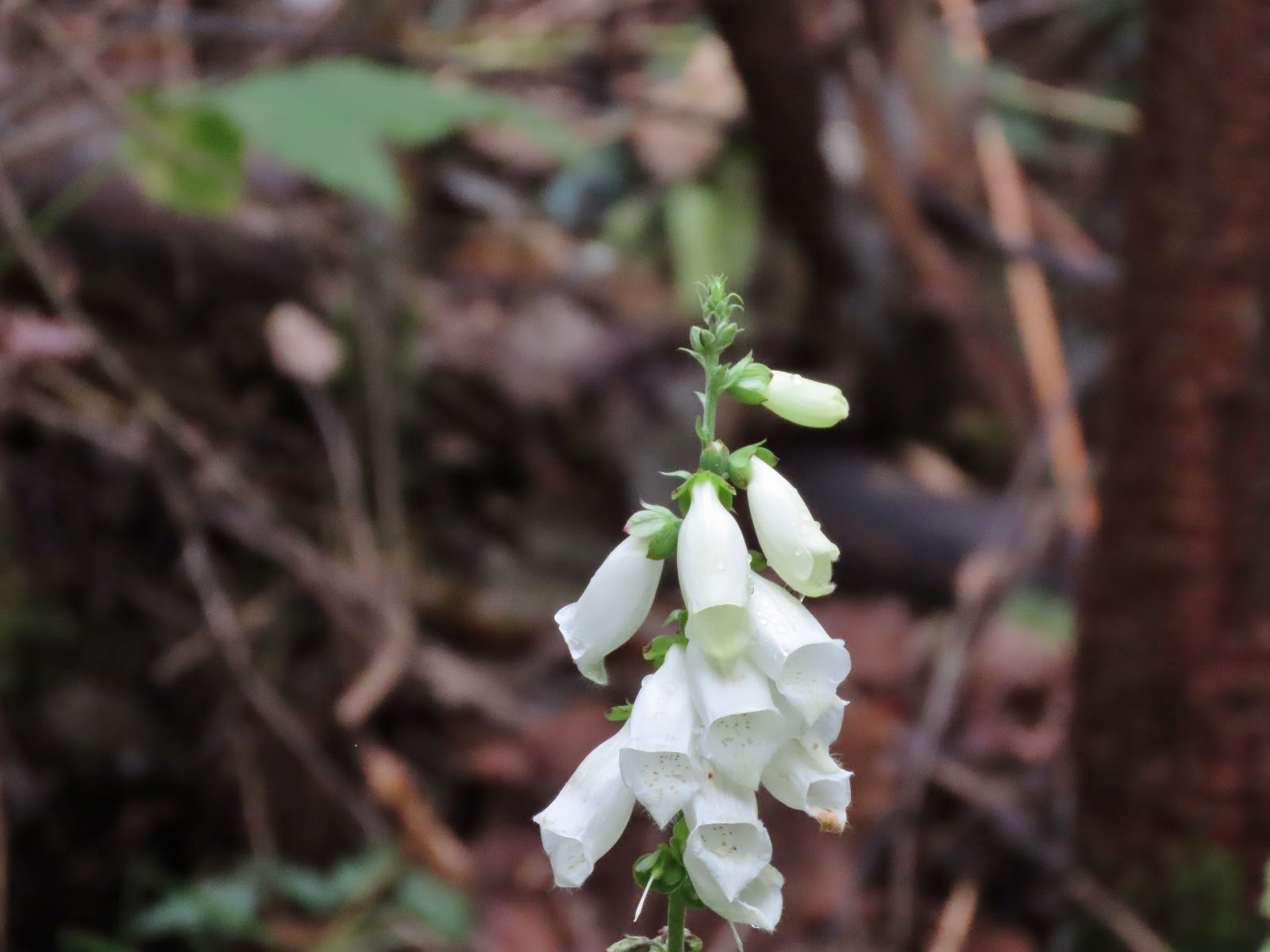
A couple of more chances to play with the new camera. I couldn't believe we found some Foxglove and Lupine still in bloom. I think the photos turned out rather nice.

A fun day on a "new to us" trail, and a chance to play with a new camera. I need to learn about focus and exposure and about a zillion other things on it but for today I'm pleased.

Relive video of our route:
Garmin stats:
total miles - 12.19 (includes the .4 to our extra "resting" area)
total ascent - 2654 feet
total descent - 2536 feet
Subscribe to:
Posts (Atom)