Day 6
Completely rained out, road trip to the
Paradise Visitor center. It wasn't any drier there. Came back to camp dejected.
Day 7
Part 6 of our Rainier camping & hiking trip.
If you'd like to catch up, you can read -
Part 1 White River campground
HERE
Part 2 Owyhigh lakes hike
HERE
Part 3 Emmons Glacier and Glacier Basin
HERE
Part 4 Shadow lake loop hike
HERE
Part 5 Burroughs Mountain
HERE
As this would be our last full day in the area, we were really hoping to make it a full hiking day. We chose
Fremont Lookout and then
Burroughs mountain, hoping to reach the 2nd Burrough. The link for Burroughs mountain contains information on all 3 Burroughs if you're interested in reading it. We hope to go back and do all 3 on another trip.
The weather pretty much cooperated with us for this last day of hiking.
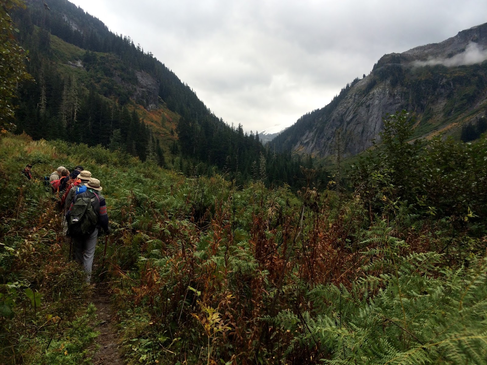
As we headed up to the Fremont trail we couldn't believe we could actually see Rainier. What a gift! If you read the Part 5 post you would see that the section of the trail in the photo below looked a little bit different from today's view.
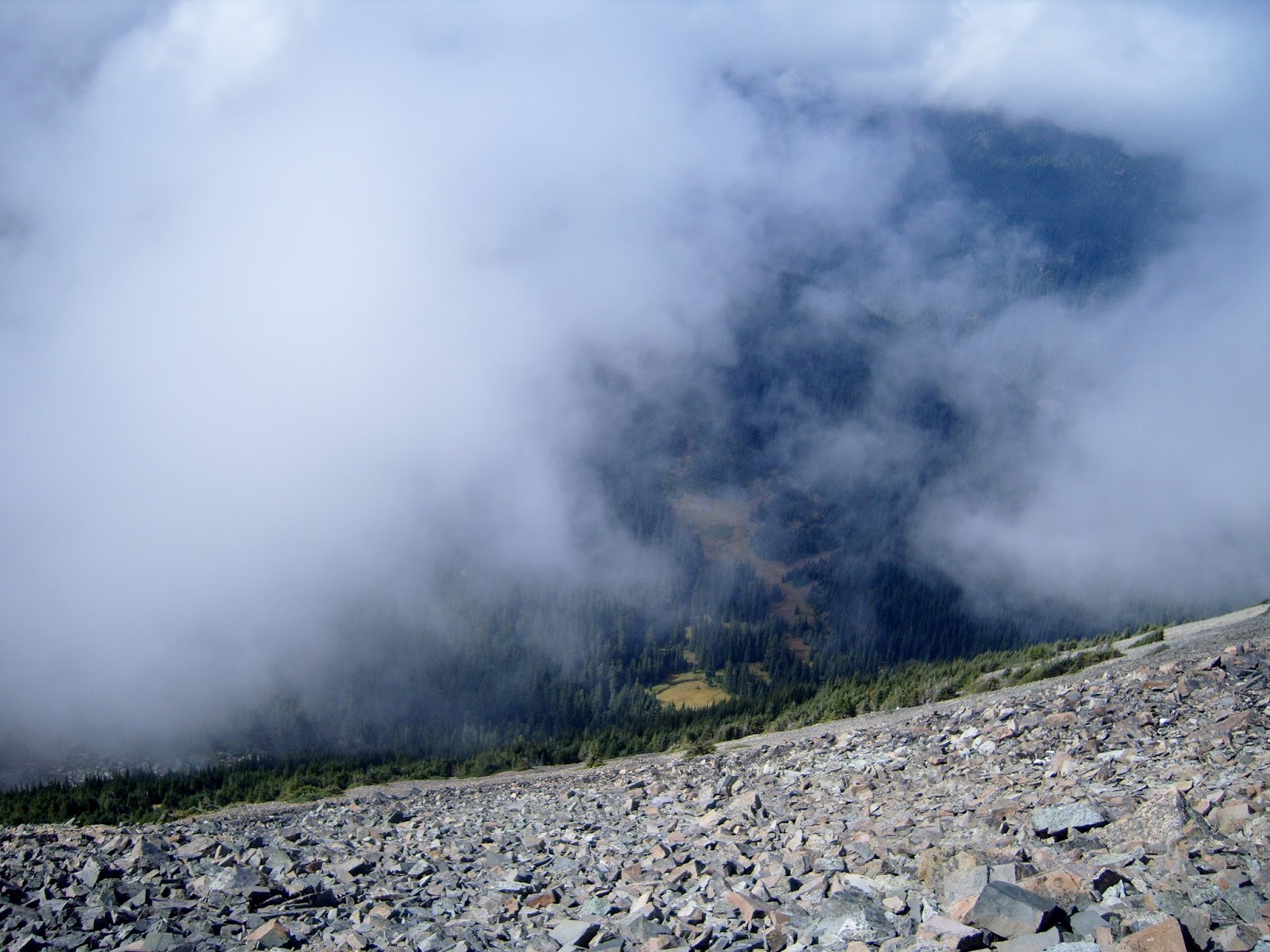
The clouds were rising up from the valleys for most of the day, but we did get some nice glimpses of the scenery. The trail was a bit exposed in areas. The photo below shows one of the views looking down (like nearly straight down) from the trail.
A nice gentle ascent to the Lookout.
We saw a Pika right beside the trail. We watched him for a while, he was gathering grass and taking it to his nest.
Fremont Lookout, that blue sky was "up", the clouds were below us - so no view :-(
Here's an excerpt from the sign below that gives you an idea of what it was like for the back country lookout fire watcher crews. "I watched as the electric storm progressed towards the lookout. I was standing on the catwalk when all of a sudden a loud humming started. I didn't worry too much until a glowing red ball raced down the antenna. I was standing under the aerial and my hair stood on end. I remembered that you were to throw the switches on your aerial, get inside and sit on your insulated stool, and not touch the fire finder. This I quickly did." Forrest Johnson, Fire control aide reminiscing about his experiences as a fire spotter in 1941.
Chipmunks, our companions at our lunch break.
Ptarmigan
We headed back to the trail junction for Burroughs mtn. This is actually a major junction for many hikes. Here are a few of the signs just a few steps from each other.
We headed up the trail to the Burroughs, again so much different than just a couple of days before. I had hoped to get a picture of the sign below when we hiked it in "arctic" like conditions on our previous hike, but it wasn't visible in the fog.
The Burroughs trail
If you look closely at the photo below you will see Fremont lookout on the hill farthest to the left. That is where we had just come from, as you can see the clouds did lift for whoever was there at that time to get some views.
The top of the first Burrough!
This is as far as we were able to go on our first attempt.
Looking up toward the 2nd Burroughs trail.
Someone had crafted a wonderful stone bench at the top of the 2nd Burrough for people to sit on. It was very cozy, and gave me a great view of the 3rd Burrough. The clouds were still moving in and out, so we're saving that hike for another time.
The 3rd Burrough & my view from the bench.
We hiked back down the Shadow lake portion of the loop hike to our car. Just as we were driving away, I asked my husband to stop so I could get this picture just outside the parking lot.
I had many emotions fill me as I stood there thinking about this trip.
No it wasn't the best of weather & the temperatures got a bit chilly (especially at night), but we didn't let that stop us from having a most excellent time.
Total miles hiked - 8.5 miles
Total ascent - 1600 feet
Maximum elevation - 7,400 feet