Thursday, August 15, 2013

Elbow lake from Pioneer camp Trailblazer hike

What was advertised as a 6 mile hike for our Senior Trailblazer group turned out to be a 10.45 mile hike. We had a long drive before we could begin our hike. We drove about 2 hours to get to the Pioneer camp trailhead to begin our Elbow lake hike from the South trail access 14 of us started on an overcast day.


We hiked through a very lush forest and the Maidenhair ferns were everywhere.


We had a couple of short creek crossings. The rocks were very slippery.


We stopped for lunch just beyond this trail marker.


After lunch we hiked on to the first lake.

Lake Doreen
and then on to Elbow lake. My husband supplied the visual "Elbow"


Do you see a Sasquatch in the bush below?!


No, just my husband being silly with some moss that was laying on the trail.

Here he is - my husband the "Sasquatch"
Marjan with the clingy greenery sticking to her socks, posing with the "Sasquatch"!


Looking back towards the lower area of the Twin Sisters range.


The rest of the hike was on a logging road and turned out to be MUCH 
longer than we thought it would be....


and MUCH wetter!


It poured on us for a good couple of miles at the end our hike, boy was it nice to see our car again.


Endomondo stats:
10.45 total miles hiked
2123 Min. altitude
3598 Max. altitude
8604 Total ascent
8820 Total descent


Wednesday, August 14, 2013

Garden Goodness - Onion Tart

We are having a bumper crop of Onions this year! We plant them every year but they don't usually get very big, but I'm thinking that they are flourishing this year because of all the 80+ temperatures we've had this summer. Whatever the reason, I'm thrilled because we now have enough to try a recipe I've not made before - Onion Tart. I scoured the internet for recipes, and finally settled on this one I saw in a blog. Here's the link for it:

 http://dishingupdelights.thedailymeal.com/2009/06/free-form-onion-tart.html

My didn't turn out as pretty as the one pictured in the blog, but my oh my was it ever delicious!

P.S. We even have ripe tomatoes already, 
unheard of at our house to be ripe by mid August. Yippee!

Thursday, August 8, 2013

Scott Paul Trailblazer hike

Today 18 Senior Trailblazers headed to Scott Paul trail, and what a gorgeous day it was!
We hiked through the trees for the first few miles, enjoying the old growth forest.


As soon as we got to a clearing we stopped for a snack to enjoy the views -


Then we split into two groups. One group would continue on and hike the entire loop and the other group would hike a bit farther and then return from the way we'd come up.
I was with the group that was going to complete the loop.

nice view just after lunch
hiking beneath the glacial moraine
just a bit of snow left on the trail
looking towards the railroad grade
Me, with Mt. Baker!
Narrow trail before heading down

fun small suspension bridge
our exciting stream crossing

Walking through Schrieber's meadows to end the hike. My husband joined us on this hike and I have to say a big thanks to him for helping us with our stream crossings. 

My Hero :-)
Endomondo stats:
8.73 total miles hiked
3314 Min. altitude
5256 Max. altitude


Thursday, August 1, 2013

Skyline Divide Trailblazer hike

18 Senior Trailblazers met at the Senior Center to begin our hike today. Wow! Since it's too large of a group to hike as one, we split up into 2 separate groups. One group hiked a little quicker and the second a little slower so it was great for everyone. We only hiked to the ridge, so it was about 4 1/2 miles round trip total today. The full Skyline Divide hike is 9 miles round trip if completed according to the guidebooks.


after hiking through the forest for a couple of miles we came to the open meadows just before the ridge. The flowers were just beginning to show, mostly Lupine and Valerian.


just had to share Helen's hat!


Some Parks workers past us and told us about the butterfly research they were doing in the area.


Views from the ridge


I liked this picture of the tree just showing through the fog on our way out.


Endomondo stats:
4.44 total miles hiked
4268 Min. altitude
5908 Max. altitude


Hike every week: Olympic Peninsula trail guide

I have to give a shout out for my awesome nephew. He is the Founder of Exotic Hikes & he has written an (ebook) Guide book for 52 hikes in the Olympic Peninsula,
one hike for every week of the year!
Please take a look at it and his website.
He's put alot of time and effort into his company as well as the ebook,
and he's come up with a fantastic product.

I know I'm just a proud auntie :-)

Here's the link for the ebook along with a quote from his website -


 “Step out of the daily grind and into the Olympics with Exotic Hikes, the Olympic Peninsula’s best travel service!”

 Founded in late 2008, Exotic Hikes went from a dream to a reality in the summer of 2009. Exotic Hikes discovered that there was a void for personalized tours of the Olympic Peninsula. Within weeks, the business sprung to life, offering tours of local areas, spreading to focus on the beautiful and remote Olympic Peninsula.

Here at Exotic Hikes, we don’t give you just a tour, we give you an entrance to part of our family. We are small, but our knowledge of the park and surround areas gives you the best vacation or hiking experience around.


Thursday, July 25, 2013

Bagley lakes and Huntoon Point Trailblazer hike

What a wonderful summer here in the Pacific Northwest. 
10 of us Senior Trailblazers headed up to Mt. Baker to hike the Bagley lakes area area. It was so beautiful in the mountains today it was hard to stop taking pictures. 

View from our starting point
Bagley lakes
Bagley lakes

The hikers!

We did manage to cross a snow bridge
We were scheduled to do an easy 5 miles today and since it was short, we headed up to Artist point in our cars and did another short hike to Huntoon Point.

looking towards Baker lake
on the way up to Huntoon Point - with a view of Shuksan
Looking across at the Chain lakes trail
Me posing with Mt. Baker
Huntoon Point
Looking back at the road and the Border peaks
Endomondo stats:
Bagley lakes -
2.63 total miles hiked
4132 Min. altitude
4472 Max altitude
1932 Total ascent
1875 Total descent

Huntoon point -
1.36 total miles hiked
5064 Min. altitude
5303 Max altitude
611 Total ascent
620 Total descent


Tuesday, July 23, 2013

Mtn. Loop hwy and a flat tire(s)

It started as a lighthearted ride off the beaten track on the Mtn. Loop hwy. We hadn't driven it for awhile and my husband wanted to check out some of the spur roads off of the main loop hwy. The road is paved only as far as the Monte Cristo ghost town. The gravel road follows the Sauk river and is very scenic. We stopped for lunch at one of the many pullout camping areas.


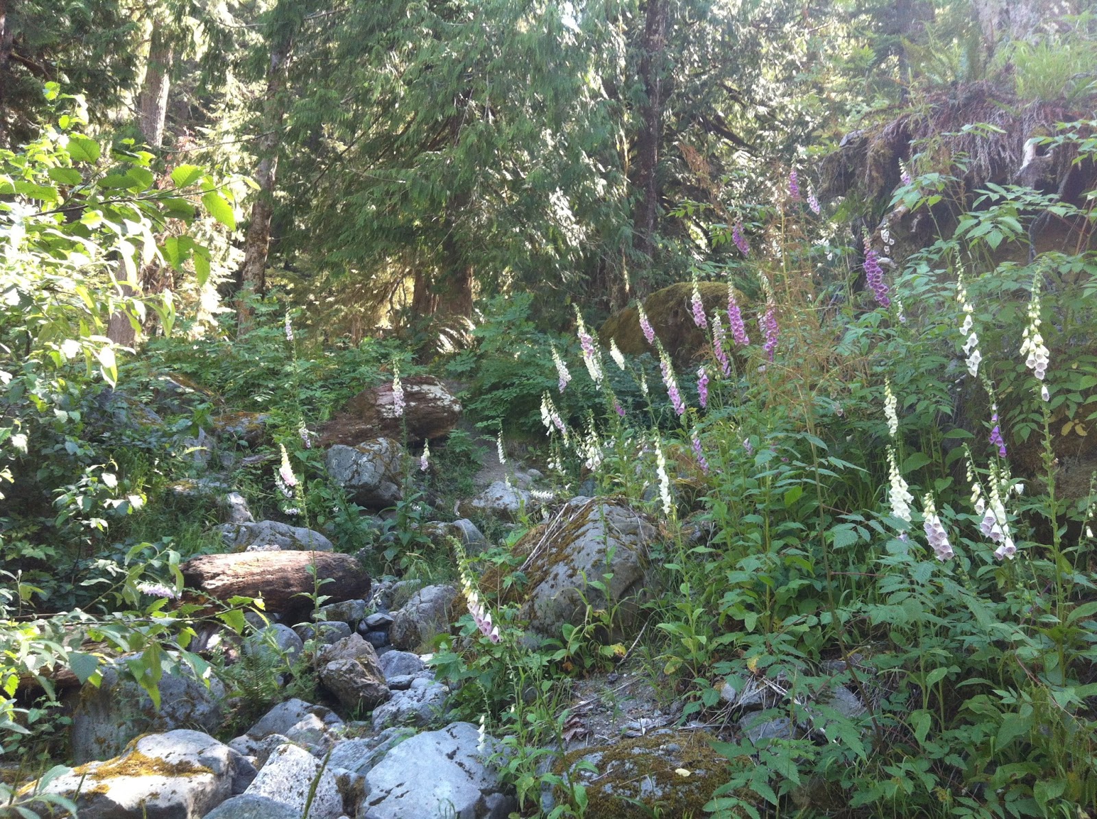
the Foxgloves were in bloom all along the road
We stopped at Bedal Campground campground and looked around. It had a map board and boat launch. Little did we know at the time how useful that map picture would be to us later in the day.


view of the Sauk river at the boat launch
from there we took our first spur road, #23 & crossed over  the White Chuck river bridge


There is a nice big parking lot with a restroom just after the bridge on the left. We then took the spur road #2700. We traveled on this for quite a while, going up and over a pass. We found out later that this area slides out quite often and is sometimes impassable. The road other than being gravel the whole way was in great condition and we were enjoying it immensely

.
as we were coming down the long fairly steep downhill we heard a strange sound and casually wondered what it was. Not long after that we arrived at the lowland flatter road that junctioned with road #25. My husband stopped the car to see what was going on with the car since it was driving different and sure enough we had a flat tire. 


So begins the epic part of our trip -

We got the smaller spare tire out & it seemed fine until my husband got it on and lowered the car back down off the jack, and we realized the small spare was low on air. 


So he decided it would be best to just drive slowly and hope we could get to Darrington and get some air in it. Thankfully I had taken a picture of the map and it gave us a general idea of where we were. We had no cell coverage so it wasn't possible to call for a tow. We had driven an hour and a half and only saw 2 cars in all that time, but we were still trying to be optimistic that we would be able to flag someone down to see if they might have a fix a flat can with them or even possibly a bicycle pump we could use. We drove 10 miles an hour on the low spare tire for about 8 miles before we realized if we continued on it we could possibly damage the rim. Thankfully we came to where the road was now paved after crossing the bridge on road #26 (Suiattle River road). So we stopped and looked at the original tire to see what the damage was. He determined that it had gash in it and wouldn't be able to be repaired so we took the spare off and put the flat original tire back on. Hoping we could drive on it for awhile before we would be on the rim. We limped along  for another 4 miles on this tire still hoping we would see a car to flag down or since the road was now paved hoping to see a house where we could get help or at least use their phone (still not cell coverage). FINALLY we spotted a jeep coming up behind us. We frantically waved at him hoping he would stop. Yay he agreed to transport us and our dog (yes we had Lexis our Malamute with us). It was a tight fit for us but he gave us a ride to Darrington. He said he felt obligated to help as he had been in the same predicament once before there himself . He said we wouldn't have had cell coverage until we were in Darrington, which was about 2 miles farther on road #26
and then about 10 miles more after we turned onto hwy 530.
He dropped us off at the Shell station in Darrington, and after giving him many, many heartfelt thank you's I got on the phone and called my AT&T roadside assistance. They couldn't find anything near there that was open and their next move would be to call the State patrol and let them help us. So we said thanks for trying but we would do some of our own investigating. Luckily while we were limping along on our flat tires I had been charging my phone so I would have a full battery when we found coverage. Again nothing was available locally so after taking a deep breath realizing it would be very expensive we called our own local 24 hr. towing company (B.J.'s towing) that was and hour and a half away and see if they were willing to come pick us up with our dog. That way we could get a ride to our home and then have them just drop off the Van at their shop (they are also our regular car repair shop) since we would need new tires put on before we could take it anywhere. Yay they would,
so I called our At&t and asked if our towing deductible would still be honored and they said yes - $50.
Oh well it was better than nothing.
 So we found a nice little bench to wait "patiently" for our ride. At about 11pm the tow truck rolled up. We were SO happy to see it. He had a nice long bench back seat so Lexis was comfy but not so happy.


All in all not such a bad day, but never quite so glad to be back home at 1:30 in the morning!

Lessons learned: 
check the spare before going on a drive 
keep a can of Fix a flat and possibly a bicycle pump in the car at all times