We decided that today would be a low key walk. We drove out to Semiahmoo park and after a quick peek at the beach, we began our walk along the beach trail.

Phooey, no clam digging today. It's closed to clamming, because of Marine biotoxins.

The beach trail had many succulents and flowers growing along it.


There is a trail on both sides of the spit. A gravel one on the north and a paved one on the south. A road runs along the center of the spit and ends where there is a resort, a marina and a small cafe.


We walked towards the Semiahmoo resort and to a cafe near the Marina for lunch.

The telescope along the trail, looks towards Whiterock, British Columbia.

Our lunch view.

You can watch the relive video of Part 1 of our walk here:
Part 1 Garmin stats:
total miles walked to the end of the spit - 1.3 miles
total ascent - 13 feet
After lunch we took the trail to look at where the Plover ferry departs for it's summertime trips to Blaine and back.

One of the buildings by the dock had one of my favorite colors of Hollyhocks growing along it.

This building also had a photo of the spit attached to a side wall. We began our walk near the end of the forest that you can see in the distance in the photo below. We walked the length of the spit to get to our lunch spot that looks out at the marina.


I loved this abandoned dock, with the yellow succulents in bloom. Also, someone had put up posts with bird houses on them.

Time to make our way back. This time we walked on the paved trail that runs along the other side of the spit.

 |
| Panorama view along the trail |

We saw an Eagle on this old snag, it had a crow harassing it for quite a long time. The Eagle patiently sat and ignored it.

Here's a video I took of the crow persistently trying to annoy the Eagle. If you turn your sound up you'll hear the Crow.
This trail is part of the Coast Millennium trail,

I spied a great Rose bush with extra large thorns. It reminded me of what I used to love to do as a child......

Play Rhinoceros!
When I was a child I would take the thorn off of the bush, lick it and stick it on my nose. Guess what? It's still fun!

Our view as we came to the end of the spit.

Instead of ending here and going to the parking lot, we kept going along the paved trail. This section used to be a road, I haven't been on it for years.

When we got to the end of the road there was a private property sign if we had wanted to go straight, to the right was a trail that we hadn't know about. Of course we had to take it and see where it went.


Thanks to my husbands sharp eyes we saw a young Coyote chewing on something.

It heard us and lifted his head, then we were able to see it's head clearly.

The trail ended at a road in a neighborhood, so we turned around and made our way back.

According to the sign, the trail is closed during the winter.

On our return we took a small side trail down to the beach. We found these two bamboo sticks (dead trees) that had grown in the rocks. I think they must be makers for the little trail we took. They sure looked out of place.


If you were walking along the beach would you know that there was a trail there? That is where we came from.

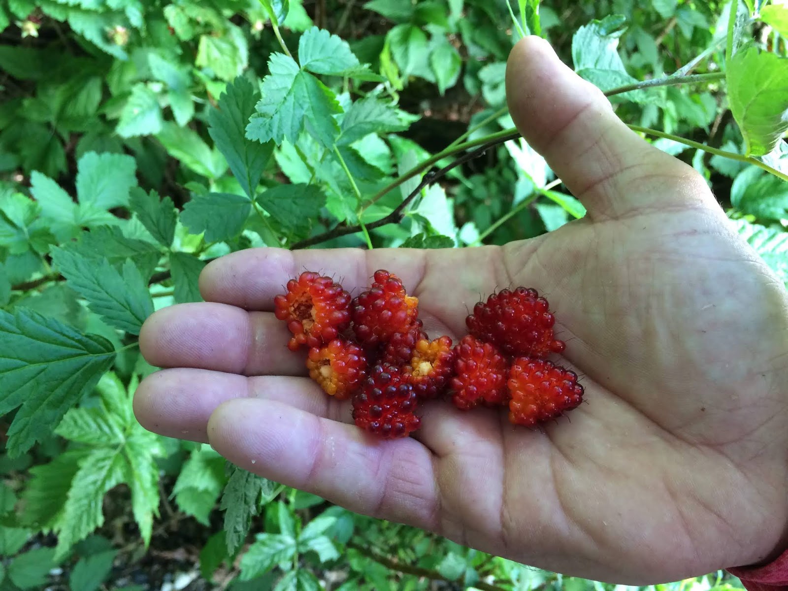
There were some great Salmon berries ripe just as we entered the trail from the beach.

When we left our home this morning I thought we were going on a simple walk along a spit, but it turned out to be a fine adventure.
Last look at the beach from the parking lot.

You can watch the relive video of Part 2 of our walk here:
Part 2 Garmin stats:
total miles of walk from cafe to car - 4.39
total ascent - 194 feet
Combined Gramin stats:
Total miles walked - 5.69 miles
Total ascent - 207 feet