Before I can go one with our day four details, I first have to back track to the night of day three. We'd had a long day on the trail, a lot of downhill not to mention very warm weather. We were both very tired as we got into the tent for the night. My husband began our nightly routine reading material. First he read from the route description for the next couple of days. Day four didn't look too bad, but day five sounded like a maze of logging roads that sounded confusing to stay on the correct course and it had an 11.8 mile hike with no water in between (which sounded horrible considering how hot the days had been). Of course both of our tired brains heard the day 5 news with trepidation. We were close enough to where we started and one of our cars was there so we talked it over and decided to turn around and hike out in the morning. It would be 3 days back over terrain we knew. He then read from the Patrick McManus book and the chapter entitled "The big trip" It was a story about how a then 17 year old Patrick would plan and execute or be executed by the big trip. I'll share what was in the book in quotations, *I hope this is legally O.K. to do. "The distance and the terrain were formidable. He decided to take on a companion "Retch". The trip lived up to it's name and Retch was the first to speak up and say "let's quit". Patrick exclaimed that if they quit it would be like a skydiver quitting halfway to the ground. So on they went, the conditions didn't improve as a matter of fact it only got worse. They were at their wits end, 10 miles from the end of the nearest trail and 20 miles to the nearest road. Patrick thought "what do we do now?" Then he remembered a surefire remedy for a predicament of the sort. "When all else fails, there's only one thing to do,"You tough it out" and then one day...they walked out of the mountains, people were going by not caring what the two had been through. Then Patrick thought he heard a sound in the empty air. He looked at Retch to see if he had heard it too. He had. As they slogged along the sound grew in volume, swelling up and filling the silence and emptiness until it reached a great thundering crescendo. It was the applause and cheering of a standing ovation.
I thought to myself "Crap, of course that would be the story we read tonight, just after reading the upcoming trip report." What were the chances of that type of a story in one of his "light hearted" books.
Of course we tossed and turned running our decision over and over in our heads over the course of the night. Hearing that story led to our "defining moment". When we woke we had another discussion and agreed that we would press on and "tough it out", we wouldn't let the confusing and supposedly hard days "reports" ahead get the best of us. So go on it was. Today's hike wasn't to be too far, so I put my fears and trepidation's into the back of my mind and just tried to enjoy this day. We walked through a lovely forest and stopped at this trail intersection. Not long before this I had dropped my buff that I used as a face covering if I met anyone on the trail, my sweet husband went back looking for it. Thankfully he didn't have far to go to find it and was back before I had time to even think what I'd do while I waited.

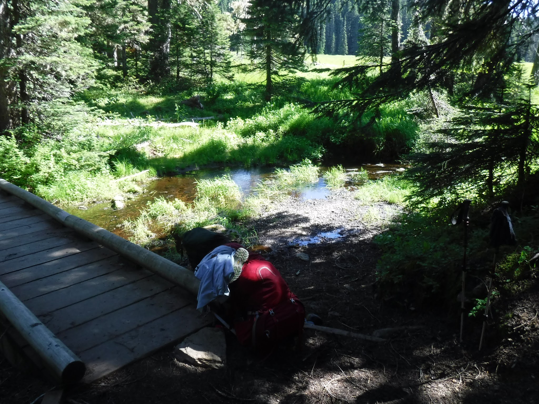
We arrived at the water source just before the Mike Urich cabin and Government meadows. We filled up our bottles and walked on to check out the area before us.
The cabin


We took a couple of "we were there" photos too.


The following photos show the signs in the alcove and some of the things from the inside.


Government Meadow
As I stared out at this amazing meadow I thought - we almost turned around and missed this wonderful place. It gave me hope for the remainder of our journey and reminded me that there will be many more glorious things in our path each day.

I found this sign about the "Longmire" wagon train interesting.

Back to watching for PCT emblems and signs so we wouldn't get lost.


I was a bit teary eyed and emotional when I found this heart rock. It may sound strange, but these little heart sightings give my spirits a boost each time I see one.

Logging road sighting!

Mount Rainier in the distance.

Whew we're still on the trail.

More brightly colored flowers growing out of the rocks.


An awkward "go around"!

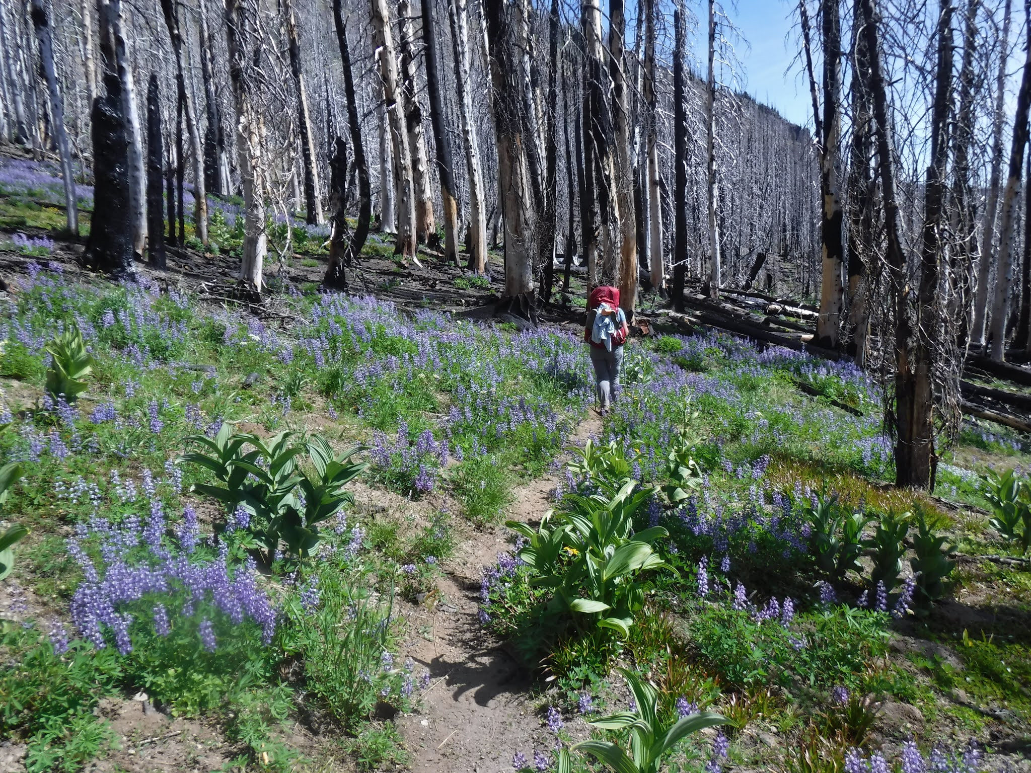
We walked through this Silver forest which gave us some great wide open views....and yes, it was very warm.


The sign below tells about the burn.

We finally arrived at our camp for the night. "Spring camp": an oasis of water and greenery❤
The perfect place to fill up our water bottles and extra carrying bags for the long journey the next day. While we were there I did a quick laundry duty. I put my hiking pants in a gallon zip-lock bag. I then added water and some environmentally safe liquid soap to it. I then shook it up vigorously, squeezed the water out of the pants, added fresh water, gave it a quick shake to rinse the soap off and then I hung up my pants to dry on a nearby tree branch. It worked great! I then filled my water bottle with water added a few drops of bleach to it and let it sit for awhile before washing it out. I use a half packet of Liquid IV as my electrolytes per water bottle and the bottle can start growing bacteria on it's sides if it's in the hot air as we'd been the last few day.

Water containers filled and waiting to be carried for our long "tomorrow's" journey.

Camp all zipped up for the night.

The story that night was more light hearted and not quite as on point with what we were going through. Thank goodness!

Relive video of our route:
Garmin stats:
miles hiked - 7.38
total ascent - 1004 feet
total descent - 784 feet
to be continued....