Wednesday, September 12, 2018

Wonderland trail: Day 11 of 12

August 31, day 11
Indian bar to Summerland
We woke to fog and cold again, we made our way through the small valley to begin our climb up. I was starting to feel congested like I was getting a cold. It was affecting my energy on the long up hills.


Looking back to Indian bar and Ohanapecosh cirque.

As we climbed the fog got thicker.


An encouraging heart rock on the trail.


Alpine flowers interspersed between short snow field crossings,


Low visibility heading towards Panhandle gap, the highest point on the Wonderland trail.


and another encouraging heart rock on the trail.

I brought my Yaktrax for the snow, but never had to use them. The snow was a little crusty in places but we could kick step them deeper if we needed better footing.
On our way to Panhandle gap.


I was surprised when my husband told me we had gone over Panhandle gap already. I was looking for a keyhole crossing. We'd always done it with more snow on the ground, it was very unfamiliar looking with just rocks along the trail.

Looking down towards Summerland, the last camp on our trek.


Even a heart impression on a rock.

Frying pan creek crossing


Down in the lower left of the photo below you can see where the old bridge ended up.

Summerland ❤ and sunshine!

A friendly Marmot welcoming committee.

We were over joyed with the sunshine, as soon as we got to camp we got out our wet things and attempted to dry them out.


It didn't last long, the fog rolled back in, so back in the bags they go. We did get one last look at Rainier that night. We found out from Ken, that he got a later start from Indian bar than us and got the luck of seeing Goats with babies close up on his journey up the hill!

Relive video of our route:

Garmin stats:
total miles hiked - 5.31
total ascent - 2054 feet
total descent - 1706

Day 12 to be continued

Tuesday, September 11, 2018

Wonderland trail: Day 10 of 12

August 30, day 10
Maple creek to Indian Bar


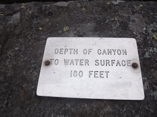
They were doing trail work at Box canyon so we had a detour,

through a tunnel!


Box Canyon


There is a tourist view parking area here with a proper bathroom. We took advantage of our stop and also dumped off some more trash from our packs. Time to cross the road again and begin our climb to Indian bar. This is one of my favorite places on the trail. When we went around with our kids we spent two sunny blissful days there.


Another fine bridge.

Big trees in this forest.

Rain diamonds on the leaves.

Making our way up Cowlitz divide, it is so much overgrown now compared to when I had hiked it last. Hardly any openings in the trees for a valley view. Not that we would have seen them today, the clouds were low.

Chicken of the Woods. I would have given my eye teeth for a cast iron skillet and some butter. Yummy!


We hiked off and on today with our trail friend.


We hiked up to a knoll that we thought was the top, but we were wrong. We hiked ever upward again to the correct "top knoll". I had my memory photo taken up here. This is a special spot for me, this was my and our kids “Sound of music” spot on a sunny day so many years ago. Not the same in the fog. Being on top of the world on a sunny day leaves a better impression. 
Today it was a day of memories past ❤

and making memories present ❤. 
Thank you Ken for being there and taking our photo at such a special place in our hearts.

Heading down to Indian bar, my legs were about done. Thankful again for that little mustard bottle.

Pasque flowers

Our first sighting of the Indian Bar shelter. This was our two day camp with the kids.


Here's a photo of what the shelter looked like in 1975. 
A much drier year.

The bridge crossing to the camp sites. 

The view from the bridge.
Looking off the left side -

Looking off the right side -


Ohanapecosh cirque from our camp.

The shelter from our camp.

It was a long physically/emotionally tiring day for me filled with sweet memories.
It was a tight fit for our tent and a little slanted, but it worked. 
Again I am going to bed tired and cold.

Relive video of our route:

Garmin stats:
total miles hiked - 10.81
total ascent - 3990
total descent - 2270

Day 11 to be continued