Two hikes today!
We decided we didn't need to hike "up" today since it was snowing low in our local hills, so we drove to our usual winter "oasis" location for our hikes - the Fidalgo/Whidbey Island area.
First we set out to explore a new to us area, the "Kukutali Preserve, located on Swinomish tribal lands. You can read about this wonderful place in THIS article published by AdventuresNW magazine.
The weather was wet and windy & cold while we were there.
We walked down the road from the parking lot towards Kiket Island and first explored the south trail.
The gravel road goes through the center of the area, between the south and the north trails.
Hiking along the south trail through salal, ferns and a few Madrona trees. Then we hiked down the north trail.
The photo below shows some one's handy work on a rock along the north trail. It's made up of small sticks and tree needles.
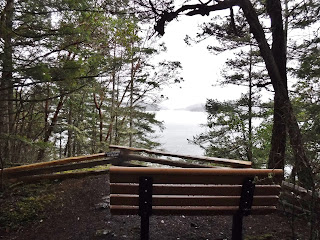
It's hard to see through the clouds, but from this view point we could see the Deception Pass bridge.
The road and trails come down to a large opening where there is a bathroom and a picnic shelter.
It was so windy and rainy when we were there for lunch that we sat in the bathroom alcove, on the cement to give us some shelter. We bring foam pads to sit on when we hike so that helped our comfort level a bit. We also sat against our packs for a back rest and it was pretty comfy.
Our lunch view.
After lunch we went down the short trail to the beach. The tide was up, so we couldn't explore there.
We then walked the short beach trail towards Flagstaff Island.
Flagstaff Island, is a wildlife sanctuary and it's closed to the public.
The wind and rain were bitter cold against our faces as we walked back along the beach trail. It was nice to get into the forest and be sheltered from the weather.
There are several information signs on the preserve. I particularly like this one. If you enlarge it you'll see that it has the original native names listed with our present day names.
We hiked the north trail again on our way back I really enjoyed exploring there and would like to go back when we could feel the sun on our faces. It would be a nice place to hang out at if the weather was better. We had planned on hiking Sharp park perimeter trail after being at Kukutali, but I wasn't sure I wanted to if the weather stayed like this. We decided we would drive to the trail head and see if the weather was any better before we bailed on the hike. The weather did get better. We headed down the trail with no rain or wind.
We hiked the trail clockwise this time, the other 3 times we hiked here we've always hike counterclockwise. When we got up to the highest view area it was still dry and a little dark.
I was so glad we stayed with our plans to do our second hike because by the time we got to the lower view area the sky had begun to clear and the sun came out.
A large Madrona with blue sky behind it.
We stopped at Porpoise point for a break and a snack. We were just talking about how we had seen Porpoise there the last time we were there, and wondered if they are always in the area. Sure enough there they were swimming by. We also saw a Harbor seal. He poked his head way out of the water and looked around. The photo below shows a large kelp bed that the Porpoise and seal swam by.
As we were walking away on the trail, I looked back and saw our lovely green patch on the rocks where we had just been. What a beautiful area.
Two hikes in one day that seemed so different, just because of the weather.
Kukutali preserve Garmin stats:
total miles hiked- 3.3 miles
total ascent - 502 feet
Sharpe park Garmin stats:
total miles hiked - 3.35 miles
total ascent - 961 feet
Combined stats:
6.65 miles hiked
1463 total ascent
Wind, rain and sun, made for a day of fun!


No comments:
Post a Comment
Thank you for taking the time to read my blog, I welcome your comments.