
Today our plan was to hike at Bowman Bay via Rosario, but a quick change of plans was needed as we had forgotten our Discover pass. We thought about it and realized Sharpe park was just up the road, so off we went to the Sharpe park trailhead parking lot.
Bear with me as this post will have a LOT of photos in it. I decided to do a type of connect the dots post about the trail by photos. If someone wanted to re-create our hike they could follow by photo😊
We've hiked this trail several times. One time we did it with a 4 mile distance, because we forgot our binoculars in the car and had to return to get them. You can read about that March 2017 two-part hike HERE, where we went to Sharpe park and Heart and Erie lakes on the same day. Another time we hiked the trail the distance was 3.35. You can read about that January 2018 day's two-part hike HERE, where we went to Kukutali preserve followed by a hike at Sharpe park. Both of those day's hikes are short enough and close enough to each other that either of the options work for a one day hiking adventure. Today's distance was 2.89 because I forgot to start my watch after our lunch stop. My husband figured we had gone about a quarter of a mile by the time I had realized my error. So the distance would have been pretty close to the 3ish mile day.
Anyway....on to the photo journal of our day on the trail.

The stand in the photo below is in the parking lot.

A close up of what is on the stand.

The kiosk

A nice marsh is at the beginning of the hike. The pond is really full of cattails now, not much of a view of the pond.

I'm still determined to get the trash off of the trails now on our day hikes. I attach my trash bag and a small trash bag glove on a carabiner attached to the waist belt on my pack. It makes for a convenient trash pick up system.

As I stopped to get a photo of these small mushrooms I noticed something else had been laid by them. Do you see it? I didn't put it in my trash bag.

I took photos of the trails we followed, to aid in your day's hike.


Looking at the photo below you would tend to think that the trail would continue to go straight, but the trees laying down are to deter you from going that way. That is the park boundary. The trail goes left just past the tree in the foreground.

Here is the easy to miss sign at the foot of a tree.

Madrona are everywhere on this trail❤

Madrona full of berries.

Hiker directional sign.


Bluff trail signs attached to trees.


Porpoise point trail sign.

The photo below shows another example of where you'd think you should go straight by the tree on the right, but no the trail does in fact go over the fallen log and to the left.

First view of the water.

Kelp beds along the shore.

I love this section of the trail. You get to go under these magnificent trees❤

The grassy knoll is our lunch spot. A perfect place for birding and looking for wildlife. We saw Porpoise swimming by and a very large Sea Lion near the kelp bed. The wind was really blowing at the point. I was glad I brought my rain jacket and pants, they were the perfect wind block.
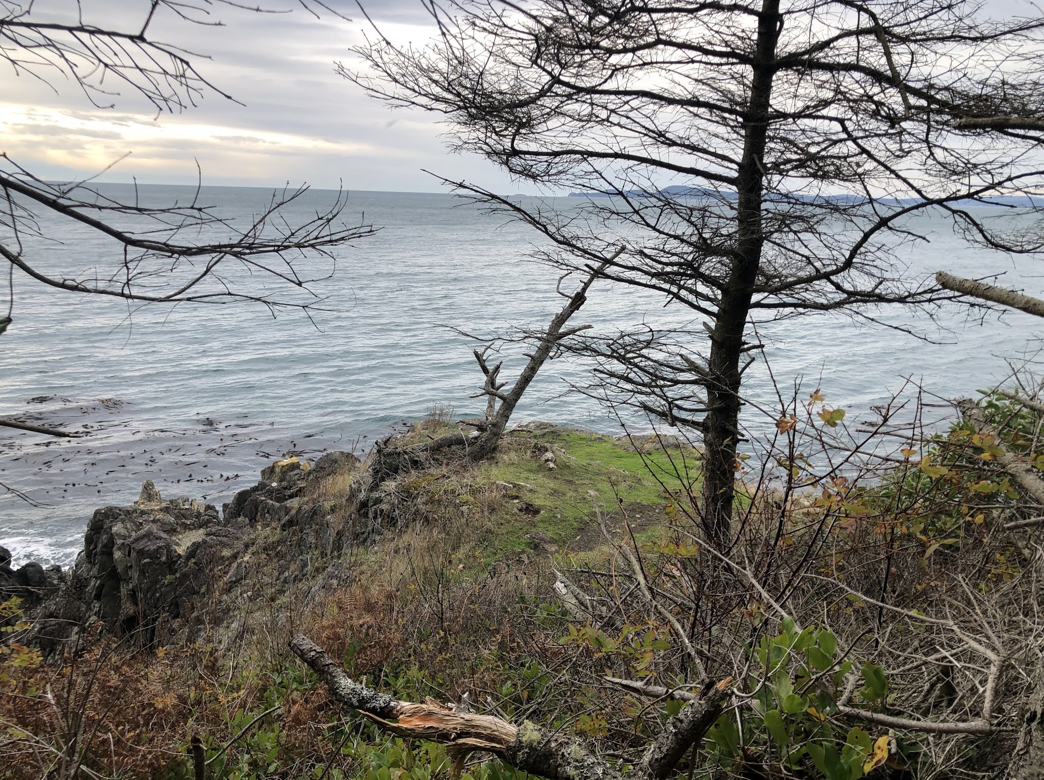
Our view from the point as we ate.

Looking to the right

Looking to the left

After lunch *and where I forgot to turn back on my Garmin😞 We turned onto the Sunburst trail and made our way to Sares head.


One of the reasons I'm picking up trash is because of these dog poop bags😡. This is the second one I picked up. I'll refrain from ranting here but seriously folks...…pick up those bags.


The view looking right from Sares head.

and looking to the left.


We then joined the Broom-Tomb loop trail.

Another view looking south

More trash...this was the second tissue/tp I'd picked up today, not to mention the gum and candy wrappers plus a dental flosser.

At the highest point of the park there is a nice bench to sit on.

The plaque on the bench.

The wind was terrific at the top. I took a video of the wonderful view, if you watch with your sound on you'll hear the wind blowing.
On our way back, we turned onto the Shelley loop trail,

and the upper trail.

Finishing in the most beautiful fern filled forest.

Just before the lot is this sitting area.

On the stand is this sun dial, surrounded by a quote. If you enlarge it you will be able to read the quote.

The rain just began to sprinkle as we were finishing. The wind continued to blow as we made our way home.
Relive video of our route:
Garmin stats:
total miles - 2.89
total ascent - 932 feet
total descent - 863 feet
I hope you enjoyed this armchair version of a hike, if you are able to get out and enjoy the trail perhaps this photo journal can help guide your way.
Happy hiking!
I loved going along with you on this hike, with all the wonderful photos. I've been on it twice, and enjoyed it just as much this third time. Thank you! :-)
ReplyDeleteThanks for coming along😉
Delete