After our hike Tuesday to
The Portals, we looked at the weather forecast to see how it will affect our last Bucket list hikes. Saturday looked the best day with Sunday nice as well but with a few more clouds. So with only a day's rest we decided to go and hike Church mountain. Church mountain is all about the views, so I wanted the clearest weather day possible to attempt this. This was a hike heavy week for us: Hannegan Peak attempt on Monday, The Portals on Thursday and now Church mountain on Saturday. Lots of high miles and ascent for us but we're running out of time in the high country. Snow is predicted midweek so this is probably our last outing in the mountains. We have Winchester lookout & Welcome pass to yet hike, my husband added these to our joint list. Who knows if the weather gives us one more window we could possibly get to the last ones on our list, but that would be a big wish.
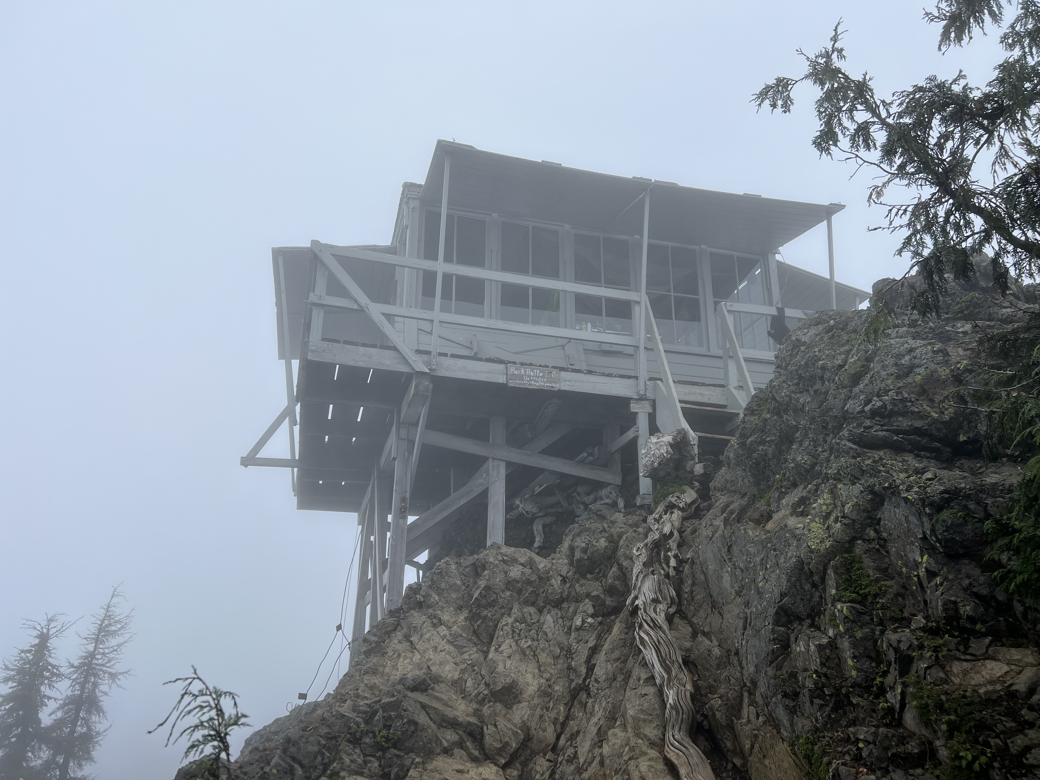
I looked to see if I could find any info. on the history of the old lookout and I found an article complete with photos of the old lookout. You can read that article
HERE. I found it very interesting.
We got up at 5am to get an early start as we didn't know how far we would get on the trail and how tired we would be so we wanted the biggest window of daylight that we could get for our hike.
When we got in our truck it was a wonderfully clear night sky, the stars were shining brightly. We got to the trailhead just after sunrise. It was a short drive to the trailhead and the best logging road surface we've had all summer. The fossil creek crossing didn't have much water in it and it wasn't tricky to drive through the dip. Our truck rubbed just a bit, so low clearance cars might have an issue.
It was a warm 47 degrees when we started. I never needed an extra layer all day.
Signing in at the register. It was the first day of deer hunting and several hunters were on the trail as we made our way up. My husband had his trusty orange hat on.
The first half mile is on an old road. It's not too steep and is fairly wide.
It's about 3 1/2 miles to the meadow, so we hiked in the forest for quite awhile.
My husband spotted this Newt/Salamander? along the trail. Scoutina wasn't interested.
Forest view
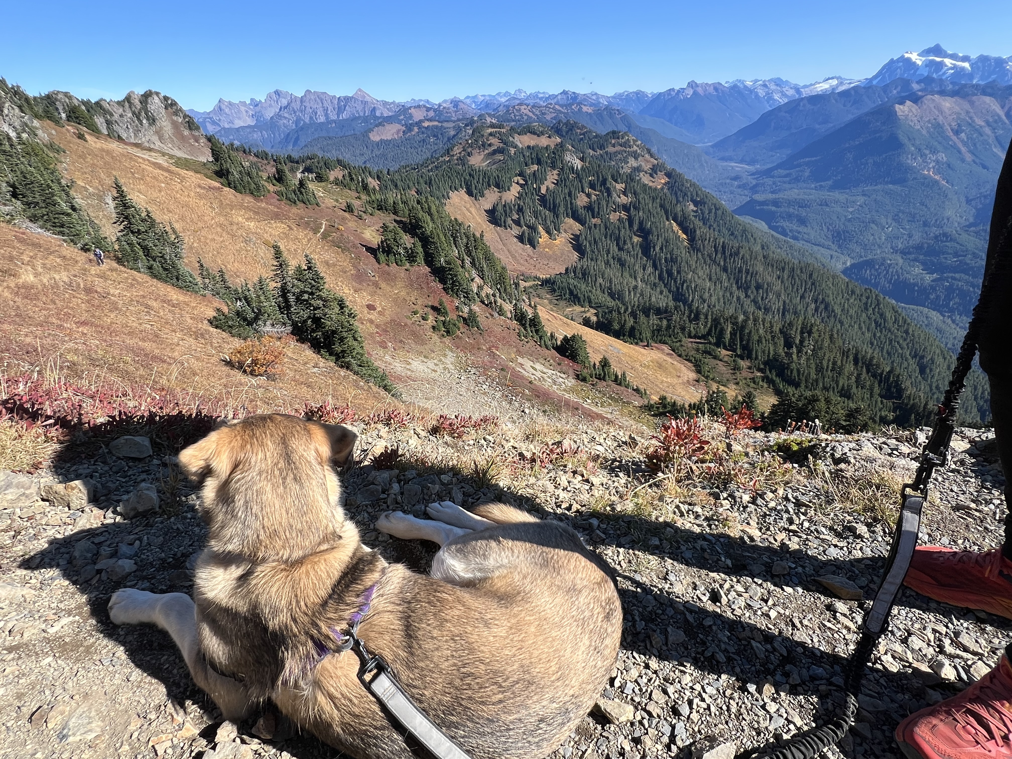
Finally we made it to the first creek, Scoutina was excited about her chance to get her feet wet and to get a drink of water. We bring her water dish and extra water with us for long dry sections of the trail, so she'd not deprived of water.
Finally we broke out of the forest to the meadow.
So bright and wonderful.
There are a couple of creeks in the meadow. We chose the farthest one with rocks around it and took a break, had some of our lunch and rested for the nearly 1 1/2 mile 1000'+ climb to the top. The last push is challenging after going 2000'+ up through the forest section.
Our lunch view.
We packed up and began our slow trek up the hillside. Thankfully it was switchbacks and manageable.
Our last section up to the top.
My husband and Scoutina began making their way up the rocky steep trail, until I decided I was too nervous to watch Scoutina attached to my husband make their way up the
Class 2 scramble area. I could just see her jump and cause my husband to lose his balance and over the edge they go. I voiced this to my husband and he said he would stay at a lower location and I would continue up the rest of the way on my own. So up I went. I followed the horizontal cable route until it turned and went at a vertical direction, at this point I continued on a path that had a bit of scrambling (using my hands) to get up.
I took this photo looking up from the trail.
Finally at the top, with a nice clear view of Baker.
Kidney lakes to the opposite direction.
The peak in the photo below is above Kidney Lakes, I tried to find the name of this peak and found nothing except possibly called Pt 6209, I found that info. in a trip report on NWHikers.net, you can read about it
HERE.
The true Church mountain summit.
A selfie bucket list photo from the top of the hikers (or false) summit.
I collapsed my trekking poles and attached them to my pack for the descent and made my way down on what I thought was the trail I'd come up from. It was very steep, but I was making good progress until I came to the cable. There was a spot that my foot just couldn't' reach (short leg people issues). I called out to my husband since he was in hearing range and said "I'm stuck". He said back to me "what are you doing on the cable route? Oops, up I went and found my correct turn for the downhill scramble. I was pleased with myself though for going as far as I did on the vertical cable route.
As I made my way back down the trail I took a photo of the place my husband and Scoutina waited for me.
Safely down to the easier section of the trail.
After getting to the top I came back down to where my husband and Scoutina had waited for me. It was nice to sit down, eat lunch and let my happy thoughts wash over me.
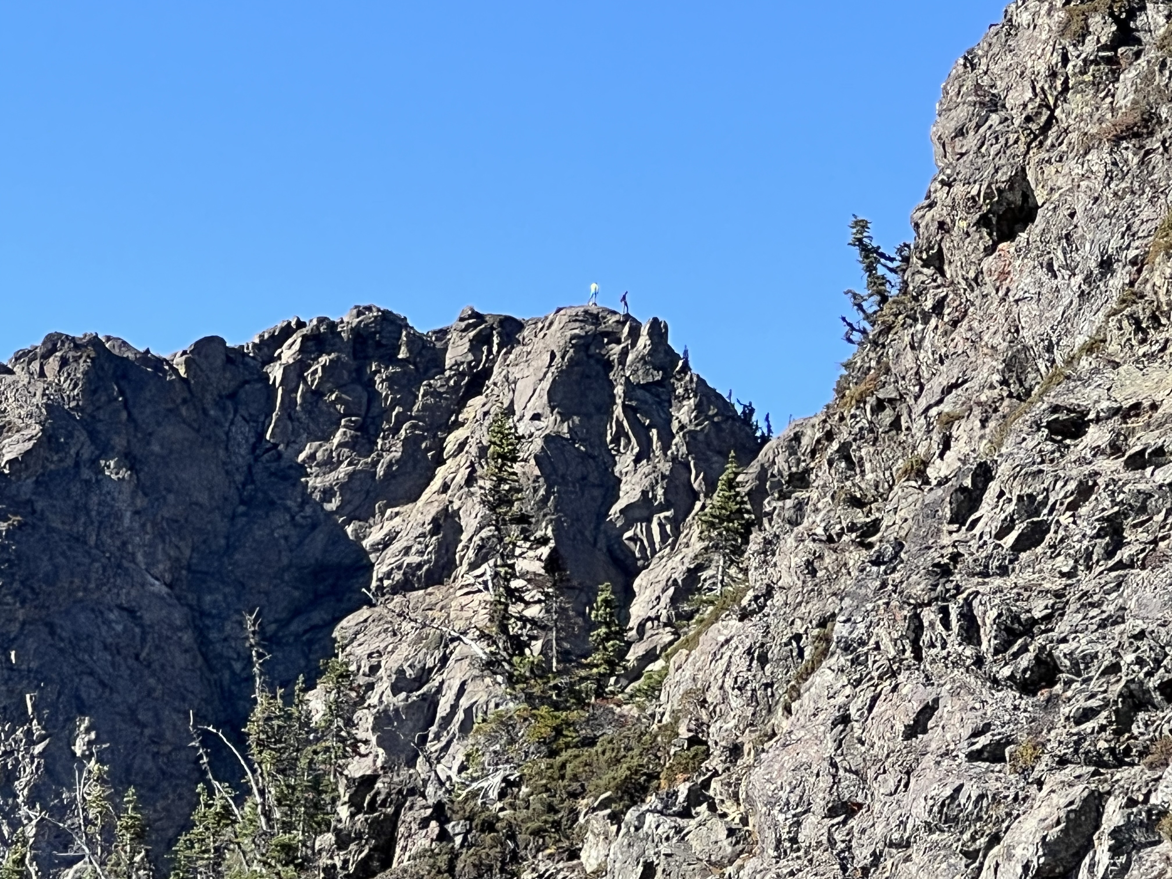
I don't think I've ever seen anyone on the true summit before. I took a photo of some people at the very top.
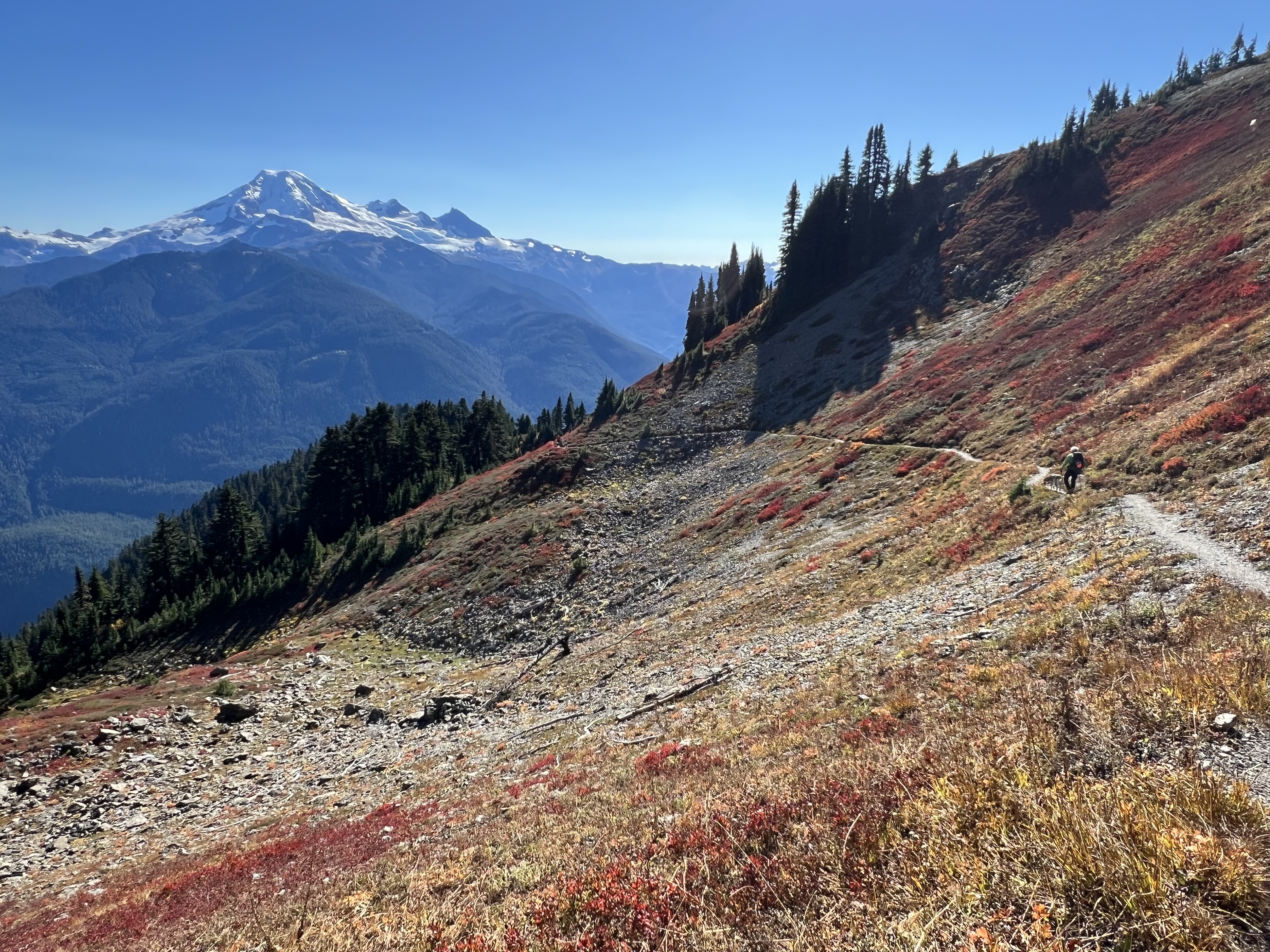
Fall colors and mountain views as we made our way down.
Always a last look back.
Into the forest we go.
The forest isn't totally without vegetation, we did see this lovely green patch on the forest floor.
The last section, nearly to the parking lot.
We were back to the truck by 5.
A splash of fall color as we drove out the parking lot.
Trail rating: Hard
Total miles: 10.4
Total ascent: 3691
I was so happy that we were able to complete this hike.
We enjoyed a nice celebration dinner at Graham’s in Glacier before going home.
My Summer bucket list has been completed✅:
Park Butte Lookout
Excelsior peak
Yellow Aster Butte
Hannegan Peak (just short of the summit)
Church mountain
Lake Ann
Heliotrope Ridge
Ptarmigan ridge (The Portals)
Sauk mountain
Watson lake
Boundary way/Cowap peak
My husband's add-ons completed✅:
Scott Paul loop
Chain lakes loop
Goat mountain (overlook)
Not completed, husbands add-ons🚫:
Winchester mountain
Welcome Pass
I've been to the top twice, you can read those trip reports from June 2015
HERE and from July 2019
HERE.