Today's agenda: hike to Longmire to collect our cache, empty our garbage and buy some goodies and necessities at the store then continue on the Cougar Rock camp for the night. Cougar Rock campground is the alternate camp for the closed Paradise River camp. We saw several people that also had Paradise River on their permits and were surprised that the ranger didn't inform them of this when they got their permit. Apparently it was too difficult for the National parks to edit this information on their computers at application time.
Rock formations just past Devil's Dream camp.
A lovely forest walk towards Pyramid creek.
It was a little chilly this morning. Thankful for my layers, although they quickly came off. It didn't take long for the sun to warm us.
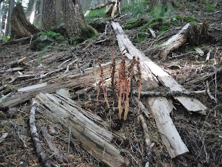
Coral Root.
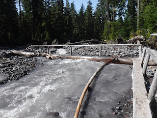
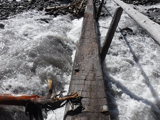
Pyramid creek. The log bridges and handrail were great.
A lovely fern just past the Pyramid creek camp.
Rainier from Kautz creek.
Kautz creek is really spread out with lots of boulders, thankfully the tape and cairns were easy to follow.
Making our way up the other side of the creek.
One last look at Rainier before heading back into the forest trail.
A look back at the side hill trail.
Nearly to Longmire!
A road crossing before we hiked the last short section.
Cache pickup!
The ranger on duty took our Longmire photo.
Rainier view from in front of the Longmire store.
We set out our cache items and organized our packs again. A hiker going the same direction as us asked if he could rest at our table. We talked about our route and camps and saw that his next camp was Paradise River. We told him that Paradise River camp was closed and had been closed for awhile, and that some rangers aren't editing the permits or informing everyone when they pick up their permits. This was new information to him. He decided to talk to the Ranger and thankfully got his permit changed to another camp farther up the trail. I'm so glad we talked to him and were able to save him some confusion after a long, tiring day on the trial. He didn't want to stop at Cougar Rock CG and was hoping to get farther up the trail for the day. He was fast packing and going many more miles than us each day.
Then it was time to hike to our camp for the night.
Even after last years fiasco of not being able to find the Cougar Rock Wonderland trail group camp, we still had trouble finding it this year. The camp is nearly a 1/2 mile from this sign. This is the only sign with directions as you enter the campground😐. It says your site is in the group loop (where is the group loop?) and by the bathroom, do they realize how many bathrooms are in this campground??
Oh well, we finally did find it. We didn't wander around nearly as much as last year, so we had a little more camp time before bed.
We were the only ones in the back country group camp until after we'd gotten into our tent. Another couple came into our camp after dark and asked if they could stay there. We said sure, since it was dark I don't think they realized that it was a camp with a couple of sites in it. When we woke we saw that they had discovered this and were camped across from our bridge, and still in the group camp.
Relive video of our route:
Garmin stats:
8.42 miles
860 ascent
2657 descent
Elevation profile:
Trip summary:
69.85 - total miles
17,517 feet - ascent
18,938 feet - descent
Elevation profile:


No comments:
Post a Comment
Thank you for taking the time to read my blog, I welcome your comments.