
Today we would hike uphill from Cougar Rock through Reflection lakes and Box Canyon to the Maple Creek group camp.
We'd only taken a few steps on the trail when I spied a heart rock.

Thankfully there is a sign about the Paradise River camp closure before the hike up the hill to Paradise River. If the sign wasn't there until people got to Paradise River I don't think many would turn around and hike back the opposite way to Cougar Rock. I was glad to see the temporary sign as we went by, although it really should be at the Cougar Rock campground junction of the trail and not even this far up the trail.

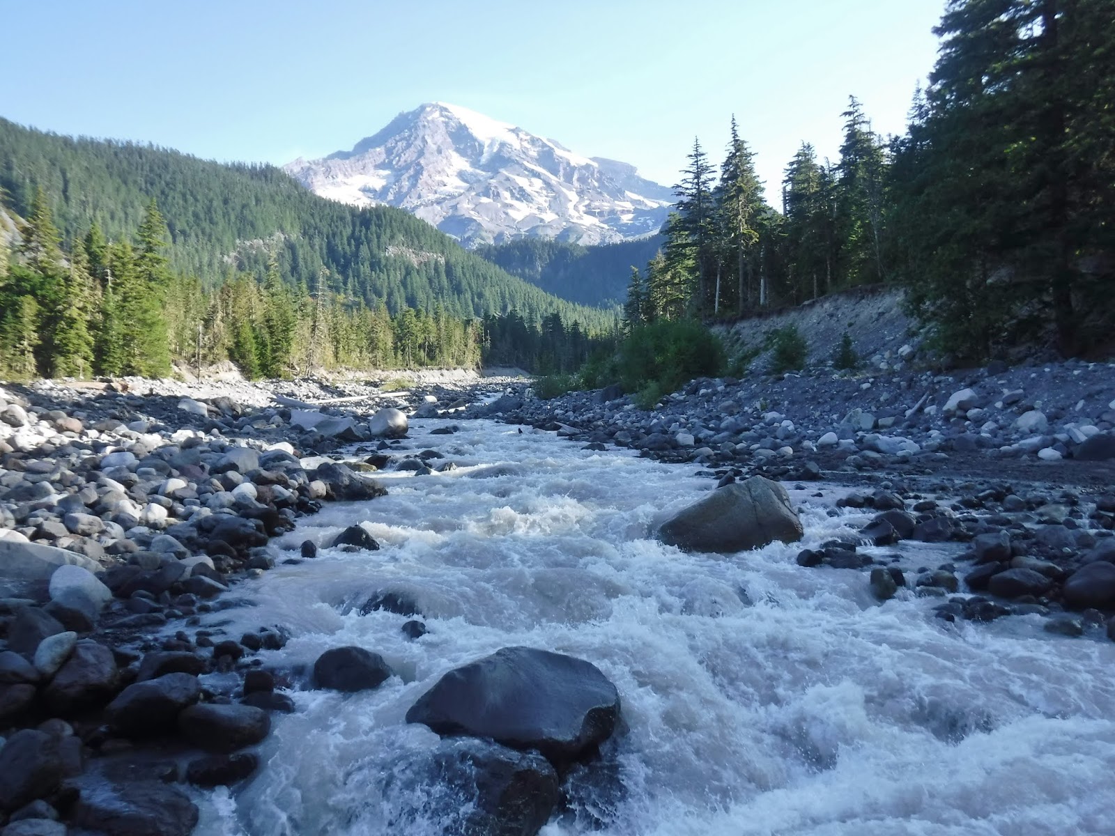
Our next river crossing was the Paradise river with a great view of Mount Rainier.

My husband found a heart rock of his own, yes he actually started looking for them too❤

After some uphill hiking we came to Carter falls.


I love this view of the falls with the lacy tree branch in the foreground.

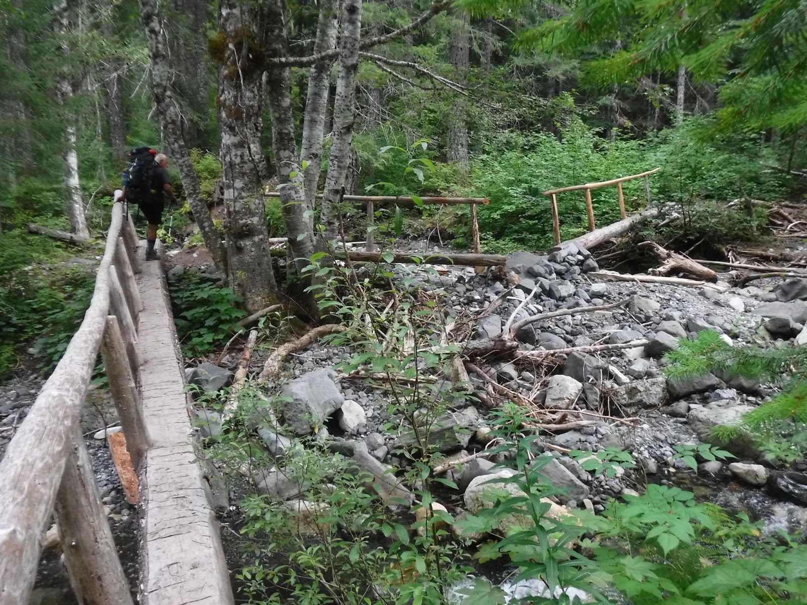
A nice "skookum" bridge.

I did remember to look up once in awhile.

Almost six "Rainier" miles to go to our camp. A nice insider joke between the hikers along the trail is that the signs are not very accurate when it comes to the mile points from camp to camp. Most of the time you can add about a mile to your day to what is posted on a sign.

A road crossing before Reflection lakes.

Our lunch view.

Time for us and apparently butterflies to rest while my husband filtered (we use a steri-pen) water at the foot bridge.


Reflection lake with a view of Mount Rainier.

And the real view minus "us".

Some roadside walking then we were back on the trail.
Louise lake.

Last year this section had some really rough bridges badly in need of repair. This year we came upon the crew actually working on that area. We had to figure out how to get past this large hole to continue on our way, but I was happy to see that it was getting the attention it so badly needed.

In the distance is Stevens Canyon. Last year I was really nervous when we spotted this section of the road as I knew we were nearing a washout section of the trail. I was concerned about how hard it would be to navigate. This year I had no qualms when I saw this view as we had survived the section and we supposedly knew what was before us this year.

Another road crossing to get us into the Stevens Canyon area.

Trail sign notice of the upcoming rough section of trail ahead.

Martha Falls

A jumble of debris at the Unicorn creek crossing.

We arrived at the slide area and I was surprised to see that it had changed. It was much narrower and the footing softer than last year. The large rock we had to dodge last year was completely gone. I guess that's why it's called a slide area🤭. The section directly in front of my husband had a fresh small slide with soft earth a small tree to navigate around. For some reason it caught me off guard that I would be so nervous. It seemed much sketchier as I made my way and I actually slipped part way along the trail and landed on my uphill right knee. I quickly regained my legs and finished going along it. When I finished I completely lost it and cried uncontrollably for several minutes. I felt silly as people were waiting from both directions to do the crossing. The woman waiting in front of me said she prayed for me as I was crossing. I appreciated the comradery in this area. The women coming along behind me were happy we had all survived such a sketchy area. Oh well, another test and time for growth. One step forward, one step at a time...oh and don't forget to use those trekking poles and trust them NOT your hand along the soft wall. Oops, hard lesson learned. I like to think I'm not such a scaredy cat as I used to be, but apparently I still have some growing to do on our adventures.

My husband waiting down below, gravity was not our friend as we made our way down this soft downhill section.

Sylvia Falls.

Even though I was still trying to calm myself at this point it was very nice to walk through this Vanilla leaf forest on our way to Maple Creek.


The dry rocky section of the Stevens Creek bed was interesting to walk through.

Finally we were at the chain of bridges that go over Maple Creek and lead to Maple Creek camp.
Camp at last❤
It was interesting because we could hear the cars honking in the tunnel on the road across the canyon throughout the evening.

I loved how the tree branch framed our camp entrance at the group camp site.

Relive video of our route:
Gaming stats:
10.92 miles
2005 feet ascent
2290 feet descent
Elevation profile:

Trip summary:
80.77 - miles
19,522 feet - ascent
21,228 feet - descent
Elevation profile:

Elevation profile:
No comments:
Post a Comment
Thank you for taking the time to read my blog, I welcome your comments.