Our PCT Section H hike had us finishing at Snowgrass flats. You can read that post to catch up to our journey HERE. This trip's goal was to finish our northbound journey of the Goat Rocks Wilderness Knife edge route. Since our last trip ended at Snowgrass flats, we began at White pass and hiked to Snowgrass flats then returned to White pass. So an out and back trip this time. We invited my brother and his wife on this journey. They had done a trip last summer that started at Walupt lake and finished at White pass, so the Knife edge section would be a repeat for them. By trips end they will have gone over the Knife edge trail three times. This would be kindof a tough kick start to them as this was their first backpacking trip of the year.
We all met and stayed at a cousins house before and after our trip, so a mini family reunion of sorts. I counted this group as my five people to meet with for the week per Governor Inslee's Covid guidelines. My brother and his wife ready to start the trip.

Filling out our permit.
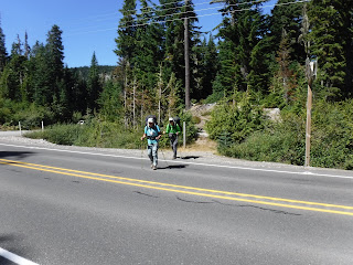
We walked along the gravel road from the parking lot to White pass hwy 12 to begin.
A sign at the Leech lake parking lot kiosk. I liked the words on this sign.
Walking across the hwy.
Trailhead: start photos.
As we made our way through the forest I spied this amazing little view in the base of a tree. Normally I'm not a fan of geocaches, painted rocks etc. in the wild places but this was very well done.
Heart rock on the trail❤
Mount Rainier sighting
Blueberries were all along the trail.
We hiked through a large boulder field.
Goat Rocks wilderness once again❤
Ginnett lake
I looked at my Guthook app and we decided it was quite awhile before any water would be found near our hoped for campsite for the night. My husband filled our extra water containers at Ginnett lake and he marched for 3 miles, so we could have water at our camp for dinner and to put water in our bottles for the next days journey❤
A meadow near the trail.
We made our way past the White pass ski area.
Another PCT sign
I nicely engraved wooden sign attached to a tree.
Ever onward
A very large mushroom
A chairlift view with Mount Rainier in the distance.
A look at the fire burning in eastern Washington.
Nearing our camp we saw large rock outcroppings in the distance.
Our tent-site view looking up the hillside.
It was very windy when we got to this camp. It made it challenging to set up our tents, but we got it done and enjoyed our dinners and watching the sunset.
Yes, and our nightly reading of Patrick McManus!
The nights' sunset.
Relive video of our route:
Garmin stats:
total miles hiked - 5.58
total ascent - 2041 feet
total descent - 154 feet
to be continued.....


No comments:
Post a Comment
Thank you for taking the time to read my blog, I welcome your comments.